
| Memorials | : | 1 |
| Location | : | Ware, Hampshire County, USA |
| Coordinate | : | 42.2533800, -72.2554700 |
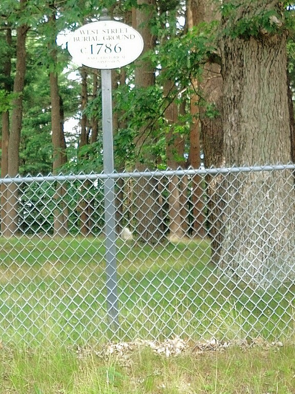
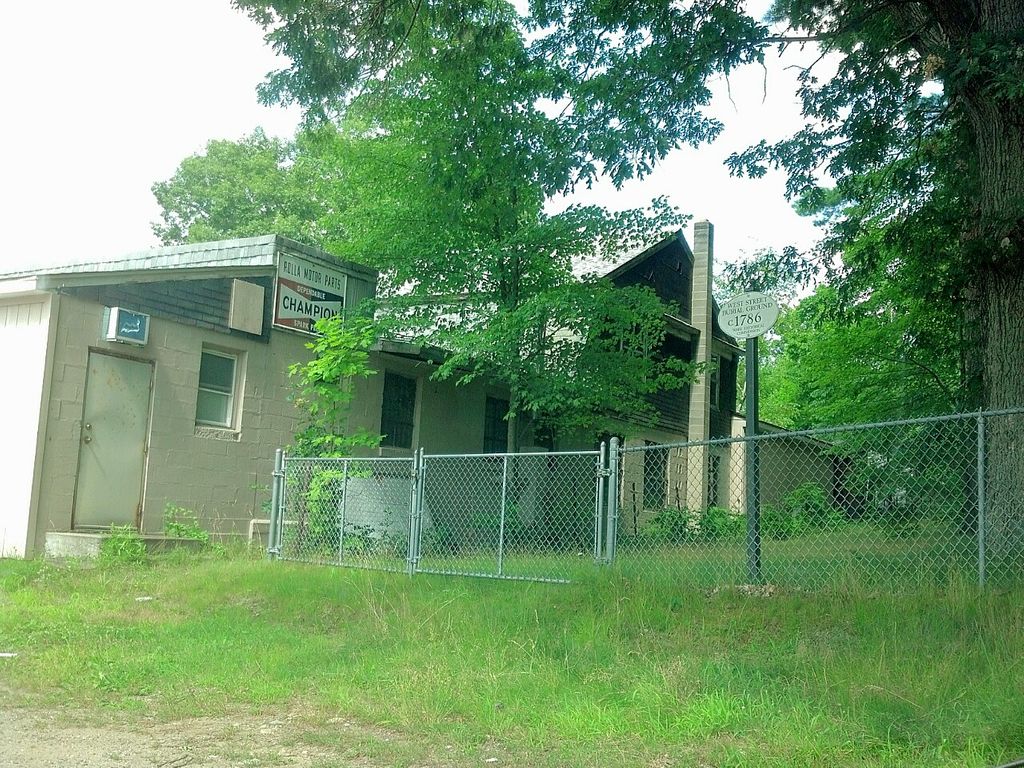
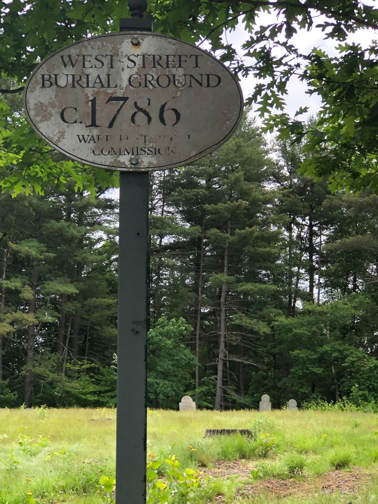
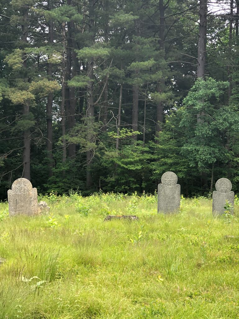
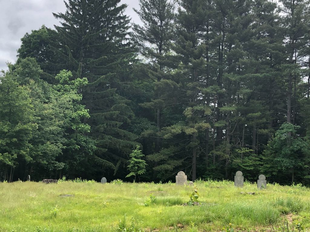
| Description | : | Contact: Town Hall 126 Main street Ware, MA 01082 (413)967-4471 Cemetery is located at the corner of West Street/Rte 32 and Robbins Street. It is in a grove of pine trees. Parking is on-street with easier access from Robbins Street. The cemetery was established shortly after the settlement of Ware in 1761. According to Walter Corbin, who transcribed the cemetery in the 1930's, "Most of the graves have sunk out of sight and are not marked by tombstones. Of these but 6 are standing" (Corbin Transcriptions, Hampshire, Vol 1, NEHGS CD) There have been NO burials there since 1826. |
frequently asked questions (FAQ):
-
Where is West Street Burial Ground?
West Street Burial Ground is located at West Street/Rte 32 Ware, Hampshire County ,Massachusetts , 01082USA.
-
West Street Burial Ground cemetery's updated grave count on graveviews.com?
1 memorials
-
Where are the coordinates of the West Street Burial Ground?
Latitude: 42.2533800
Longitude: -72.2554700
Nearby Cemetories:
1. New Saint William Cemetery
Ware, Hampshire County, USA
Coordinate: 42.2597400, -72.2526400
2. Holy Cross Polish National Catholic Cemetery
Ware, Hampshire County, USA
Coordinate: 42.2595300, -72.2508200
3. Old Saint William Cemetery
Ware, Hampshire County, USA
Coordinate: 42.2582380, -72.2472420
4. Saint Marys Cemetery
Ware, Hampshire County, USA
Coordinate: 42.2472000, -72.2438965
5. Aspen Grove Cemetery
Ware, Hampshire County, USA
Coordinate: 42.2653008, -72.2450027
6. Walnut Grove Cemetery
Ware, Hampshire County, USA
Coordinate: 42.2623430, -72.2367810
7. Mount Carmel Cemetery
Ware, Hampshire County, USA
Coordinate: 42.2694016, -72.2491989
8. Ware Center Cemetery
Ware, Hampshire County, USA
Coordinate: 42.2641180, -72.2744130
9. West Cemetery
Ware, Hampshire County, USA
Coordinate: 42.2651860, -72.2757270
10. Quabbin Park Cemetery
Ware, Hampshire County, USA
Coordinate: 42.2792015, -72.3056030
11. Methodist Cemetery
West Brookfield, Worcester County, USA
Coordinate: 42.2833700, -72.2061400
12. Hardwick Baptist Cemetery
Hardwick, Worcester County, USA
Coordinate: 42.3082700, -72.2479600
13. Taylor Cemetery
West Brookfield, Worcester County, USA
Coordinate: 42.2695300, -72.1839700
14. Pine Grove Cemetery
Warren, Worcester County, USA
Coordinate: 42.2097015, -72.1971970
15. Saint Pauls Cemetery
Warren, Worcester County, USA
Coordinate: 42.2069016, -72.1999969
16. Saint Aloysius Cemetery
Hardwick, Worcester County, USA
Coordinate: 42.3125000, -72.1967010
17. Blue Meadow Cemetery (Defunct)
Belchertown, Hampshire County, USA
Coordinate: 42.2802300, -72.3530000
18. Millbrook Road Cemetery
West Brimfield, Hampden County, USA
Coordinate: 42.1746470, -72.2581020
19. Sacred Heart Cemetery
West Brookfield, Worcester County, USA
Coordinate: 42.2334900, -72.1517300
20. Old Indian Cemetery
West Brookfield, Worcester County, USA
Coordinate: 42.2372600, -72.1456500
21. Palmer Center Cemetery
Palmer, Hampden County, USA
Coordinate: 42.1819000, -72.3125000
22. Pine Grove Cemetery
West Brookfield, Worcester County, USA
Coordinate: 42.2382960, -72.1406610
23. Saints Peter and Paul Cemetery
Bondsville, Hampden County, USA
Coordinate: 42.2020690, -72.3524170
24. Cemetery Hill (Defunct)
Enfield, Hampshire County, USA
Coordinate: 42.3217500, -72.3310700