
| Memorials | : | 1 |
| Location | : | Goodland, Sherman County, USA |
| Coordinate | : | 39.2785988, -101.7457962 |
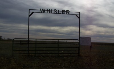
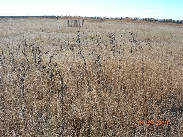
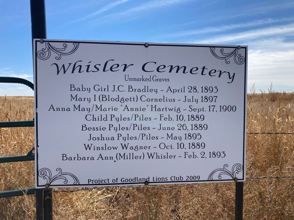
| Description | : | The Whisler cemetery is located in the North East Quarter of section 14, Township 9, South Range 40. West of the Sixth Principal Meridian in Sherman County, Kansas, which is 4 miles south on Highway 27 from intersections of Highway 24 and 27, and then about 1 2/8 miles west and is located on the southside. It is 2 acres deeded for the cemetery and 2 acres for the German Baptist, or Bretheren Church, also known as the Dunkard Church. The cemetery was in the Fairview School District #59 when this district was up and running. |
frequently asked questions (FAQ):
-
Where is Whisler Cemetery?
Whisler Cemetery is located at Goodland, Sherman County ,Kansas ,USA.
-
Whisler Cemetery cemetery's updated grave count on graveviews.com?
1 memorials
-
Where are the coordinates of the Whisler Cemetery?
Latitude: 39.2785988
Longitude: -101.7457962
Nearby Cemetories:
1. Frerichs Cemetery
Goodland, Sherman County, USA
Coordinate: 39.2792015, -101.6511002
2. Goodland Cemetery
Goodland, Sherman County, USA
Coordinate: 39.3652992, -101.7138977
3. Mennonite Cemetery
Edson, Sherman County, USA
Coordinate: 39.2069016, -101.5980988
4. Harmony Cemetery
Sherman County, USA
Coordinate: 39.4236107, -101.6921158
5. Edson Cemetery
Edson, Sherman County, USA
Coordinate: 39.3375600, -101.5587800
6. Fairview Cemetery
Wallace County, USA
Coordinate: 39.1264000, -101.8681030
7. New Liberty Cemetery
Ruleton, Sherman County, USA
Coordinate: 39.4374400, -101.8727700
8. North Township Cemetery
Sharon Springs, Wallace County, USA
Coordinate: 39.0878360, -101.7389010
9. Kanorado Catholic Cemetery
Sherman County, USA
Coordinate: 39.2944450, -102.0087891
10. Hollenbeck Cemetery
Edson, Sherman County, USA
Coordinate: 39.3736000, -101.4656982
11. Fairview Cemetery
Sherman County, USA
Coordinate: 39.3736000, -101.4653015
12. Kanorado Cemetery
Kanorado, Sherman County, USA
Coordinate: 39.3427400, -102.0419900
13. Lava Cemetery
Sherman County, USA
Coordinate: 39.2001830, -101.4337300
14. Shermanville Cemetery
Edson, Sherman County, USA
Coordinate: 39.5111084, -101.5782242
15. Brewster Cemetery
Sherman County, USA
Coordinate: 39.3605995, -101.3917007
16. Freeland Cemetery
Sherman County, USA
Coordinate: 39.4678001, -101.4552994
17. Brownville Cemetery
Brownville, Thomas County, USA
Coordinate: 39.1933660, -101.3727160
18. Beaver Valley Cemetery
Kit Carson County, USA
Coordinate: 39.4625015, -102.0899963
19. Lawn Ridge Cemetery
Saint Francis, Cheyenne County, USA
Coordinate: 39.6268997, -101.7882996
20. Sunnyside Cemetery
Bird City, Cheyenne County, USA
Coordinate: 39.5827800, -101.5109900
21. Sharon Springs Cemetery
Sharon Springs, Wallace County, USA
Coordinate: 38.9171982, -101.7506027
22. Saint Pauls Lutheran Cemetery
Wheeler, Cheyenne County, USA
Coordinate: 39.6389000, -101.6937000
23. Dinas Community Church Cemetery
Wallace County, USA
Coordinate: 38.9089317, -101.7540283
24. Fairview Cemetery
Brewster, Thomas County, USA
Coordinate: 39.5260530, -101.3799140