
| Memorials | : | 0 |
| Location | : | Catawba County, USA |
| Coordinate | : | 35.5681200, -81.0160300 |
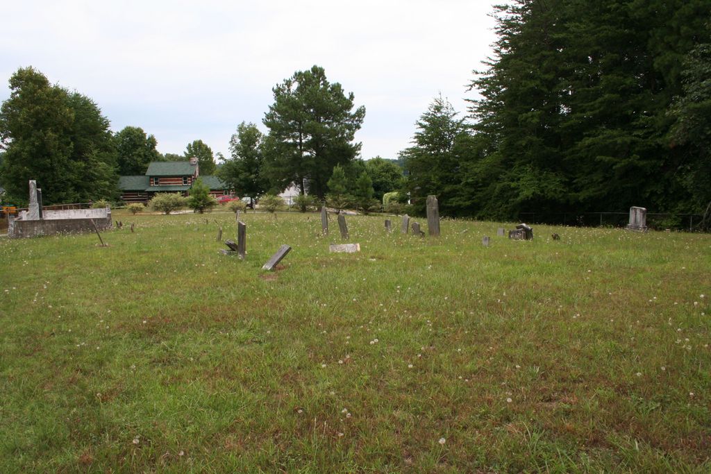
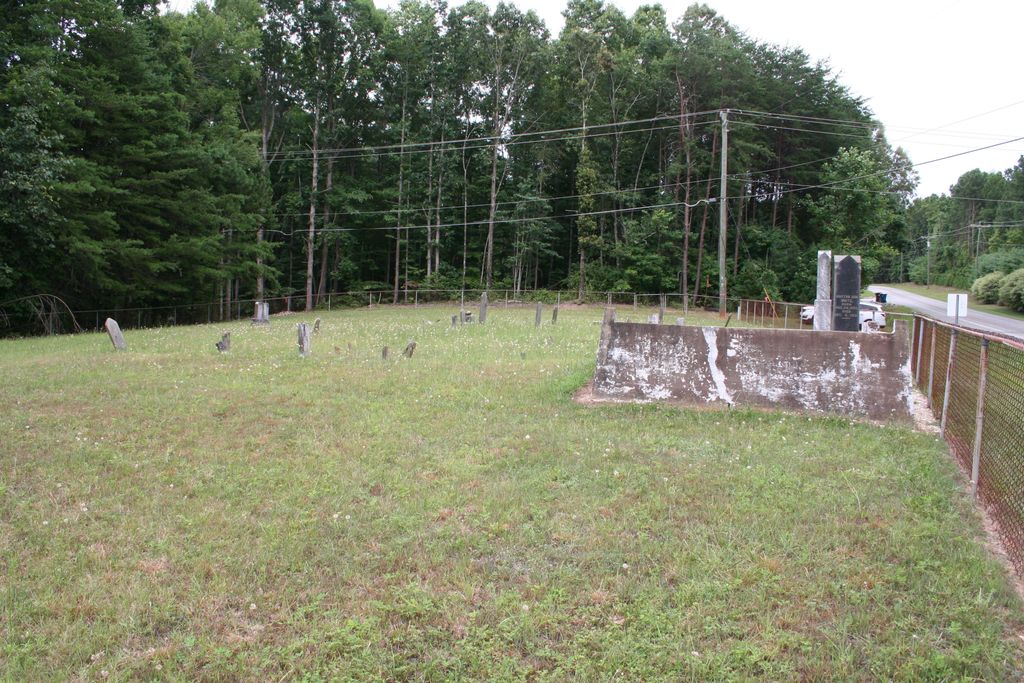
| Description | : | Cemetery is at the end of Catawba Burris Road, on the right just past the fire station. Per GIS the land is owned by Sherrills Ford Presbyterian Church. There is no listed address other than Burris Road. Information on cemetery was found in the Catawba County Cemeteries, volume 1. There are many field stones with no inscriptions. |
frequently asked questions (FAQ):
-
Where is White Cemetery?
White Cemetery is located at Burris Road Catawba County ,North Carolina , 28037USA.
-
White Cemetery cemetery's updated grave count on graveviews.com?
0 memorials
-
Where are the coordinates of the White Cemetery?
Latitude: 35.5681200
Longitude: -81.0160300
Nearby Cemetories:
1. McCorkle Cemetery
Sherrills Ford, Catawba County, USA
Coordinate: 35.5661130, -81.0271480
2. Mount Pleasant United Methodist Church Cemetery
Sherrills Ford, Catawba County, USA
Coordinate: 35.5808020, -81.0287840
3. Bethel United Methodist Church Cemetery
Denver, Lincoln County, USA
Coordinate: 35.5420990, -81.0114975
4. Francis A.H. Shelton Burial Site
Denver, Lincoln County, USA
Coordinate: 35.5350000, -81.0226600
5. Denver Community Cemetery
Denver, Lincoln County, USA
Coordinate: 35.5364400, -81.0329700
6. Denver United Methodist Church Cemetery
Denver, Lincoln County, USA
Coordinate: 35.5351571, -81.0329984
7. Rehobeth United Methodist Church Columbarium
Terrell, Catawba County, USA
Coordinate: 35.5871800, -80.9763200
8. Rehobeth United Methodist Church Cemetery
Terrell, Catawba County, USA
Coordinate: 35.5867240, -80.9757240
9. Mount Beulah United Methodist Church Cemetery
Sherrills Ford, Catawba County, USA
Coordinate: 35.6000650, -81.0462290
10. Motts Grove United Methodist Church Cemetery
Sherrills Ford, Catawba County, USA
Coordinate: 35.6019360, -80.9816370
11. Sherrills Ford Presbyterian Church Cemetery
Sherrills Ford, Catawba County, USA
Coordinate: 35.6108740, -80.9873170
12. Webbs Chapel United Methodist Church Cemetery
Denver, Lincoln County, USA
Coordinate: 35.5322220, -80.9719440
13. Mountain View Baptist Church Cemetery
Catawba County, USA
Coordinate: 35.5563700, -81.0827600
14. Lebanon United Methodist Cemetery
Maiden, Catawba County, USA
Coordinate: 35.5515430, -81.0838050
15. Abram Forney Cemetery
Denver, Lincoln County, USA
Coordinate: 35.5159800, -81.0513200
16. Friendly Chapel Baptist Church Cemetery
Denver, Lincoln County, USA
Coordinate: 35.5493876, -81.0854950
17. Mount Anderson Baptist Cemetery
Maiden, Catawba County, USA
Coordinate: 35.5872500, -81.0885700
18. Victory Baptist Church Cemetery
Denver, Lincoln County, USA
Coordinate: 35.5298755, -81.0779818
19. Hopewell United Methodist Church Cemetery
Sherrills Ford, Catawba County, USA
Coordinate: 35.6316650, -81.0314150
20. Episcopal Church of Saint Peter By-The-Lake
Denver, Lincoln County, USA
Coordinate: 35.5078500, -80.9770800
21. Fairfield United Methodist Church
Denver, Lincoln County, USA
Coordinate: 35.5025700, -80.9933000
22. McKendree Chapel United Methodist Church Cemetery
Mooresville, Iredell County, USA
Coordinate: 35.5664420, -80.9308290
23. Pisgah United Methodist Church Cemetery
Catawba, Catawba County, USA
Coordinate: 35.6120000, -81.0860000
24. Morrows Chapel UMC Cemetery
Mooresville, Iredell County, USA
Coordinate: 35.5557350, -80.9265050