
| Memorials | : | 6 |
| Location | : | Cottongim, Clay County, USA |
| Coordinate | : | 37.0723800, -83.7814600 |
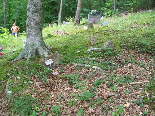
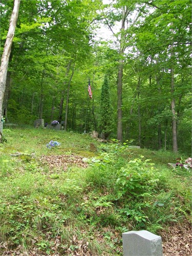
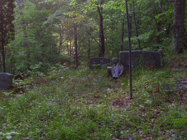
| Description | : | The Cemetery is on South Highway 11. 5 or 6 miles south of Manchester. There is Little white house before you turn on to Balls Branch on the same side as Ball Branch on the left side. You turn at the edge of the yard at the little white house and the road goes up a big hill the cemetery is on the right (that is the Hubbard Family side of the Cemetery and if you go on up the hill on the right is the White Family side of the Cemetery). You might have to walk up there because... Read More |
frequently asked questions (FAQ):
-
Where is White-Hubbard Cemetery?
White-Hubbard Cemetery is located at Cottongim, Clay County ,Kentucky , 40962USA.
-
White-Hubbard Cemetery cemetery's updated grave count on graveviews.com?
6 memorials
-
Where are the coordinates of the White-Hubbard Cemetery?
Latitude: 37.0723800
Longitude: -83.7814600
Nearby Cemetories:
1. White Cemetery
Cottongim, Clay County, USA
Coordinate: 37.0775300, -83.7786800
2. Cottongim Cemetery
Cottongim, Clay County, USA
Coordinate: 37.0637600, -83.8038500
3. Ruth Cemetery
Lincoln, Clay County, USA
Coordinate: 37.0777300, -83.7424300
4. Bundy-Delph Cemetery
Cottongim, Clay County, USA
Coordinate: 37.0458800, -83.8060100
5. Curry Branch Cemetery
Pigeonroost, Clay County, USA
Coordinate: 37.0971400, -83.8109300
6. Hooker Cemetery
Bluehole, Clay County, USA
Coordinate: 37.1021990, -83.7571320
7. Reid Cemetery
Lincoln, Clay County, USA
Coordinate: 37.0587300, -83.7398300
8. Buzzard Creek Cemetery
Manchester, Clay County, USA
Coordinate: 37.0459251, -83.7499364
9. Abner-Stewart Cemetery
Bluehole, Clay County, USA
Coordinate: 37.0491650, -83.7456820
10. Sizemore-Asher Cemetery
Lincoln, Clay County, USA
Coordinate: 37.0491650, -83.7456360
11. Downey Cemetery
Bluehole, Clay County, USA
Coordinate: 37.0800200, -83.7345200
12. Wiley Smith Cemetery
Lincoln, Clay County, USA
Coordinate: 37.0519350, -83.7386780
13. Roberts Cemetery
Pigeonroost, Clay County, USA
Coordinate: 37.1041200, -83.8130700
14. Asher Cemetery
Cottongim, Clay County, USA
Coordinate: 37.0393040, -83.8128660
15. Smith Cemetery #3
Garrard, Clay County, USA
Coordinate: 37.1010300, -83.7436200
16. Napier Cemetery
Lincoln, Clay County, USA
Coordinate: 37.0728420, -83.7292790
17. Engine Cemetery
Bluehole, Clay County, USA
Coordinate: 37.1105995, -83.7592010
18. Birch Cemetery
Hima, Clay County, USA
Coordinate: 37.1151500, -83.7788700
19. Asher Cemetery
Clay County, USA
Coordinate: 37.0364784, -83.8127860
20. Swafford Cemetery
Pigeonroost, Clay County, USA
Coordinate: 37.1108450, -83.8086840
21. Williams Cemetery
Garrard, Clay County, USA
Coordinate: 37.1002200, -83.7375900
22. Roots Branch Cemetery
Pigeonroost, Clay County, USA
Coordinate: 37.1034500, -83.8228400
23. Jarvis-Goins Cemetery
Hima, Clay County, USA
Coordinate: 37.1129700, -83.8069100
24. Gregory Cemetery
Hima, Clay County, USA
Coordinate: 37.1179600, -83.7763600