
| Memorials | : | 0 |
| Location | : | Monroe County, USA |
| Coordinate | : | 39.1707993, -86.6806030 |
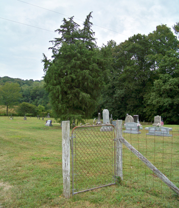
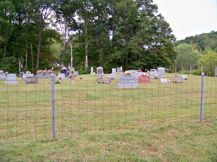
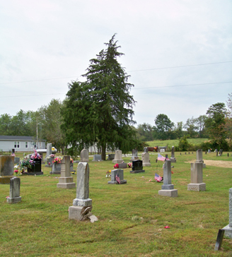
| Description | : | The cemetery is located in Richland Township on the north side of Indiana State Highway 48 at its intersection with Indiana State Highway 43. The cemetery is listed in the Cemetery and Burial Grounds Registry of the Indiana Department of Natural Resources (DNR) and in the State Historical Architectural and Archaeological Research Database (SHAARD) with Cemetery Record Number CR-53-225 (Whitehall). The U.S. Geological Survey (USGS) Geographic Names Information System (GNIS) feature ID for the cemetery is 445968 (Whitehall Cemetery). |
frequently asked questions (FAQ):
-
Where is Whitehall Cemetery?
Whitehall Cemetery is located at Indiana State Highway 48 Monroe County ,Indiana , 47404USA.
-
Whitehall Cemetery cemetery's updated grave count on graveviews.com?
0 memorials
-
Where are the coordinates of the Whitehall Cemetery?
Latitude: 39.1707993
Longitude: -86.6806030
Nearby Cemetories:
1. Butler Cemetery
Owen County, USA
Coordinate: 39.1837006, -86.6868973
2. Ham Cemetery
Greene County, USA
Coordinate: 39.1588058, -86.6899796
3. Beaumont Cemetery
Monroe County, USA
Coordinate: 39.1704840, -86.6621310
4. Gross Cemetery
Whitehall, Owen County, USA
Coordinate: 39.1772230, -86.6972240
5. Richland Cemetery
Bloomington, Monroe County, USA
Coordinate: 39.1667786, -86.6604080
6. Coon Cemetery
Elwren, Monroe County, USA
Coordinate: 39.1512880, -86.6670550
7. Marys Children Cemetery
Bloomington, Monroe County, USA
Coordinate: 39.1635560, -86.6531670
8. Liberty Cemetery #2
Greene County, USA
Coordinate: 39.1506600, -86.7107500
9. Liberty Cemetery
Hendricksville, Greene County, USA
Coordinate: 39.1474991, -86.7108002
10. Garrison Chapel Cemetery
Van Buren Township, Monroe County, USA
Coordinate: 39.1505013, -86.6437912
11. Brown Cemetery
Owen County, USA
Coordinate: 39.1717170, -86.7282310
12. Andrew Livingston Cemetery
Greene County, USA
Coordinate: 39.1641998, -86.7303009
13. Stogsdill-Malicoat Cemetery
Ellettsville, Monroe County, USA
Coordinate: 39.2059800, -86.6549600
14. Hudson Cemetery
Greene County, USA
Coordinate: 39.1356010, -86.7082977
15. Livingston Cemetery
Clay Township, Owen County, USA
Coordinate: 39.1982994, -86.7210999
16. Rone Family Cemetery
Spencer, Owen County, USA
Coordinate: 39.2102100, -86.6984100
17. Coffey Cemetery
Owen County, USA
Coordinate: 39.2058487, -86.7129898
18. Coffey Cemetery
Ellettsville, Monroe County, USA
Coordinate: 39.2148550, -86.6730500
19. Kerr Cemetery
Bloomington, Monroe County, USA
Coordinate: 39.1564660, -86.6243070
20. Blair Cemetery
Monroe County, USA
Coordinate: 39.1261530, -86.6632770
21. Sims Cemetery
Whitehall, Owen County, USA
Coordinate: 39.1703000, -86.7413330
22. Ritter Cemetery
Freeman, Owen County, USA
Coordinate: 39.2165360, -86.6966640
23. Vernal-Mayfield Cemetery
Monroe County, USA
Coordinate: 39.1699140, -86.6191180
24. Hopewell Cemetery
Owen County, USA
Coordinate: 39.2208860, -86.6839580