
| Memorials | : | 22 |
| Location | : | Merricourt, Dickey County, USA |
| Coordinate | : | 46.1689090, -98.8568200 |
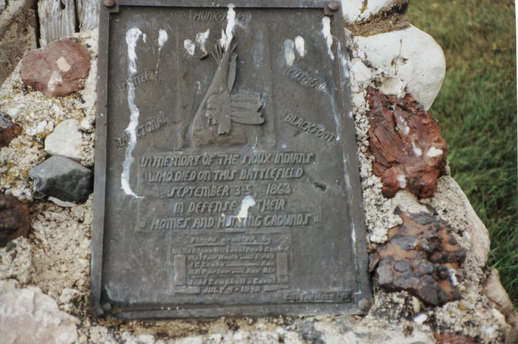
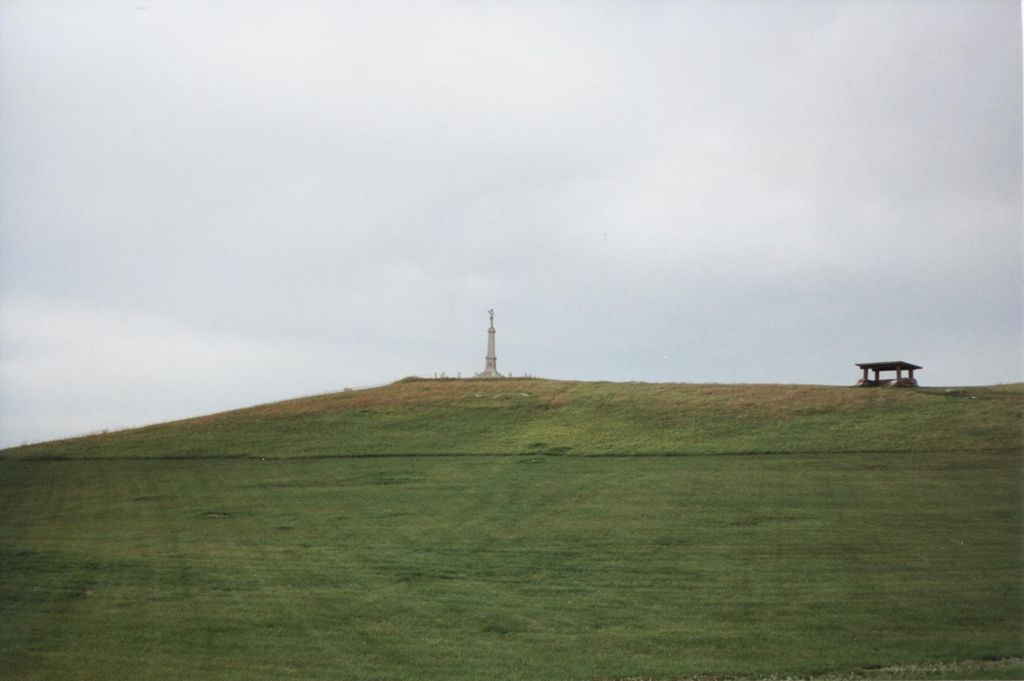
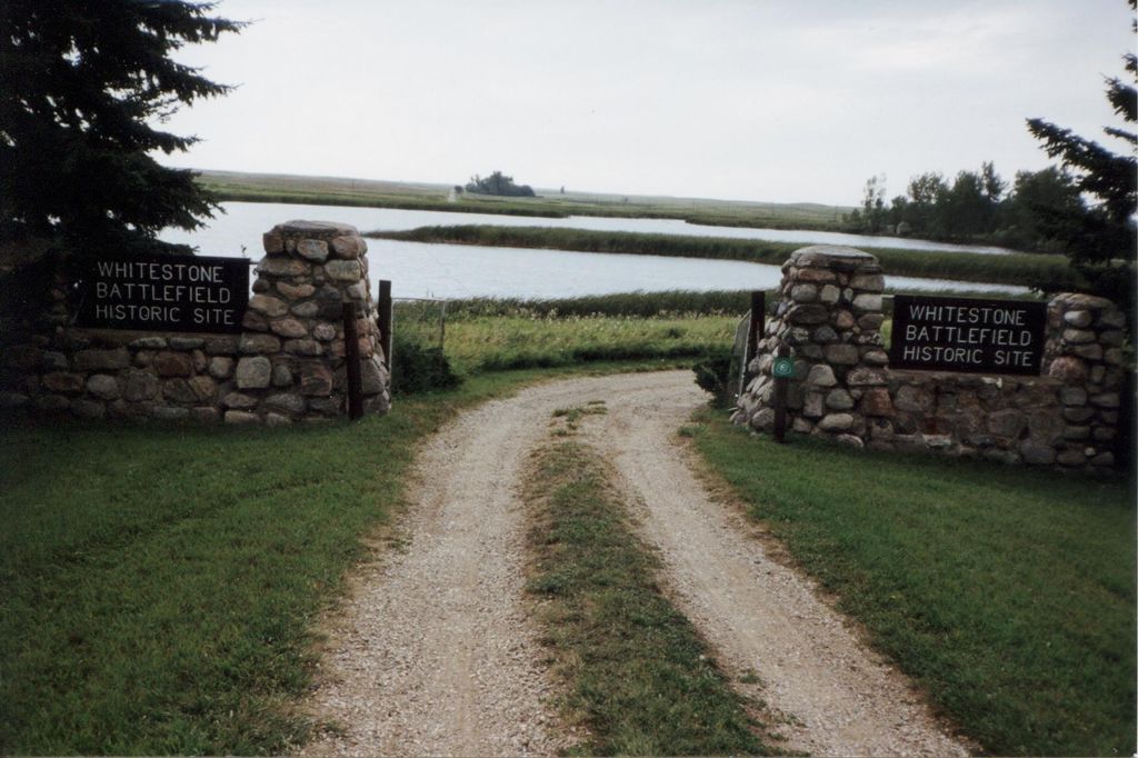
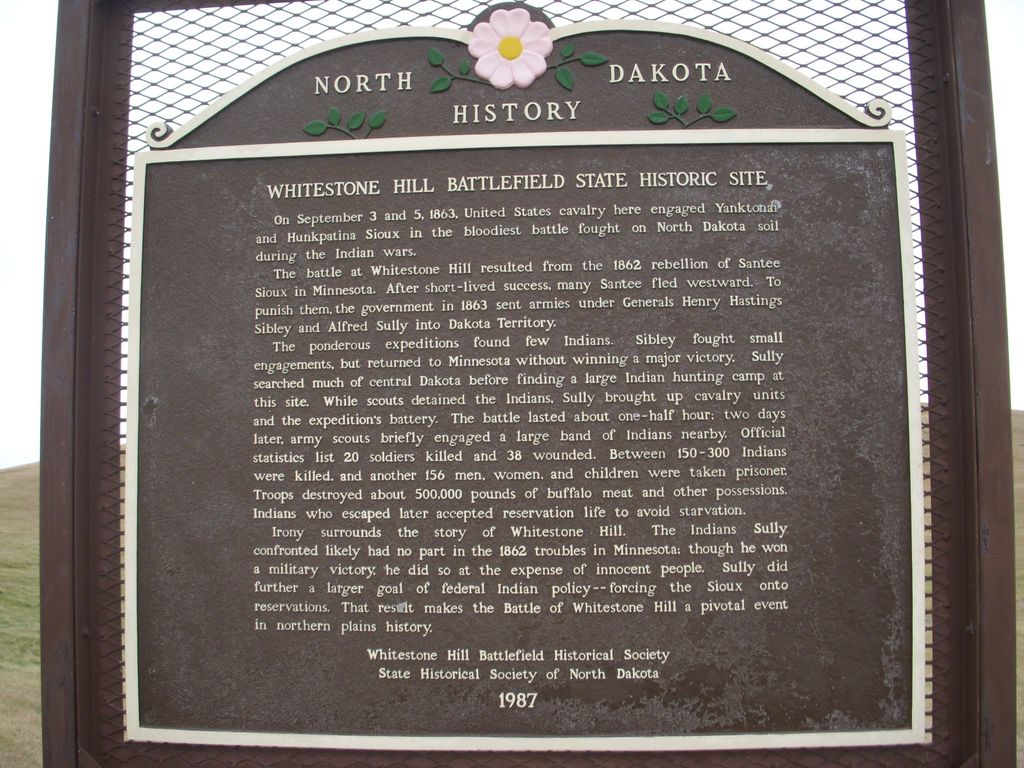
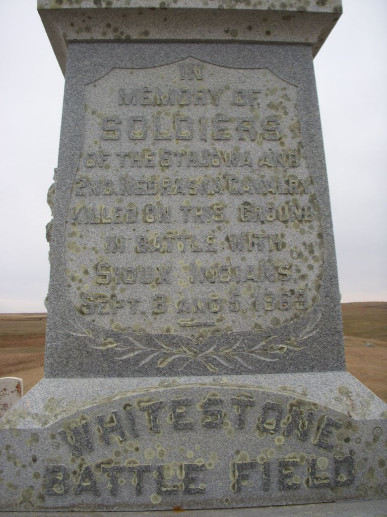
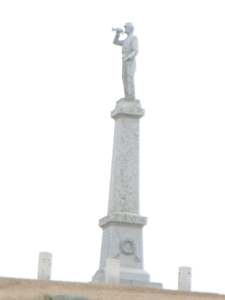
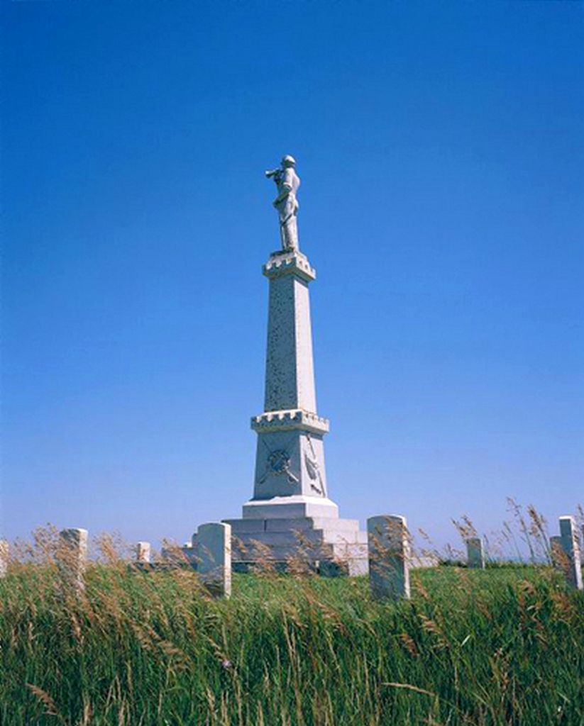
| Description | : | "Whitestone Hill State Historic Site, located 23 miles southeast of Kulm, Dickey County, marks the scene of the fiercest clash between Indians and white soldiers in North Dakota. On September 3, 1863, General Alfred Sully's troops attacked a tipi camp of Yanktonai, some Dakota, Hunkpapa Lakota, and Blackfeet (Sihasapa Lakota), as part of a military mission to punish participants of the Dakota Conflict of 1862. In the ensuing battle, many Indian men, women, and children died or were captured. Military casualties were comparatively light. The Indians also suffered the destruction of virtually all of their property, leaving them nearly destitute... Read More |
frequently asked questions (FAQ):
-
Where is Whitestone Hill State Historic Site?
Whitestone Hill State Historic Site is located at Located 23 miles southeast of Kulm, ND. Merricourt, Dickey County ,North Dakota ,USA.
-
Whitestone Hill State Historic Site cemetery's updated grave count on graveviews.com?
22 memorials
-
Where are the coordinates of the Whitestone Hill State Historic Site?
Latitude: 46.1689090
Longitude: -98.8568200
Nearby Cemetories:
1. Hoffnungsfeld Cemetery
Dickey County, USA
Coordinate: 46.1674995, -98.9002991
2. Spring Valley Cemetery
Merricourt, Dickey County, USA
Coordinate: 46.1062812, -98.9007168
3. Haffner Family Farm Cemetery
Merricourt, Dickey County, USA
Coordinate: 46.2055650, -98.7628900
4. Merricourt Cemetery
Merricourt, Dickey County, USA
Coordinate: 46.1999140, -98.7555030
5. Seventh-Day Adventist Cemetery
Dickey County, USA
Coordinate: 46.1422550, -98.9704330
6. Roloff Cemetery
Dickey County, USA
Coordinate: 46.2296982, -98.9439011
7. Zion United Methodist Cemetery
Dickey County, USA
Coordinate: 46.2731018, -98.9421997
8. Saint Pauls Lutheran Cemetery
Dickey County, USA
Coordinate: 46.2803001, -98.9210968
9. New Beresena Cemetery
LaMoure County, USA
Coordinate: 46.2977982, -98.8602982
10. Wirch Cemetery
Dickey County, USA
Coordinate: 46.0558014, -98.9533005
11. Peace Cemetery
Dickey County, USA
Coordinate: 46.2280998, -98.6821976
12. Unnamed Pioneer Cemetery
McIntosh County, USA
Coordinate: 46.0947200, -99.0252100
13. Gnadenfeld Congregational Cemetery
McIntosh County, USA
Coordinate: 46.2282982, -99.0441971
14. Saint Pauls Cemetery
Monango, Dickey County, USA
Coordinate: 46.1693993, -98.6508026
15. Pomona Valley Lutheran Cemetery
Kulm, LaMoure County, USA
Coordinate: 46.3064003, -98.9443970
16. Hillside Cemetery
Kulm, LaMoure County, USA
Coordinate: 46.3116600, -98.9744100
17. Kulm Congregational Cemetery
Kulm, LaMoure County, USA
Coordinate: 46.3114014, -98.9756012
18. Assembly of God Cemetery
Kulm, LaMoure County, USA
Coordinate: 46.3117190, -98.9766830
19. Monango City Cemetery
Monango, Dickey County, USA
Coordinate: 46.1764430, -98.6075310
20. Zion Lutheran Cemetery #2
Ashley, McIntosh County, USA
Coordinate: 46.0994600, -99.0879300
21. Salem Congregational Cemetery
McIntosh County, USA
Coordinate: 46.0269012, -99.0046997
22. Christ Lutheran Cemetery
Ellendale, Dickey County, USA
Coordinate: 46.0539090, -98.6497540
23. Saint Pauls Evangelical Lutheran Cemetery
Ashley, McIntosh County, USA
Coordinate: 46.0119300, -99.0151220
24. Berlin Baptist Church Cemetery
McIntosh County, USA
Coordinate: 46.1535570, -99.1493800