
| Memorials | : | 0 |
| Location | : | Whitney, Baker County, USA |
| Coordinate | : | 44.6597000, -118.2810000 |
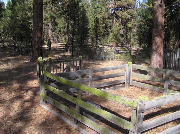
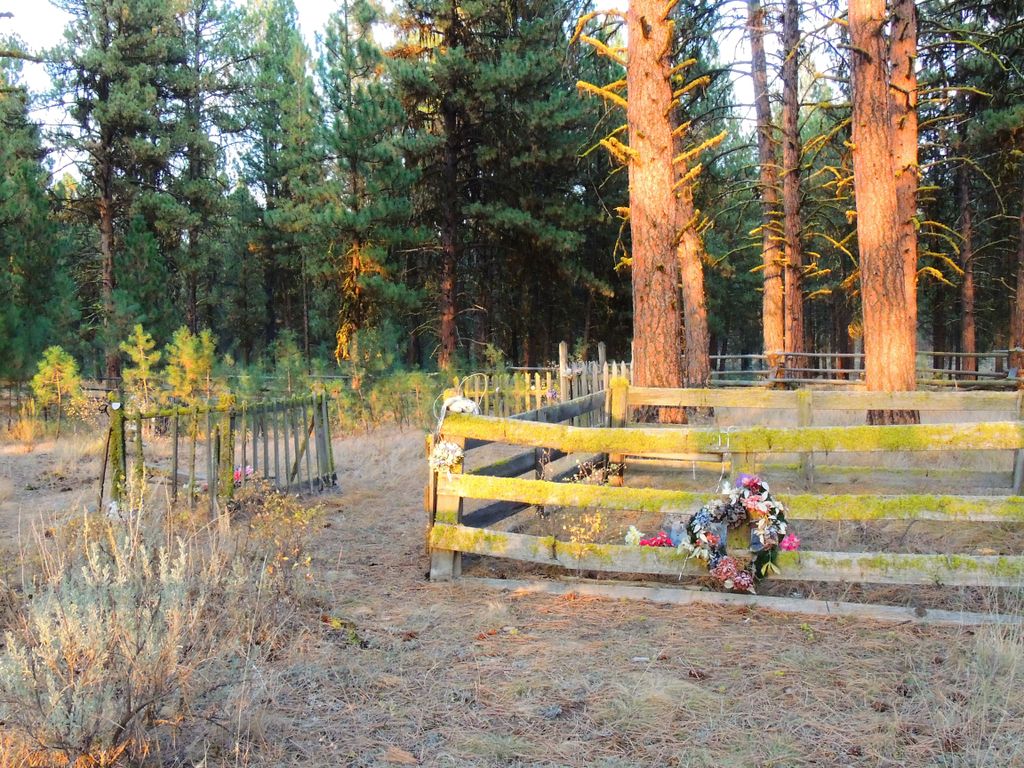
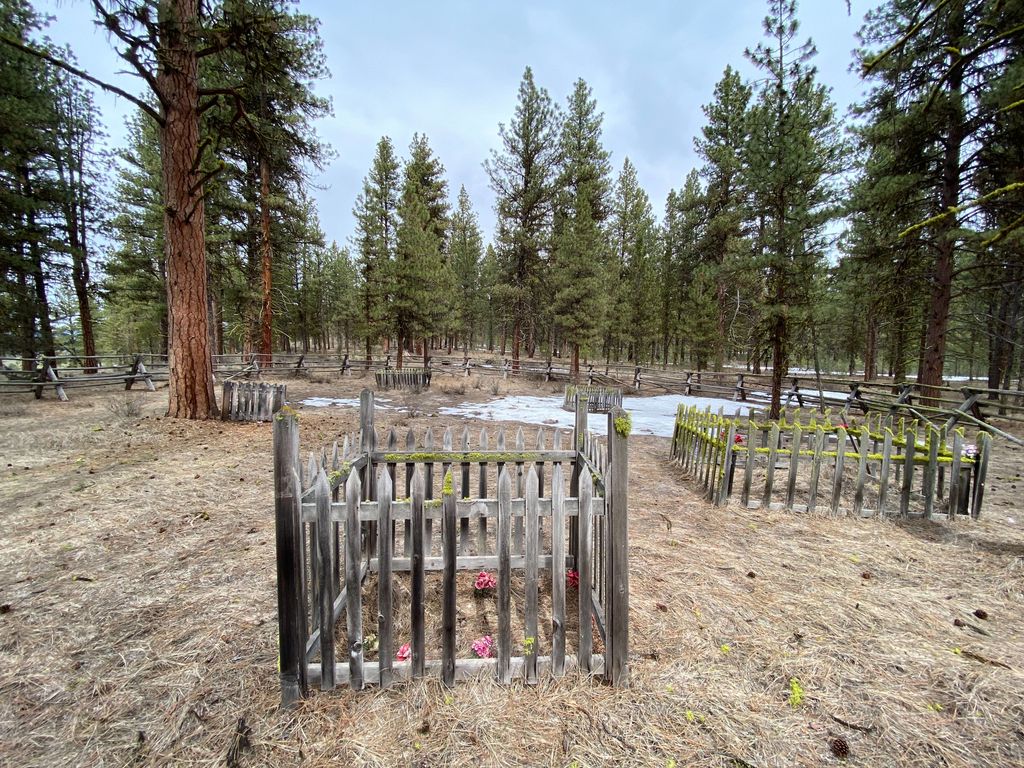
| Description | : | About one mile northeast of Whitney, the Whitney Cemetery is on the old Whitney-Sumpter Road (now State Hwy 7) and is situated about 15 miles southwest of Sumpter. Whitney is an abandoned railroad and mining town and it is difficult to secure information on the cemetery there. The railroad was the Sumpter Valley Rail Road. It is not known when the cemetery was started but it was before the year 1905. The grounds are neglected and no known records have been maintained of the burials. |
frequently asked questions (FAQ):
-
Where is Whitney Cemetery?
Whitney Cemetery is located at Whitney, Baker County ,Oregon ,USA.
-
Whitney Cemetery cemetery's updated grave count on graveviews.com?
0 memorials
-
Where are the coordinates of the Whitney Cemetery?
Latitude: 44.6597000
Longitude: -118.2810000
Nearby Cemetories:
1. Blue Mountain Cemetery
Sumpter, Baker County, USA
Coordinate: 44.7317009, -118.1810989
2. McEwen Cemetery
McEwen, Baker County, USA
Coordinate: 44.7010002, -118.0999985
3. Big Flat Cemetery
Baker County, USA
Coordinate: 44.5430984, -118.1624985
4. Greenhorn Cemetery
Baker County, USA
Coordinate: 44.7071991, -118.4935989
5. Granite Cemetery
Granite, Grant County, USA
Coordinate: 44.8108530, -118.4188440
6. Unity Cemetery
Unity, Baker County, USA
Coordinate: 44.4592018, -118.2391968
7. Van Cleave Family Cemetery
Hereford, Baker County, USA
Coordinate: 44.4941700, -118.1021900
8. Fleetwood Cemetery
Baker County, USA
Coordinate: 44.5061700, -118.0714800
9. Auburn Cemetery
Baker County, USA
Coordinate: 44.7000008, -117.9599991
10. Aunt Polly Cemetery
Hereford, Baker County, USA
Coordinate: 44.4988526, -118.0321175
11. Cabell Cemetery
Cabell City, Grant County, USA
Coordinate: 44.8965720, -118.3695880
12. Wingville Cemetery
Baker County, USA
Coordinate: 44.8368988, -117.9627991
13. Rock Creek Cemetery
Haines, Baker County, USA
Coordinate: 44.9053001, -117.9946976
14. Saint Francis de Sales Catholic Church Cemetery
Baker City, Baker County, USA
Coordinate: 44.7890015, -117.8349991
15. Mount Hope Cemetery
Baker City, Baker County, USA
Coordinate: 44.7662300, -117.8197900
16. Chinese Cemetery
Baker City, Baker County, USA
Coordinate: 44.7822710, -117.8074500
17. Prairie City Cemetery
Prairie City, Grant County, USA
Coordinate: 44.4566994, -118.7027969
18. Haines Cemetery
Haines, Baker County, USA
Coordinate: 44.9372177, -117.9490967
19. McHaley Cemetery
Prairie City, Grant County, USA
Coordinate: 44.4618988, -118.7169037
20. Galena Cemetery
Grant County, USA
Coordinate: 44.7083015, -118.8056030
21. Ironside Cemetery
Malheur County, USA
Coordinate: 44.3244019, -117.9499969
22. Bridgeport Cemetery
Baker County, USA
Coordinate: 44.4916992, -117.7472000
23. Pleasant Valley Cemetery
Encina, Baker County, USA
Coordinate: 44.6520004, -117.6660004
24. North Powder Cemetery
North Powder, Union County, USA
Coordinate: 45.0328200, -117.9140800