
| Memorials | : | 0 |
| Location | : | Edenton, Madison County, USA |
| Coordinate | : | 37.7726220, -84.4820500 |
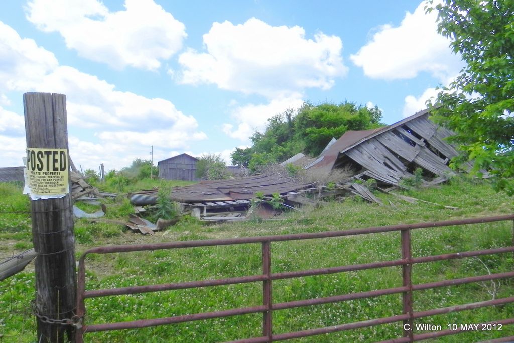
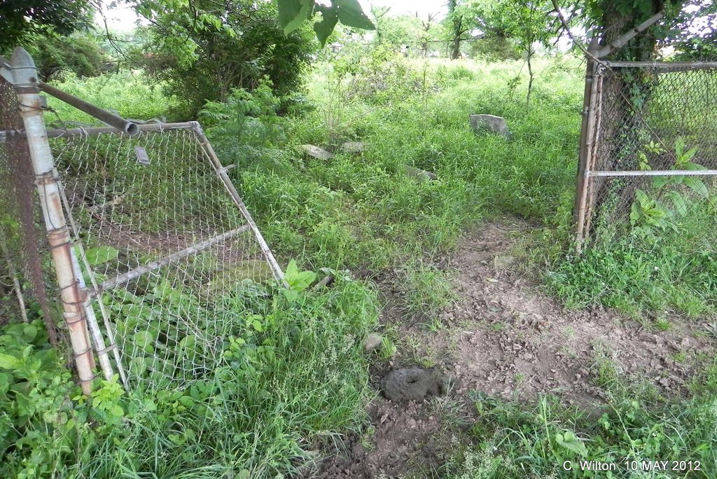
| Description | : | Cemetery is located north and slightly west of Edenton, Kentucky - at the intersection of New Road and Poosey Ridge Road go .6 mile on Poosey Ridge Road - gate to two barns - cemetery is behind the the first barn - private property. |
frequently asked questions (FAQ):
-
Where is William D. Smith Cemetery?
William D. Smith Cemetery is located at Edenton, Madison County ,Kentucky ,USA.
-
William D. Smith Cemetery cemetery's updated grave count on graveviews.com?
0 memorials
-
Where are the coordinates of the William D. Smith Cemetery?
Latitude: 37.7726220
Longitude: -84.4820500
Nearby Cemetories:
1. Antioch Christian Church Cemetery
Pollard, Jessamine County, USA
Coordinate: 37.7890670, -84.4944930
2. Friendship Cemetery
Million, Madison County, USA
Coordinate: 37.7677994, -84.4582977
3. Elizabeth Wylie Cemetery
Edenton, Madison County, USA
Coordinate: 37.7759210, -84.5100370
4. Stocker Cemetery
Baldwin, Madison County, USA
Coordinate: 37.7868260, -84.4582720
5. Harvey Cemetery
Baldwin, Madison County, USA
Coordinate: 37.7915950, -84.4583230
6. Teater Cemetery
Edenton, Madison County, USA
Coordinate: 37.7734290, -84.5200540
7. Hendren Cemetery
Cottonburg, Madison County, USA
Coordinate: 37.7453700, -84.4637650
8. Moses Reynolds Cemetery
Pollard, Jessamine County, USA
Coordinate: 37.7865730, -84.5221470
9. Sanders-Brumfield Cemetery
Mount Lebanon, Jessamine County, USA
Coordinate: 37.8054820, -84.4639640
10. Reynolds Cemetery
Paint Lick, Garrard County, USA
Coordinate: 37.7661370, -84.5266660
11. Poosey Cemetery
Madison County, USA
Coordinate: 37.7378006, -84.4693985
12. Sanders Cemetery
Mount Lebanon, Jessamine County, USA
Coordinate: 37.8085400, -84.4690800
13. Mount Beulah Church Cemetery
Pollard, Jessamine County, USA
Coordinate: 37.8059130, -84.5057710
14. Samuel Davis Cemetery
Buckeye, Garrard County, USA
Coordinate: 37.7396970, -84.5069440
15. Parker Cemetery
Buckeye, Garrard County, USA
Coordinate: 37.7392780, -84.5069430
16. Burton Cemetery
Kirksville, Madison County, USA
Coordinate: 37.7404040, -84.4546510
17. Reynolds Cemetery
Nicholasville, Jessamine County, USA
Coordinate: 37.8055700, -84.5090310
18. Gunns Chapel Cemetery
Garrard County, USA
Coordinate: 37.7447130, -84.5179940
19. Fain Cemetery
Pollard, Jessamine County, USA
Coordinate: 37.8078140, -84.5098110
20. Perkins-Jones Cemetery
Baldwin, Madison County, USA
Coordinate: 37.7969000, -84.4364000
21. William Murphy Cemetery
Buckeye, Garrard County, USA
Coordinate: 37.7411030, -84.5222160
22. James Irvine Cemetery
Nicholasville, Jessamine County, USA
Coordinate: 37.7788470, -84.5407330
23. Vintner Cobb Cemetery
Jessamine County, USA
Coordinate: 37.7975450, -84.5335540
24. John Reynolds Cemetery
Pollard, Jessamine County, USA
Coordinate: 37.8142490, -84.5191590