
| Memorials | : | 13 |
| Location | : | Westland, Wayne County, USA |
| Coordinate | : | 42.2743988, -83.3388977 |
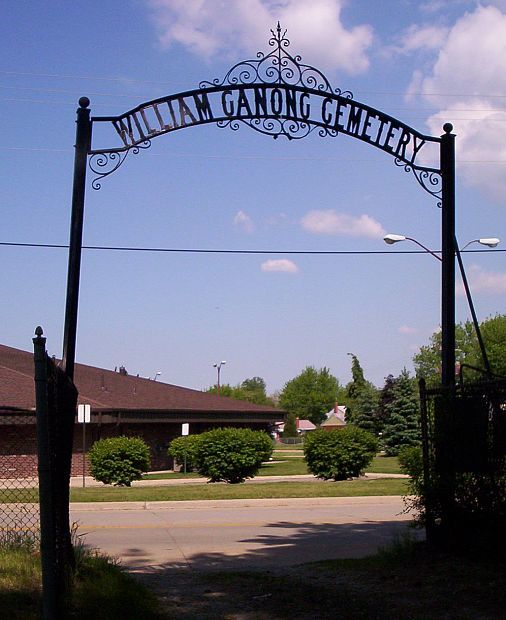
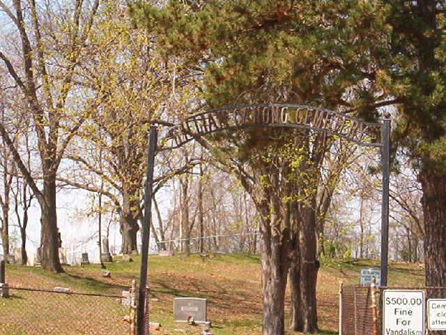
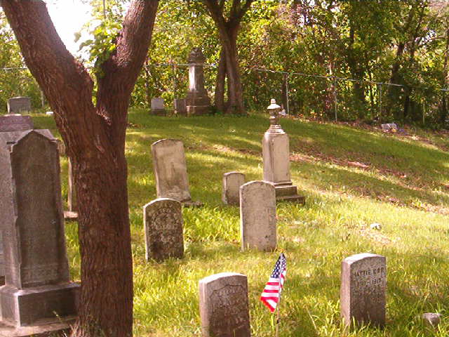
| Description | : | The land for the cemetery was set aside by William Ganong in 1832, from a portion of his farm land, so that family and friends would have a place to be buried. The Cemetery now owned by the City of Westland. The Westland Historical Society hopes to find interested people to help maintain the Cemetery and restore it to a good condition. |
frequently asked questions (FAQ):
-
Where is William Ganong Cemetery?
William Ganong Cemetery is located at 3036 Henry Ruff Rd. Westland, Wayne County ,Michigan , 48186USA.
-
William Ganong Cemetery cemetery's updated grave count on graveviews.com?
12 memorials
-
Where are the coordinates of the William Ganong Cemetery?
Latitude: 42.2743988
Longitude: -83.3388977
Nearby Cemetories:
1. Eloise Cemetery
Eloise, Wayne County, USA
Coordinate: 42.2817001, -83.3392029
2. Westlawn Cemetery
Wayne, Wayne County, USA
Coordinate: 42.2863998, -83.3507996
3. Saint Mary Cemetery
Wayne, Wayne County, USA
Coordinate: 42.2821999, -83.3728027
4. Glenwood Cemetery
Wayne, Wayne County, USA
Coordinate: 42.2883820, -83.3696760
5. Union Chapel Cemetery
Inkster, Wayne County, USA
Coordinate: 42.2939610, -83.3059790
6. Flight 255 Memorial
Romulus, Wayne County, USA
Coordinate: 42.2418785, -83.3272781
7. Old Wayne Cemetery
Wayne, Wayne County, USA
Coordinate: 42.2831345, -83.3874130
8. Westwood Cemetery
Inkster, Wayne County, USA
Coordinate: 42.2965300, -83.2956600
9. Oak Grove Burying Ground
Taylor, Wayne County, USA
Coordinate: 42.2671967, -83.2746048
10. Nowlin Cemetery
Dearborn Heights, Wayne County, USA
Coordinate: 42.2696991, -83.2649994
11. Kirk of Our Savior Memorial Garden
Westland, Wayne County, USA
Coordinate: 42.3102798, -83.4002838
12. Cadillac Memorial Gardens West
Westland, Wayne County, USA
Coordinate: 42.3280983, -83.3768997
13. Romulus Memorial Cemetery
Romulus, Wayne County, USA
Coordinate: 42.2287300, -83.3962310
14. Mount Kelly Cemetery
Dearborn, Wayne County, USA
Coordinate: 42.3133011, -83.2628021
15. Saint Paul Memorial Garden
Taylor, Wayne County, USA
Coordinate: 42.2268010, -83.2715610
16. Northview Cemetery
Dearborn, Wayne County, USA
Coordinate: 42.3149986, -83.2577972
17. Christ Episcopal Church Memorial Rose Garden
Dearborn, Wayne County, USA
Coordinate: 42.3122139, -83.2530899
18. Southminster Presbyterian Church Columbarium
Taylor, Wayne County, USA
Coordinate: 42.2410330, -83.2492890
19. Mason Street Cemetery (Defunct)
Dearborn, Wayne County, USA
Coordinate: 42.3003870, -83.2436300
20. Maple Grove Cemetery
Westland, Wayne County, USA
Coordinate: 42.3502998, -83.3272018
21. Tyler Street Cemetery
Van Buren Township, Wayne County, USA
Coordinate: 42.2372017, -83.4300003
22. Islamic Memorial Gardens
Westland, Wayne County, USA
Coordinate: 42.3519080, -83.3265260
23. Downer Cemetery
Canton, Wayne County, USA
Coordinate: 42.2790950, -83.4447670
24. Sloss Cemetery (Defunct)
Dearborn, Wayne County, USA
Coordinate: 42.3024000, -83.2381900