
| Memorials | : | 0 |
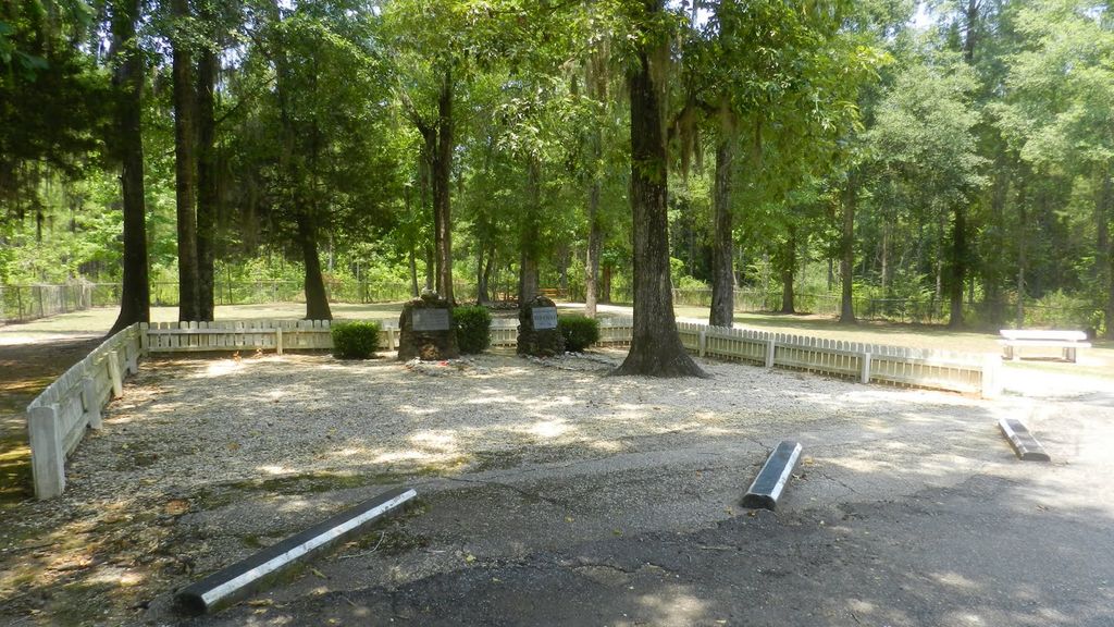
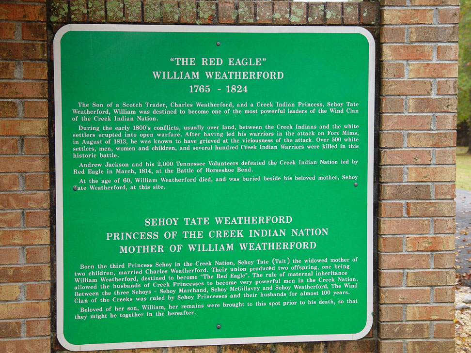
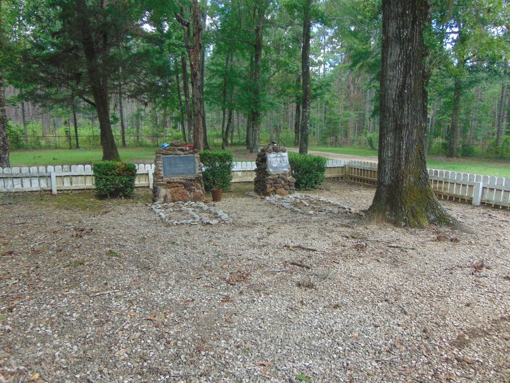
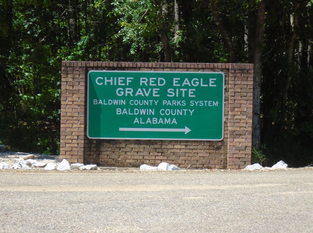
| Location | : | Little River, Baldwin County, USA |
| Coordinate | : | 31.2782993, -87.7675018 |
frequently asked questions (FAQ):
-
Where is William Weatherford Memorial Park?
William Weatherford Memorial Park is located at Little River, Baldwin County ,Alabama ,USA.
-
William Weatherford Memorial Park cemetery's updated grave count on graveviews.com?
0 memorials
-
Where are the coordinates of the William Weatherford Memorial Park?
Latitude: 31.2782993
Longitude: -87.7675018
Nearby Cemetories:
1. Tate Cemetery
Baldwin County, USA
Coordinate: 31.2450008, -87.7611008
2. Steadham Cemetery
Baldwin County, USA
Coordinate: 31.2406006, -87.7455978
3. Shipp Cemetery
Little River, Baldwin County, USA
Coordinate: 31.2973995, -87.7204971
4. Mamies Chapel Cemetery
Little River, Baldwin County, USA
Coordinate: 31.2830009, -87.7134018
5. Phillips Family Cemetery
Little River, Baldwin County, USA
Coordinate: 31.2761993, -87.7026901
6. Little River Baptist Church Cemetery
Chrysler, Monroe County, USA
Coordinate: 31.2999870, -87.7065690
7. Norris Cemetery
Chrysler, Monroe County, USA
Coordinate: 31.3118700, -87.7028100
8. Blake Place
Montgomery Hill, Baldwin County, USA
Coordinate: 31.2180800, -87.7397100
9. Lee Slaughter Family Cemetery
Baldwin County, USA
Coordinate: 31.2189121, -87.7233658
10. Ferrell Cemetery
Monroe County, USA
Coordinate: 31.3174992, -87.6980972
11. Williams Cemetery
Monroe County, USA
Coordinate: 31.3006001, -87.6883011
12. Wilson Family Cemetery
Little River, Baldwin County, USA
Coordinate: 31.2111588, -87.7379303
13. Scott Field
Clarke County, USA
Coordinate: 31.3266200, -87.8331200
14. Tate Tunstall Family Cemetery
Blacksher, Baldwin County, USA
Coordinate: 31.2121830, -87.7194824
15. Mount Gilead Baptist Church Cemetery
Carlton, Clarke County, USA
Coordinate: 31.3474110, -87.8155340
16. Tensaw Memorial Cemetery
Tensaw, Baldwin County, USA
Coordinate: 31.1977997, -87.7944031
17. Shomo Cemetery
Monroe County, USA
Coordinate: 31.3360996, -87.6941986
18. Carlton Cemetery
Carlton, Clarke County, USA
Coordinate: 31.3435210, -87.8454780
19. Mount Pleasant Methodist Church Cemetery
Eliska, Monroe County, USA
Coordinate: 31.3524500, -87.6831400
20. Weatherford Cemetery
Mineola, Monroe County, USA
Coordinate: 31.3281002, -87.6607971
21. Eliska Community Cemetery
Eliska, Monroe County, USA
Coordinate: 31.3531250, -87.6809780
22. Mineola Cemetery
Uriah, Monroe County, USA
Coordinate: 31.2861004, -87.6418991
23. Mount Nebo Cemetery
Carlton, Clarke County, USA
Coordinate: 31.3467007, -87.8685989
24. New Canaan Cemetery
Clarke County, USA
Coordinate: 31.3903008, -87.7572021