| Memorials | : | 0 |
| Location | : | Dry Fork, Pittsylvania County, USA |
| Coordinate | : | 36.6578500, -79.5620900 |
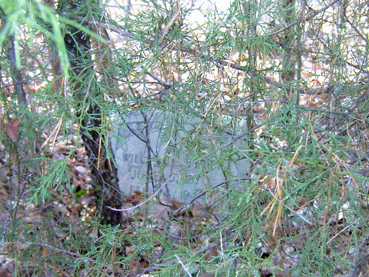
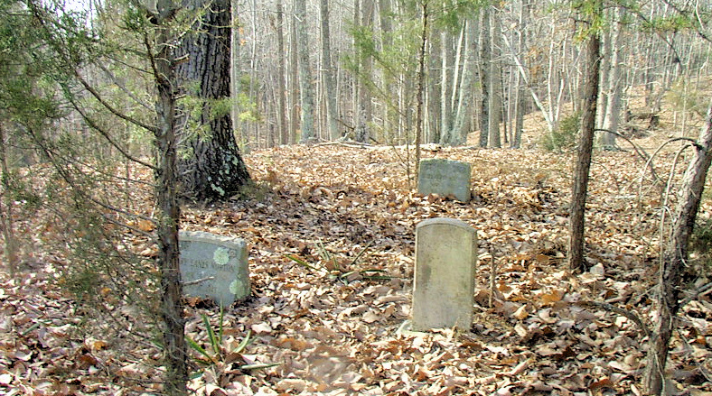
| Description | : | Family Cemetery of George Smith Wilson, the cemetery is in critical condition, some parts stones can't be reached because of overgrowth. There are known graves that I couldn't find markers for. Dircetions: From Danville follow Mount Cross Rd, make left on Sugartree Church Rd(St Rt 851), then go maybe half mile, turn left on Vance Mill Rd(St Rt 852), go maybe half a mile, turn by an old barn on left, follow path to a growth of trees, the cemetery is in the middle of the trees. [Edit Description] |
frequently asked questions (FAQ):
-
Where is Wilson Cemetery?
Wilson Cemetery is located at Vance Hill Rd(St Rt 852) Dry Fork, Pittsylvania County ,Virginia ,USA.
-
Wilson Cemetery cemetery's updated grave count on graveviews.com?
0 memorials
-
Where are the coordinates of the Wilson Cemetery?
Latitude: 36.6578500
Longitude: -79.5620900
Nearby Cemetories:
1. Smith Cemetery
Dry Fork, Pittsylvania County, USA
Coordinate: 36.6579900, -79.5620000
2. Blair - Scarce - Scearce Cemetery
Pittsylvania County, USA
Coordinate: 36.6733240, -79.5453880
3. Booker Cemetery
Pittsylvania County, USA
Coordinate: 36.6660720, -79.5338920
4. Saint Matthews Baptist Church Cemetery
Dry Fork, Pittsylvania County, USA
Coordinate: 36.6826000, -79.5676200
5. Still Springs Cemetery
Brosville, Pittsylvania County, USA
Coordinate: 36.6399390, -79.6006356
6. Gourley Cemetery
Brosville, Pittsylvania County, USA
Coordinate: 36.6354180, -79.5970850
7. Ashworth Cemetery
Pittsylvania County, USA
Coordinate: 36.6179500, -79.5560600
8. Mount Tatum Primitive Baptist Church Cemetery
Dry Fork, Pittsylvania County, USA
Coordinate: 36.6948150, -79.5305140
9. Eanes Cemetery
Brosville, Pittsylvania County, USA
Coordinate: 36.6297180, -79.6080490
10. Dishman Family Cemetery
Brosville, Pittsylvania County, USA
Coordinate: 36.6329380, -79.6114180
11. Severt Cemetery
Brosville, Pittsylvania County, USA
Coordinate: 36.6734250, -79.6205530
12. Crews Family Cemetery
Chatham, Pittsylvania County, USA
Coordinate: 36.7052740, -79.5817810
13. Piney Grove Primitive Baptist Church
Brosville, Pittsylvania County, USA
Coordinate: 36.6125820, -79.5885870
14. Hyler Family Cemetery
Bachelors Hall, Pittsylvania County, USA
Coordinate: 36.6081800, -79.5459300
15. Turner Cemetery
Brosville, Pittsylvania County, USA
Coordinate: 36.6495190, -79.6259020
16. Scearce Gammon Cemetery
Bachelors Hall, Pittsylvania County, USA
Coordinate: 36.6156006, -79.5239029
17. Whitmell Christian Church Cemetery
Dry Fork, Pittsylvania County, USA
Coordinate: 36.6999450, -79.5220350
18. Hyler-Hylton Cemetery
Brosville, Pittsylvania County, USA
Coordinate: 36.6049995, -79.5668030
19. Merchant Family Cemetery
Chatham, Pittsylvania County, USA
Coordinate: 36.6289340, -79.6197540
20. Dishman Family Cemetery
Pittsylvania County, USA
Coordinate: 36.6200800, -79.6166860
21. Dalton Cemetery
Pittsylvania County, USA
Coordinate: 36.6505210, -79.6349830
22. Pritchett Family Cemetery
Cascade, Pittsylvania County, USA
Coordinate: 36.6327720, -79.6300110
23. Long Cemetery
Brosville, Pittsylvania County, USA
Coordinate: 36.6180770, -79.6180920
24. Brown-Lewis Cemetery
Bachelors Hall, Pittsylvania County, USA
Coordinate: 36.6008180, -79.5891690


