
| Memorials | : | 28 |
| Location | : | Plattsburg, Clark County, USA |
| Coordinate | : | 39.8981018, -83.5547028 |
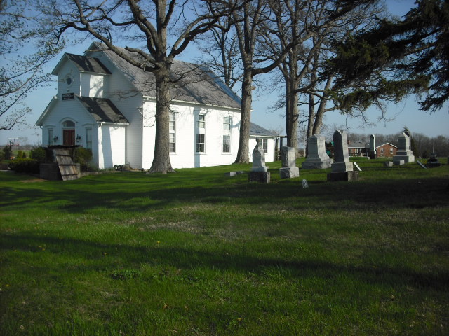
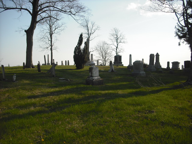
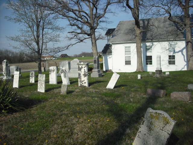
| Description | : | The cemetery is located on the south side of Plattsburg Road (Township Road 364) about 0.2 miles west of its intersection with Summerford Road (Township Road 384). The cemetery is located in Harmony Township, Clark County, Ohio and is # 1660 (Wilson Chapel Cemetery) and # 7147 (Williams Cemetery) [mistakenly listed in Paint Township, Madison County, Ohio] and #7194 (Turner Cemetery / Wilson Chapel) [mistakenly listed in Union Township, Madison County, Ohio] in “Ohio Cemeteries 1803-2003”, compiled by the Ohio Genealogical Society. |
frequently asked questions (FAQ):
-
Where is Wilson Chapel Cemetery?
Wilson Chapel Cemetery is located at Plattsburg Road (Township Road 364) Plattsburg, Clark County ,Ohio , 45368USA.
-
Wilson Chapel Cemetery cemetery's updated grave count on graveviews.com?
28 memorials
-
Where are the coordinates of the Wilson Chapel Cemetery?
Latitude: 39.8981018
Longitude: -83.5547028
Nearby Cemetories:
1. Brighton Cemetery
Clark County, USA
Coordinate: 39.9342003, -83.5686035
2. Plattsburg Cemetery
Plattsburg, Clark County, USA
Coordinate: 39.8939476, -83.6038132
3. Infirmary Cemetery
London, Madison County, USA
Coordinate: 39.8624992, -83.5121994
4. Williams Chapel Cemetery
Madison County, USA
Coordinate: 39.8497009, -83.5603027
5. Institution Cemetery
London, Madison County, USA
Coordinate: 39.8960991, -83.4891968
6. Pleasant Hill Cemetery
South Vienna, Clark County, USA
Coordinate: 39.9441986, -83.5958023
7. Kirkwood Cemetery
Union Township, Madison County, USA
Coordinate: 39.8741989, -83.4828033
8. Somerford Old Cemetery
Summerford, Madison County, USA
Coordinate: 39.9366989, -83.4942017
9. Somerford Cemetery
Summerford, Madison County, USA
Coordinate: 39.9453011, -83.5038986
10. South Vienna Cemetery
South Vienna, Clark County, USA
Coordinate: 39.9286003, -83.6258011
11. Statler Cemetery
Madison County, USA
Coordinate: 39.9650002, -83.5124969
12. Paint Township Cemetery
London, Madison County, USA
Coordinate: 39.8400002, -83.4927979
13. Lisbon Cemetery
Lisbon, Clark County, USA
Coordinate: 39.8591995, -83.6393967
14. Bodkin Cemetery
Clark County, USA
Coordinate: 39.9707985, -83.5932999
15. First Presbyterian Church Columbarium
London, Madison County, USA
Coordinate: 39.9002180, -83.4521610
16. Goodfellow Cemetery
Harmony, Clark County, USA
Coordinate: 39.9146620, -83.6556300
17. Evans Cemetery
Madison County, USA
Coordinate: 39.8457985, -83.4721985
18. Davisson-Ellsworth Cemetery
South Charleston, Clark County, USA
Coordinate: 39.8288410, -83.6153980
19. Saint Charles Cemetery
South Charleston, Clark County, USA
Coordinate: 39.8316994, -83.6247025
20. Wraggs Cemetery
Clark County, USA
Coordinate: 39.9028015, -83.6667023
21. Ropp Cemetery
Catawba, Clark County, USA
Coordinate: 39.9759220, -83.6090250
22. Greenlawn Cemetery
South Charleston, Clark County, USA
Coordinate: 39.8342018, -83.6350021
23. Arbuckle Cemetery
Madison County, USA
Coordinate: 39.9583015, -83.4644012
24. Oak Hill Cemetery
London, Madison County, USA
Coordinate: 39.8997002, -83.4321976