
| Memorials | : | 0 |
| Location | : | Blue Diamond, Clark County, USA |
| Coordinate | : | 36.0691340, -115.4613950 |
| Description | : | Spring Mountain Ranch State Park is a state park of Nevada, USA, preserving the historic Sandstone Ranch established in 1876. It is located within the Red Rock Canyon National Conservation Area in the Cottonwood Valley, 15.2 miles (24.5 km) west of Las Vegas. |
frequently asked questions (FAQ):
-
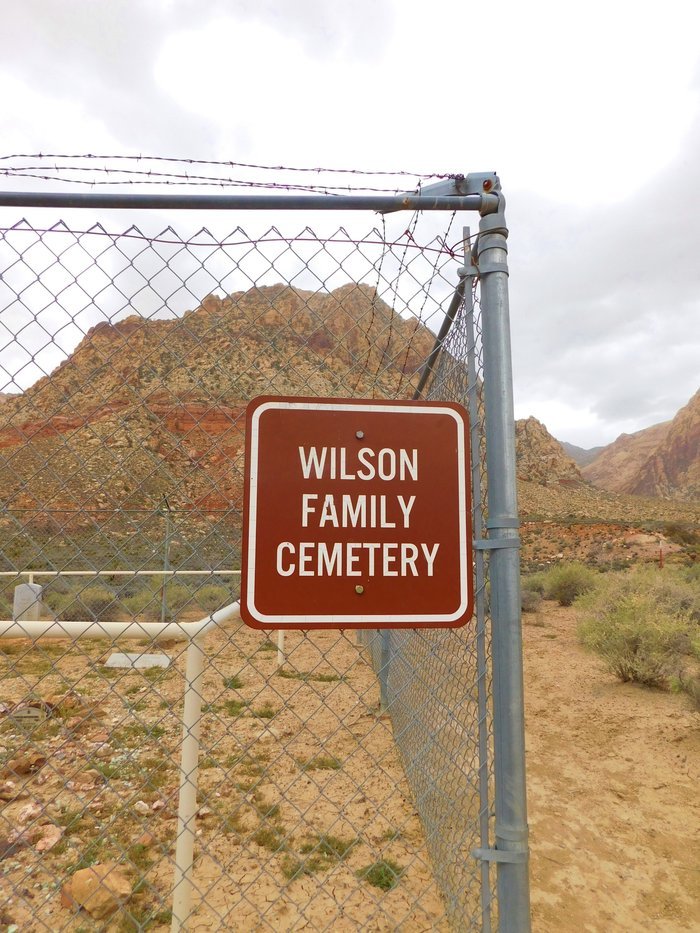
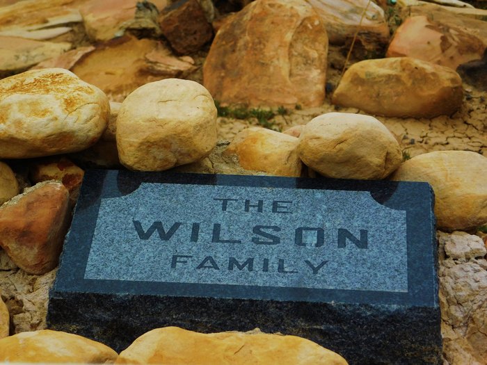
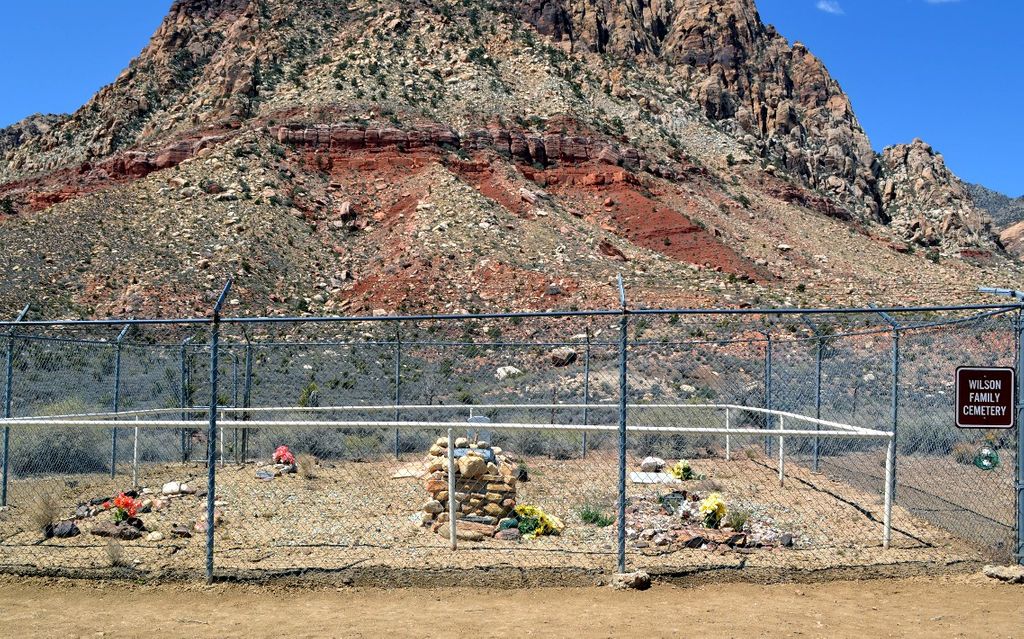
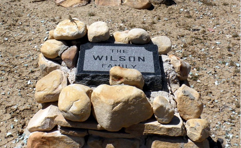
Where is Wilson Family Cemetery?
Wilson Family Cemetery is located at Blue Diamond, Clark County ,Nevada ,USA.
-
Wilson Family Cemetery cemetery's updated grave count on graveviews.com?
0 memorials
-
Where are the coordinates of the Wilson Family Cemetery?
Latitude: 36.0691340
Longitude: -115.4613950
Nearby Cemetories:
1. Barbara G. Edwards 9-11 Memorial
Las Vegas, Clark County, USA
Coordinate: 36.1706696, -115.3346481
2. Christ Lutheran Church Prayer Garden Columbarium
Las Vegas, Clark County, USA
Coordinate: 36.1742000, -115.2338700
3. Our Lady of Wisdom Catholic Church Columbarium
Las Vegas, Clark County, USA
Coordinate: 36.1487800, -115.2158200
4. All Saints Episcopal Church Columbarium
Las Vegas, Clark County, USA
Coordinate: 36.1810700, -115.1982480
5. Craig Road Pet Cemetery
Las Vegas, Clark County, USA
Coordinate: 36.2408752, -115.2525482
6. Goodsprings Cemetery
Goodsprings, Clark County, USA
Coordinate: 35.8296700, -115.4282913
7. Bunkers Memory Gardens Cemetery
Las Vegas, Clark County, USA
Coordinate: 36.2463989, -115.2514038
8. Christ Church Columbarium
Las Vegas, Clark County, USA
Coordinate: 36.1465830, -115.1374620
9. Davis Memorial Park
Las Vegas, Clark County, USA
Coordinate: 36.0772209, -115.1181488
10. Palm Memorial Park
Las Vegas, Clark County, USA
Coordinate: 36.0516014, -115.1166992
11. King David Memorial Chapel and Cemetery
Las Vegas, Clark County, USA
Coordinate: 36.0529518, -115.1136475
12. Las Vegas Paiute Tribe Cemetery
Las Vegas, Clark County, USA
Coordinate: 36.1860008, -115.1399994
13. Palm Memorial Park Northwest
Las Vegas, Clark County, USA
Coordinate: 36.2813700, -115.2251700
14. Palm Downtown Cemetery
Las Vegas, Clark County, USA
Coordinate: 36.1847992, -115.1377029
15. Bunkers Eden Vale Memorial Park
Las Vegas, Clark County, USA
Coordinate: 36.1841011, -115.1333008
16. Sandy Valley Cemetery
Sandy Valley, Clark County, USA
Coordinate: 35.8035800, -115.6032500
17. Woodlawn Cemetery
Las Vegas, Clark County, USA
Coordinate: 36.1871986, -115.1316986
18. Kiel Ranch Cemetery
North Las Vegas, Clark County, USA
Coordinate: 36.2042000, -115.1408700
19. Community Lutheran Church Columbarium
Las Vegas, Clark County, USA
Coordinate: 36.1006670, -115.0936600
20. Saint Matthew's Episcopal Church Columbarium
Las Vegas, Clark County, USA
Coordinate: 36.1039150, -115.0646130
21. Quehoe Gravesite
Pahrump, Nye County, USA
Coordinate: 36.0116500, -115.8550600
22. Saint Therese Mission Catholic Cemetery
Tecopa, Inyo County, USA
Coordinate: 35.9742060, -115.8660180
23. Nellis AFB Freedom Park
Las Vegas, Clark County, USA
Coordinate: 36.2357830, -115.0573550
24. Saint Timothys Episcopal Church Columbarium
Henderson, Clark County, USA
Coordinate: 36.0323900, -114.9860900