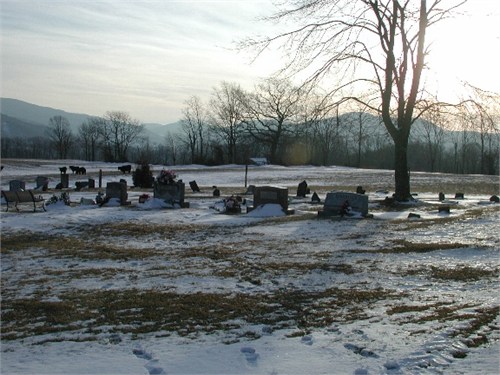
| Memorials | : | 2 |
| Location | : | Tucker County, USA |
| Coordinate | : | 38.9859580, -79.4784080 |
| Description | : | Also may be known as Rohrbaugh family graveyard. Location: Wolford or Rohrbaugh, Dry Fork District; North of Red Creek on Route 32, to intersection 72 (The Red Creek Road). West on Route 72 for 0.03 mile to property of Cletus Hoffman in 1975. South Side of road. Sixteen marked and 40 or more unmarked. - Odie Velta Nestor Chapman, "They Rest Quietly: Cemetery Records of Tucker County West Virginia", McClain Printing, 1985. |
frequently asked questions (FAQ):
-
Where is Wolford-Rohrbaugh Cemetery?
Wolford-Rohrbaugh Cemetery is located at Tucker County ,West Virginia ,USA.
-
Wolford-Rohrbaugh Cemetery cemetery's updated grave count on graveviews.com?
2 memorials
-
Where are the coordinates of the Wolford-Rohrbaugh Cemetery?
Latitude: 38.9859580
Longitude: -79.4784080
Nearby Cemetories:
1. Hedrick Cemetery
Red Creek, Tucker County, USA
Coordinate: 38.9894850, -79.4693680
2. Flanagan Memorial Cemetery
Laneville, Tucker County, USA
Coordinate: 38.9858017, -79.4591980
3. Nelson Cemetery
Dryfork, Randolph County, USA
Coordinate: 38.9756260, -79.4959780
4. Lanesville Bethel Church Cemetery
Laneville, Tucker County, USA
Coordinate: 38.9835020, -79.4541530
5. Judy Cemetery
Laneville, Tucker County, USA
Coordinate: 38.9904950, -79.4526050
6. Huffman Cemetery
Tucker County, USA
Coordinate: 38.9905210, -79.4525900
7. Flanagan Hill Cemetery
Red Creek, Tucker County, USA
Coordinate: 39.0013400, -79.4964020
8. D. B. Harper Cemetery
Randolph County, USA
Coordinate: 38.9679380, -79.4931890
9. Bonner-Johnson Cemetery
Tucker County, USA
Coordinate: 38.9839800, -79.5087700
10. Old Ault Family Cemetery
Red Creek, Tucker County, USA
Coordinate: 38.9962140, -79.5075670
11. Turner Cemetery
Dryfork, Randolph County, USA
Coordinate: 38.9687195, -79.5028305
12. Bonner Mountain Cemetery
Dryfork, Randolph County, USA
Coordinate: 38.9600754, -79.4767303
13. Nine Cemetery
Tucker County, USA
Coordinate: 39.0254500, -79.4642930
14. Pennington Cemetery
Harman, Randolph County, USA
Coordinate: 38.9463760, -79.5049300
15. Mick Family Cemetery
Harman, Randolph County, USA
Coordinate: 38.9463470, -79.5053720
16. Buena Chapel Cemetery
Canaan Heights, Tucker County, USA
Coordinate: 39.0223200, -79.4438200
17. Laban Smith Family Cemetery
Randolph County, USA
Coordinate: 38.9587080, -79.5259120
18. Carr-White Cemetery
Tucker County, USA
Coordinate: 39.0234100, -79.5201220
19. Teter Cemetery
Gladwin, Tucker County, USA
Coordinate: 39.0018997, -79.5432968
20. Brights Chapel Cemetery
Elk, Tucker County, USA
Coordinate: 39.0201000, -79.5312400
21. Judy Cemetery
Harman, Randolph County, USA
Coordinate: 38.9368480, -79.5170200
22. Vandevender Cemetery
Harman, Randolph County, USA
Coordinate: 38.9341240, -79.5237940
23. Andrew Shirk Cemetery
Gladwin, Tucker County, USA
Coordinate: 38.9987970, -79.5581280
24. Clark-Carr Cemetery
Red Creek, Tucker County, USA
Coordinate: 39.0240580, -79.5434710


