| Memorials | : | 2 |
| Location | : | Durham, Strafford County, USA |
| Coordinate | : | 43.1501750, -70.9413870 |
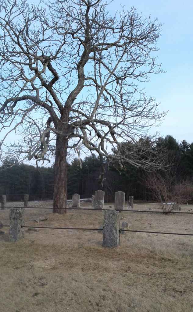
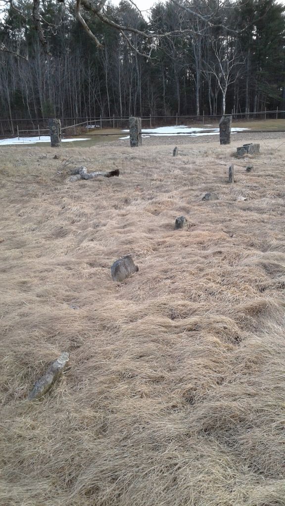
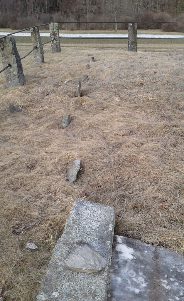
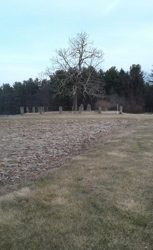
| Description | : | Cemetery is located at the end of Spinney Lane at the Moses Woodman Farm which is now the Woodman Research Farm (70 Spinney Lane) of the University of New Hampshire. After passing through the gate, the cemetery is easily seen in the field on the right. There are 6 graves with memorial stones and 7 graves that are clearly marked in a row, with head and foot granite stones. The cemetery is surrounded by a stone/pipe fence with a single tree in the middle. Three of the memorial stones have broken and are laying upright. New Hampshire Old Graveyard... Read More |
frequently asked questions (FAQ):
-
Where is Woodman Cemetery?
Woodman Cemetery is located at Spinney Lane Durham, Strafford County ,New Hampshire , 03824USA.
-
Woodman Cemetery cemetery's updated grave count on graveviews.com?
2 memorials
-
Where are the coordinates of the Woodman Cemetery?
Latitude: 43.1501750
Longitude: -70.9413870
Nearby Cemetories:
1. Woodman Cemetery
Durham, Strafford County, USA
Coordinate: 43.1501700, -70.9413700
2. Stevens Cemetery
Durham, Strafford County, USA
Coordinate: 43.1452780, -70.9430560
3. Demeritt Cemetery
Durham, Strafford County, USA
Coordinate: 43.1479000, -70.9517000
4. White Cemetery
Durham, Strafford County, USA
Coordinate: 43.1400210, -70.9410600
5. Page Cemetery
Durham, Strafford County, USA
Coordinate: 43.1396344, -70.9383405
6. Miles Cemetery
Madbury, Strafford County, USA
Coordinate: 43.1613190, -70.9315910
7. Demeritt Cemetery
Durham, Strafford County, USA
Coordinate: 43.1427780, -70.9572220
8. Durham Cemetery
Durham, Strafford County, USA
Coordinate: 43.1474991, -70.9614029
9. Emerson Cemetery
Durham, Strafford County, USA
Coordinate: 43.1431964, -70.9211684
10. Town Hall Cemetery
Madbury, Strafford County, USA
Coordinate: 43.1672910, -70.9422020
11. Demeritt Town Hall Road Cemetery
Madbury, Strafford County, USA
Coordinate: 43.1673040, -70.9431620
12. Madbury Memorial Cemetery
Madbury, Strafford County, USA
Coordinate: 43.1677000, -70.9483300
13. Demeritt Cemetery
Lee, Strafford County, USA
Coordinate: 43.1563890, -70.9655560
14. Griffin Cemetery
Durham, Strafford County, USA
Coordinate: 43.1377850, -70.9205550
15. Woodman Cemetery
Durham, Strafford County, USA
Coordinate: 43.1377850, -70.9205370
16. Emerson-Buzzell Family Graveyard
Lee, Strafford County, USA
Coordinate: 43.1591518, -70.9667262
17. Community Church of Durham Memorial Garden
Durham, Strafford County, USA
Coordinate: 43.1316000, -70.9210900
18. Young Cemetery
Durham, Strafford County, USA
Coordinate: 43.1339680, -70.9168160
19. School House Lane Cemetery
Durham, Strafford County, USA
Coordinate: 43.1328735, -70.9181442
20. Hoitt Cemetery
Lee, Strafford County, USA
Coordinate: 43.1412770, -70.9726820
21. Demerritt Family Cemetery
Lee, Strafford County, USA
Coordinate: 43.1513890, -70.9750000
22. Foss Family Cemetery
Durham, Strafford County, USA
Coordinate: 43.1452914, -70.9077409
23. Hamilton Smith Chapel Cemetery
Durham, Strafford County, USA
Coordinate: 43.1276990, -70.9243530
24. Leathers Cemetery
Durham, Strafford County, USA
Coordinate: 43.1357920, -70.9107460


