
| Memorials | : | 0 |
| Location | : | McDuffie County, USA |
| Coordinate | : | 33.5499992, -82.5721970 |
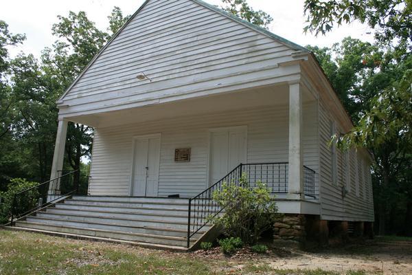
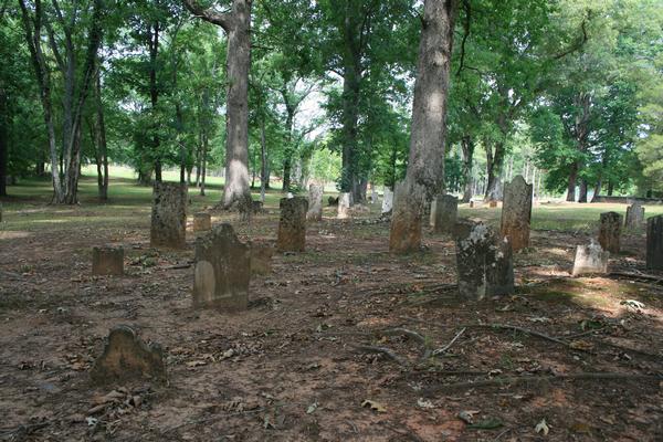
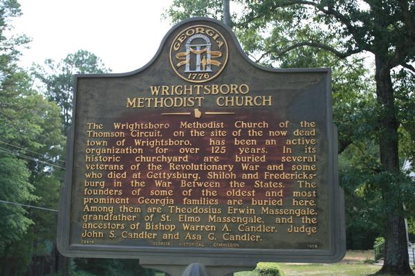
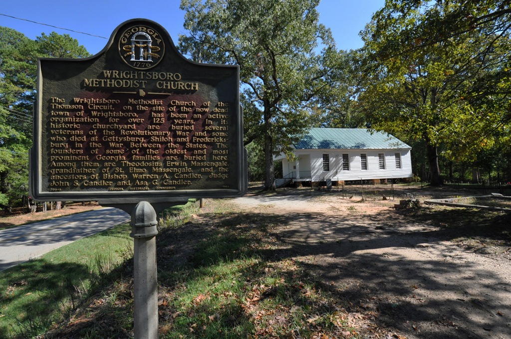
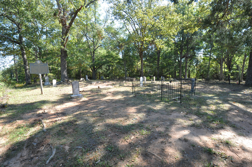
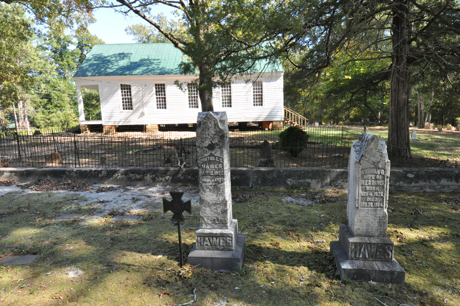
| Description | : | The Wrightsboro Methodist Church is located on a small hill overlooking the site that in 1754, Edmund Grey, founded the Quaker town of Brandon. The first meeting house would have been constructed at about this time, and some records show that two buildings were built and burned before the church now standing was constructed. The current structure was built between 1810 and 1812 by the selling of public subscriptions and land. Ancestors of prominent Georgia families are buried at Wrightsboro Methodist, including the ancestors of Asa G. Candler – founder of the Coca-Cola Company and mayor of Atlanta... Read More |
frequently asked questions (FAQ):
-
Where is Wrightsboro Methodist Church Cemetery?
Wrightsboro Methodist Church Cemetery is located at McDuffie County ,Georgia ,USA.
-
Wrightsboro Methodist Church Cemetery cemetery's updated grave count on graveviews.com?
0 memorials
-
Where are the coordinates of the Wrightsboro Methodist Church Cemetery?
Latitude: 33.5499992
Longitude: -82.5721970
Nearby Cemetories:
1. New Zion Hill AME Church Cemetery
McDuffie County, USA
Coordinate: 33.5466995, -82.5905991
2. Liberty Hill Cemetery
McDuffie County, USA
Coordinate: 33.5447006, -82.5950012
3. Pleasant Grove Cemetery
McDuffie County, USA
Coordinate: 33.5435982, -82.5475006
4. Gentleman's Hill Cemetery
Thomson, McDuffie County, USA
Coordinate: 33.5380930, -82.5482460
5. Ridge Road Cemetery
Wrightsboro, McDuffie County, USA
Coordinate: 33.5396528, -82.6019444
6. Rees-Wade-Short Family Cemetery
Wrightsboro, McDuffie County, USA
Coordinate: 33.5497017, -82.5381012
7. McCord Cemetery
McDuffie County, USA
Coordinate: 33.5397222, -82.5366667
8. Ivey Cemetery
McDuffie County, USA
Coordinate: 33.5050011, -82.5839005
9. Green Branch Baptist Church Cemetery Old
Thomson, McDuffie County, USA
Coordinate: 33.5855900, -82.5354310
10. Hugh Rees Family Cemetery
Wrightsboro, McDuffie County, USA
Coordinate: 33.5161270, -82.5234420
11. Pine Grove Baptist Church Cemetery
McDuffie County, USA
Coordinate: 33.5475006, -82.5085983
12. Union Baptist Church Cemetery
McDuffie County, USA
Coordinate: 33.4958000, -82.5642014
13. William Hill Memorial Cemetery
Thomson, McDuffie County, USA
Coordinate: 33.5216020, -82.5100110
14. Brinkley Chapel Baptist Church Cemetery
Thomson, McDuffie County, USA
Coordinate: 33.6129590, -82.5654460
15. Wilson Family Cemetery
Thomson, McDuffie County, USA
Coordinate: 33.4961700, -82.5304990
16. Savannah Valley Memorial Gardens
Thomson, McDuffie County, USA
Coordinate: 33.5168991, -82.5042038
17. Moore Cemetery
McDuffie County, USA
Coordinate: 33.6082993, -82.6085968
18. Shank Family Cemetery
Thomson, McDuffie County, USA
Coordinate: 33.5008900, -82.5168400
19. House Of God Church Of God In Christ Cemetery
Thomson, McDuffie County, USA
Coordinate: 33.5009000, -82.5159300
20. Earle Street Cemetery
Thomson, McDuffie County, USA
Coordinate: 33.5072820, -82.5069130
21. Foster Cemetery
McDuffie County, USA
Coordinate: 33.4810982, -82.5903015
22. White Oak Grove Baptist Church Cemetery
Thomson, McDuffie County, USA
Coordinate: 33.5310300, -82.4838500
23. New Hope Cemetery
McDuffie County, USA
Coordinate: 33.4660250, -82.5815220
24. Collins Cemetery
Scuffletown, McDuffie County, USA
Coordinate: 33.5210991, -82.4741974