| Memorials | : | 3 |
| Location | : | San Francisco, San Francisco County, USA |
| Coordinate | : | 37.8127420, -122.3707880 |
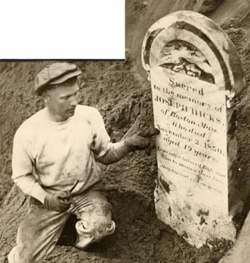
| Description | : | Established in 1852. The little cemetery, enclosed by an iron pipe and housing 98 graves marked with little wooden crosses was and may still be located on the western side of Yerba Buena Island. In preparation for the 1939 World’s Fair, workers cut away two rows of the eucalyptus trees that shaded the burial ground leaving the small cemetery exposed. During his visit to Yerba Buena, Assistant Secretary of the Navy, Charles Edison, discussed with other naval officials that because of its proximity to the fair grounds entrance, the cemetery should be removed, either to a more secluded spot on the... Read More |
frequently asked questions (FAQ):
-
Where is Yerba Buena Island Cemetery (Defunct)?
Yerba Buena Island Cemetery (Defunct) is located at San Francisco, San Francisco County ,California ,USA.
-
Yerba Buena Island Cemetery (Defunct) cemetery's updated grave count on graveviews.com?
3 memorials
-
Where are the coordinates of the Yerba Buena Island Cemetery (Defunct)?
Latitude: 37.8127420
Longitude: -122.3707880
Nearby Cemetories:
1. First Street Cemetery (Defunct)
San Francisco, San Francisco County, USA
Coordinate: 37.7906170, -122.3991770
2. Bush Street Cemetery (Defunct)
San Francisco, San Francisco County, USA
Coordinate: 37.7907950, -122.4011960
3. Old Saint Marys Cathedral Crypt
San Francisco, San Francisco County, USA
Coordinate: 37.7929010, -122.4058220
4. Grace Cathedral Columbarium
San Francisco, San Francisco County, USA
Coordinate: 37.7921110, -122.4133220
5. Hebrew Cemetery (Defunct)
San Francisco, San Francisco County, USA
Coordinate: 37.7959320, -122.4261060
6. Yerba Buena Cemetery (Defunct)
San Francisco, San Francisco County, USA
Coordinate: 37.7792015, -122.4124985
7. First Unitarian Universalist Church Grounds
San Francisco, San Francisco County, USA
Coordinate: 37.7852859, -122.4231339
8. Saint Mary's Columbarium
San Francisco, San Francisco County, USA
Coordinate: 37.7965330, -122.4376000
9. Saint Dominics Catholic Church Columbarium
San Francisco, San Francisco County, USA
Coordinate: 37.7870300, -122.4355000
10. Episcopal Church of Saint John the Evangelist Garden
San Francisco, San Francisco County, USA
Coordinate: 37.7662880, -122.4212860
11. Saint Francis Lutheran Church Memorial Terrace
San Francisco, San Francisco County, USA
Coordinate: 37.7685290, -122.4293100
12. Laurel Hill Cemetery (Defunct)
San Francisco, San Francisco County, USA
Coordinate: 37.7841300, -122.4508670
13. Angel Island Cemetery (defunct)
Tiburon, Marin County, USA
Coordinate: 37.8621830, -122.4325920
14. Hartford Street Zen Center Garden
San Francisco, San Francisco County, USA
Coordinate: 37.7615830, -122.4338080
15. Calvary Cemetery (Defunct)
San Francisco, San Francisco County, USA
Coordinate: 37.7799580, -122.4513390
16. Masonic Cemetery
San Francisco, San Francisco County, USA
Coordinate: 37.7767020, -122.4503950
17. San Francisco National Cemetery
San Francisco, San Francisco County, USA
Coordinate: 37.8011208, -122.4617462
18. Mission Dolores Cemetery
San Francisco, San Francisco County, USA
Coordinate: 37.7596359, -122.4366150
19. Greco Russian Cemetery
San Francisco, San Francisco County, USA
Coordinate: 37.7774110, -122.4542260
20. Chinese Cemetery
San Francisco, San Francisco County, USA
Coordinate: 37.7854530, -122.4589380
21. San Francisco Columbarium
San Francisco, San Francisco County, USA
Coordinate: 37.7806587, -122.4570694
22. Odd Fellows Cemetery (Defunct)
San Francisco, San Francisco County, USA
Coordinate: 37.7791100, -122.4564240
23. Presidio of San Francisco Pet Cemetery
San Francisco, San Francisco County, USA
Coordinate: 37.8025490, -122.4671960
24. World War II West Coast Memorial
San Francisco, San Francisco County, USA
Coordinate: 37.7941742, -122.4653168

