| Memorials | : | 0 |
| Location | : | Ylitornio Municipality, Finland |
| Website | : | www.ylitornionseurakunta.fi/etusivu |
| Coordinate | : | 66.3135511, 23.6702528 |
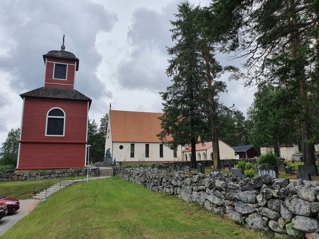
| Description | : | The old cemetery in Ylitornio has been drawn on the map from 1928 to 1934. A copy of the original map of the cemetery is on the wall of the parish home. The cemetery is known for its wooded nature and steep slope. Although the cemetery is old, it is still in active use. The cemetery is single-story and was originally designed for coffin burials only. As urn burials become more common, many urns have been buried in family cemeteries over the years. Ylitornion vanha hautausmaa on piirretty kartaksi vuosien 1928 - 1934 aikana. Hautausmaan alkuperäisen kartan kopio... Read More |
frequently asked questions (FAQ):
-
Where is Ylitornio Cemetery?
Ylitornio Cemetery is located at Alkkulanraitti 8 Ylitornio Municipality ,Lapland , 95600Finland.
-
Ylitornio Cemetery cemetery's updated grave count on graveviews.com?
0 memorials
-
Where are the coordinates of the Ylitornio Cemetery?
Latitude: 66.3135511
Longitude: 23.6702528
Nearby Cemetories:
1. Övertorneå Kyrkogård
Övertorneå, Övertorneå kommun, Sweden
Coordinate: 66.3907287, 23.6567216
2. Hietaniemi kyrkogård
Hedenaset, Övertorneå kommun, Sweden
Coordinate: 66.2149571, 23.7102455
3. Kalix Gamla Kyrkogård
Kalix kommun, Sweden
Coordinate: 66.2294120, 23.2160430
4. Karunki Cemetery
Tornio Municipality, Finland
Coordinate: 66.0397196, 24.0104161
5. Turtolan hautausmaa
Turtola, Pello Municipality, Finland
Coordinate: 66.6513855, 23.8754876
6. Morjärvs Kyrkogård
Kalix kommun, Sweden
Coordinate: 66.0693020, 22.7007360
7. Pellon Hautausmaa
Pello, Pello Municipality, Finland
Coordinate: 66.7955974, 23.9953825
8. Tornio Church Cemetery
Tornio, Tornio Municipality, Finland
Coordinate: 65.8494180, 24.1438290
9. Älvkyrkogården
Kalix kommun, Sweden
Coordinate: 65.8596210, 23.1327860
10. Seskarö kyrkogård
Seskaro, Haparanda kommun, Sweden
Coordinate: 65.7349953, 23.7380941
11. Råneå kyrkogård
Råneå, Luleå kommun, Sweden
Coordinate: 65.8671127, 22.2993637
12. Narkens kapell
Narken, Pajala kommun, Sweden
Coordinate: 66.9422071, 22.7194885
13. Tavivaaran hautausmaa
Rovaniemi, Rovaniemi Municipality, Finland
Coordinate: 66.4274600, 25.6929400
14. Rovaniemi IV Cemetery
Rovaniemi, Rovaniemi Municipality, Finland
Coordinate: 66.4890200, 25.6970800
15. Rovaniemen I hautausmaa
Rovaniemi, Rovaniemi Municipality, Finland
Coordinate: 66.4940731, 25.7307516
16. Saurbaerjarkirkja
Iceland
Coordinate: 65.4788800, 24.0036110
17. Rovaniemi Norvajärvi Saksalaisten sotilaiden hauta
Rovaniemi Municipality, Finland
Coordinate: 66.6279970, 25.7855650
18. Pajala Cemetery
Pajala, Pajala kommun, Sweden
Coordinate: 67.2076900, 23.3793000
19. Skogskyrkogården Södra Svartbyn
Bodens kommun, Sweden
Coordinate: 65.7964697, 21.7598486
20. Tärendö Kyrkogård
Tarendo, Pajala kommun, Sweden
Coordinate: 67.1563935, 22.6326660
21. Överluleå Gamla Kyrkogården
Boden, Bodens kommun, Sweden
Coordinate: 65.8296808, 21.6871287
22. Nederluleå kyrkogård
Gammelstad, Luleå kommun, Sweden
Coordinate: 65.6445700, 22.0288400
23. Lundagård Kyrkogård
Boden, Bodens kommun, Sweden
Coordinate: 65.8193519, 21.6787128
24. Innerstadens griftegård
Luleå, Luleå kommun, Sweden
Coordinate: 65.5914314, 22.1575676

