
| Memorials | : | 4 |
| Location | : | Franklin, Johnson County, USA |
| Coordinate | : | 39.4342003, -86.0400009 |
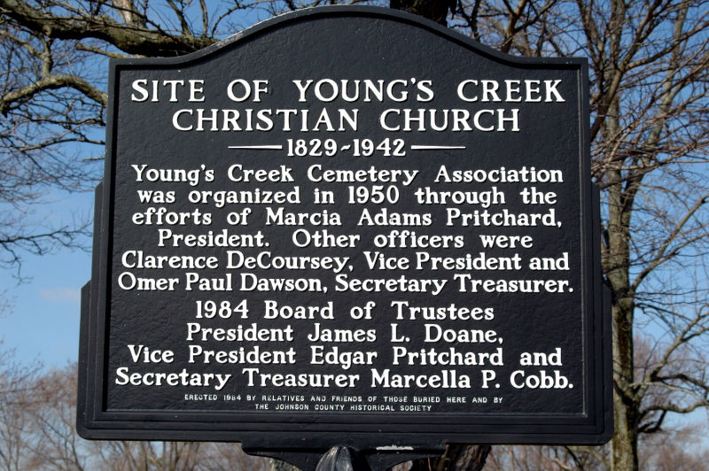
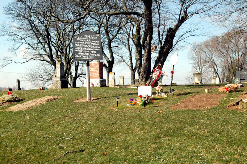
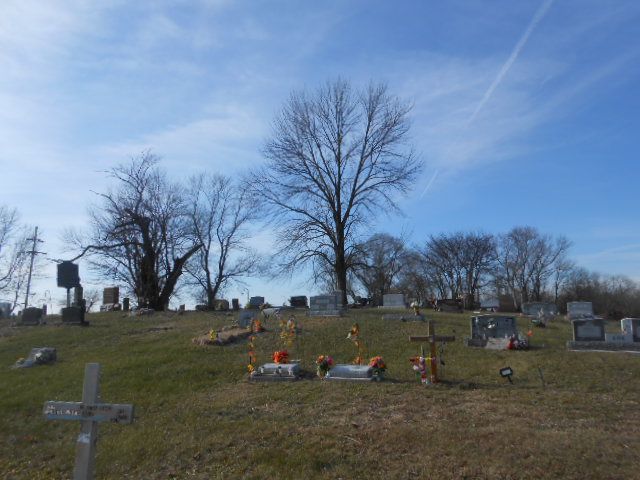
| Description | : | The cemetery is located in Needham Township (SE quadrant of the SW quadrant of the SW quadrant of Section 36 Township 12N Range 4E) on the northwest corner of the intersection of S Mauxferry Road and E County Road 300 S. Indiana Cemetery Locations, Volume 1, published by the Indiana Genealogical Society (02 April 2005), gives the primary cemetery name as Youngs Creek Cemetery with an alternate name of Tennessee Cemetery. The cemetery is listed in the Cemetery and Burial Grounds Registry of the Indiana Department of Natural Resources (DNR) and in the State Historical Architectural and Archaeological... Read More |
frequently asked questions (FAQ):
-
Where is Youngs Creek Cemetery?
Youngs Creek Cemetery is located at S Mauxferry Road and E County Road 300 S Franklin, Johnson County ,Indiana , 46131USA.
-
Youngs Creek Cemetery cemetery's updated grave count on graveviews.com?
4 memorials
-
Where are the coordinates of the Youngs Creek Cemetery?
Latitude: 39.4342003
Longitude: -86.0400009
Nearby Cemetories:
1. Legan Cemetery
Nineveh, Johnson County, USA
Coordinate: 39.4185890, -86.0495710
2. Tucker Cemetery
Nineveh, Johnson County, USA
Coordinate: 39.4179650, -86.0671090
3. Nay-Tremain Cemetery
Nineveh, Johnson County, USA
Coordinate: 39.4010620, -86.0416031
4. Forsythe-Featherngill Cemetery
Nineveh, Johnson County, USA
Coordinate: 39.4174042, -86.0797653
5. Hamner Cemetery
Amity, Johnson County, USA
Coordinate: 39.4143982, -86.0006027
6. Devore Family Cemetery
Needham, Johnson County, USA
Coordinate: 39.4551392, -86.0011597
7. McCaslin Cemetery
Franklin, Johnson County, USA
Coordinate: 39.4578650, -86.0807870
8. Mullikin Cemetery
Nineveh, Johnson County, USA
Coordinate: 39.4314003, -86.0911026
9. Armstrong Cemetery
Amity, Johnson County, USA
Coordinate: 39.4191933, -85.9914856
10. Greenlawn Cemetery
Franklin, Johnson County, USA
Coordinate: 39.4768982, -86.0597000
11. Pioneer Park Cemetery
Johnson County, USA
Coordinate: 39.4789000, -86.0504600
12. Grace United Methodist Church Columbarium
Franklin, Johnson County, USA
Coordinate: 39.4841250, -86.0351260
13. County Farm Cemetery
Franklin, Johnson County, USA
Coordinate: 39.4773620, -86.0754850
14. Middle of the Road Grave
Franklin, Johnson County, USA
Coordinate: 39.4198800, -85.9759000
15. Forsyth Cemetery
Franklin, Johnson County, USA
Coordinate: 39.3885000, -86.0776000
16. Smiley Cemetery
Franklin, Johnson County, USA
Coordinate: 39.4513390, -85.9694120
17. Atwood Cemetery
Johnson County, USA
Coordinate: 39.4170800, -85.9616000
18. POW Chapel Cemetery (Defunct)
Nineveh, Johnson County, USA
Coordinate: 39.3752940, -86.0688320
19. Pritchard Cemetery (Defunct)
Nineveh, Johnson County, USA
Coordinate: 39.3682750, -86.0423480
20. Riggs Cemetery
Nineveh, Johnson County, USA
Coordinate: 39.3871540, -86.1000200
21. Mount Pleasant Cemetery
Franklin, Johnson County, USA
Coordinate: 39.4619827, -86.1215134
22. Freeman Cemetery
Edinburgh, Johnson County, USA
Coordinate: 39.3760986, -85.9894028
23. Old Nineveh Cemetery
Nineveh, Johnson County, USA
Coordinate: 39.3669624, -86.0665817
24. Owens Cemetery
Franklin, Johnson County, USA
Coordinate: 39.4960861, -85.9964447