
| Memorials | : | 36 |
| Location | : | Pickrell, Gage County, USA |
| Coordinate | : | 40.3456001, -96.6147003 |
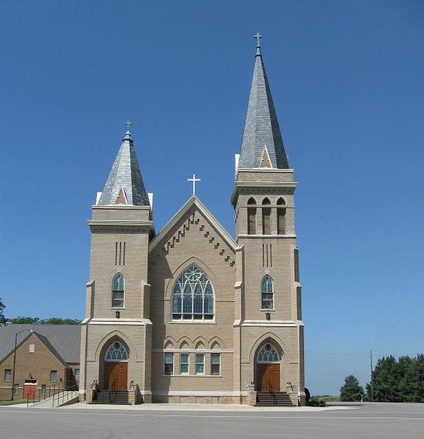
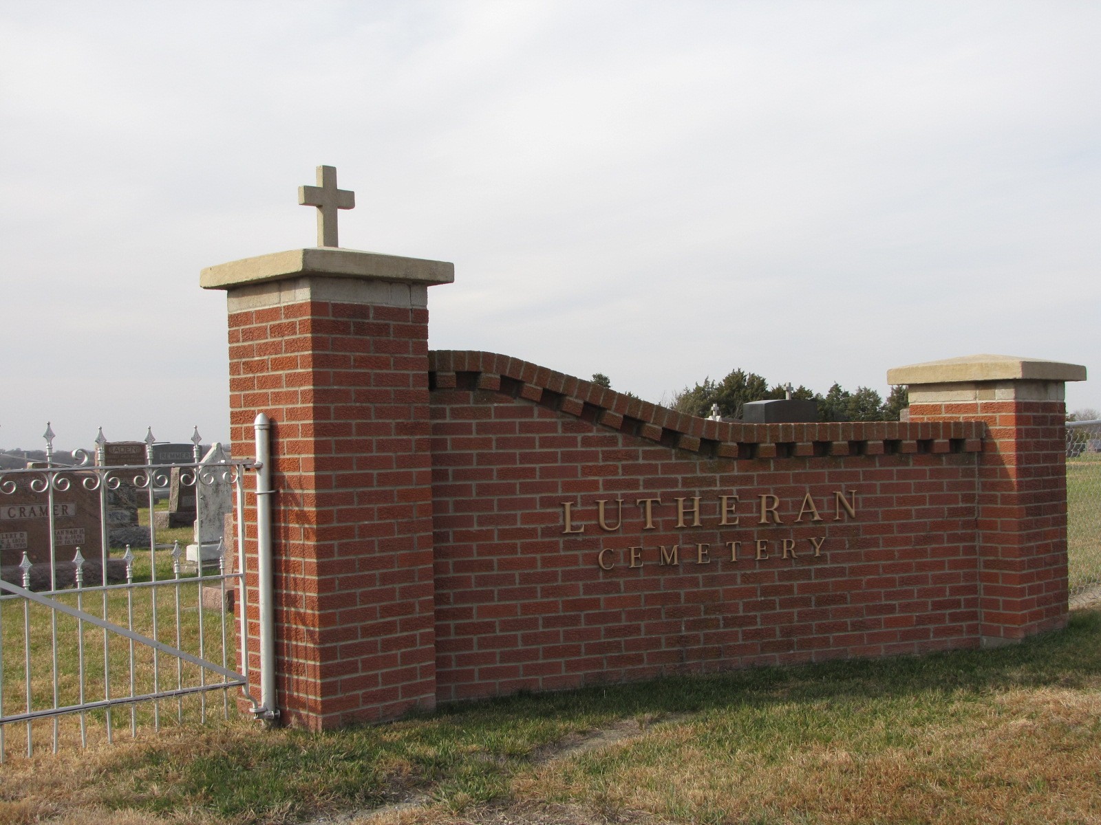
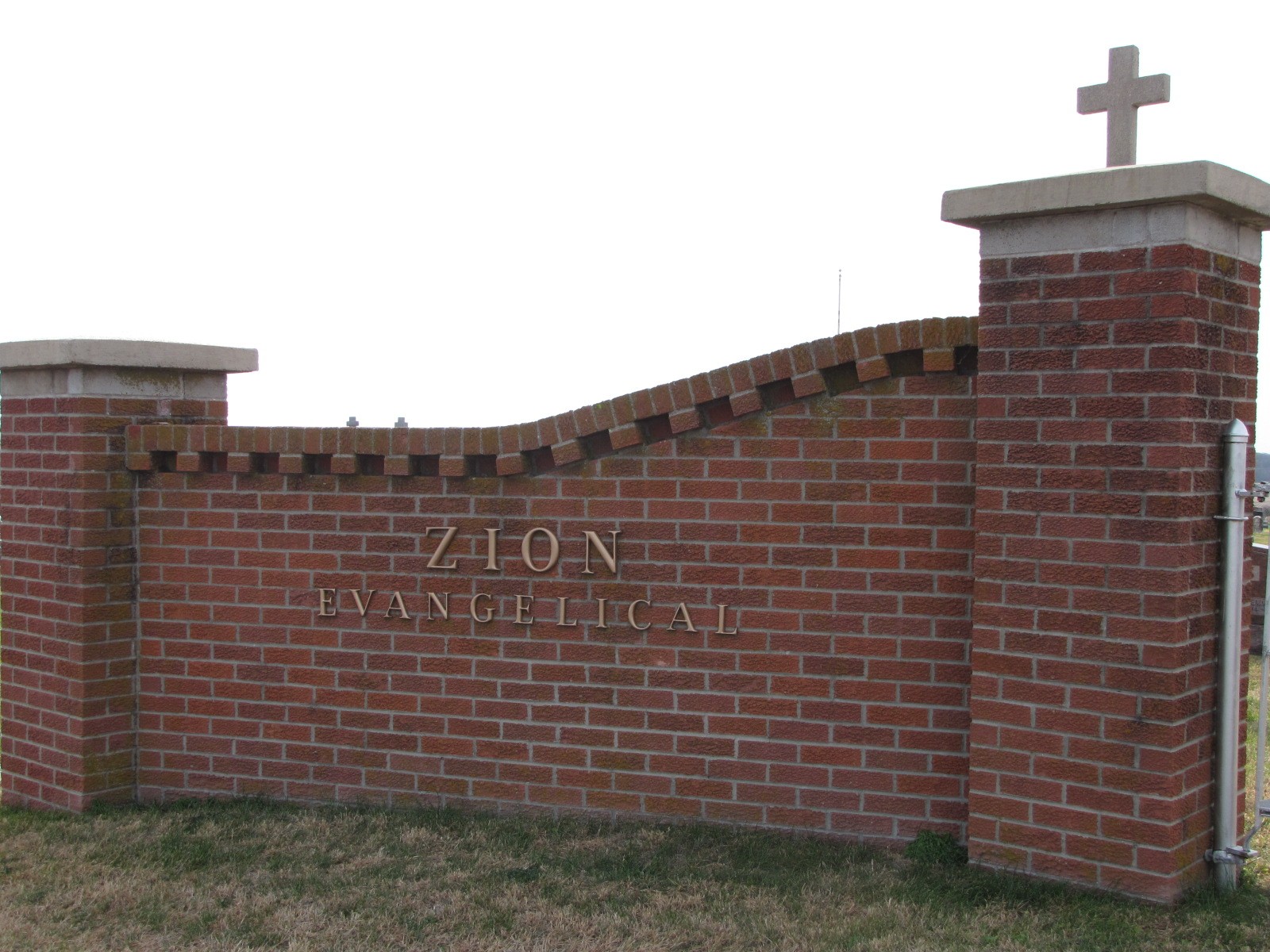
| Description | : | From Pickrell, Gage County, Nebraska: Go east (about 6 miles) on Austin Street/East Pickrell Road to South 82nd Road. Go south (about 2 miles) on South 82nd Road to East Elm Road. Go west on East Elm Road (about .25 miles) to South 80th Road. Turn south directly in front of Zion Evangelical Lutheran Church. The cemetery adjoins the church on the south. |
frequently asked questions (FAQ):
-
Where is Zion Evangelical Lutheran Cemetery?
Zion Evangelical Lutheran Cemetery is located at 18401 S. 80th Road Pickrell, Gage County ,Nebraska ,USA.
-
Zion Evangelical Lutheran Cemetery cemetery's updated grave count on graveviews.com?
32 memorials
-
Where are the coordinates of the Zion Evangelical Lutheran Cemetery?
Latitude: 40.3456001
Longitude: -96.6147003
Nearby Cemetories:
1. Emmanuel Lutheran Cemetery
Beatrice, Gage County, USA
Coordinate: 40.2934100, -96.6521900
2. Pleasant View Cemetery
Pickrell, Gage County, USA
Coordinate: 40.3493240, -96.7101000
3. Christ Lutheran Church Cemetery
Pickrell, Gage County, USA
Coordinate: 40.4079410, -96.6848370
4. Austin Creek Cemetery
Beatrice, Gage County, USA
Coordinate: 40.3282280, -96.7233020
5. Filley Cemetery
Filley, Gage County, USA
Coordinate: 40.2761002, -96.5306015
6. Evergreen Home Cemetery
Beatrice, Gage County, USA
Coordinate: 40.2677994, -96.7052994
7. Saint Joseph Cemetery
Beatrice, Gage County, USA
Coordinate: 40.3054700, -96.7460700
8. Grandview Cemetery
Gage County, USA
Coordinate: 40.4617004, -96.6091995
9. Beatrice Cemetery
Beatrice, Gage County, USA
Coordinate: 40.2625970, -96.7332670
10. Hooker Cemetery
Adams, Gage County, USA
Coordinate: 40.4207993, -96.4732971
11. Stark Cemetery
Holmesville, Gage County, USA
Coordinate: 40.2122002, -96.6147003
12. Highland Cemetery
Adams, Gage County, USA
Coordinate: 40.4580994, -96.5196991
13. Brethren Cemetery
Holmesville, Gage County, USA
Coordinate: 40.2125015, -96.6331024
14. Crab Orchard Cemetery
Crab Orchard, Johnson County, USA
Coordinate: 40.3274994, -96.4366989
15. Sunnyside Cemetery
Cortland, Gage County, USA
Coordinate: 40.4799200, -96.6511800
16. Walnut Grove Pet Cemetery
Beatrice, Gage County, USA
Coordinate: 40.2613200, -96.7605920
17. Virginia Cemetery
Virginia, Gage County, USA
Coordinate: 40.2186012, -96.5117035
18. Granite Hill Cemetery
Johnson County, USA
Coordinate: 40.4180984, -96.4417038
19. Cortland Cemetery
Cortland, Gage County, USA
Coordinate: 40.4879200, -96.7041250
20. Saint James Cemetery
Cortland, Gage County, USA
Coordinate: 40.4886050, -96.7036050
21. Dolen Cemetery
Gage County, USA
Coordinate: 40.3494950, -96.8225930
22. First Mennonite Church Cemetery
Beatrice, Gage County, USA
Coordinate: 40.2856800, -96.8120500
23. Saint Johns Lutheran Cemetery
Cortland, Gage County, USA
Coordinate: 40.5078300, -96.6252700
24. Highland Center Cemetery
Cortland, Gage County, USA
Coordinate: 40.4660988, -96.7611008