
| Memorials | : | 0 |
| Location | : | Baileyton, Greene County, USA |
| Coordinate | : | 36.3286150, -82.8450880 |
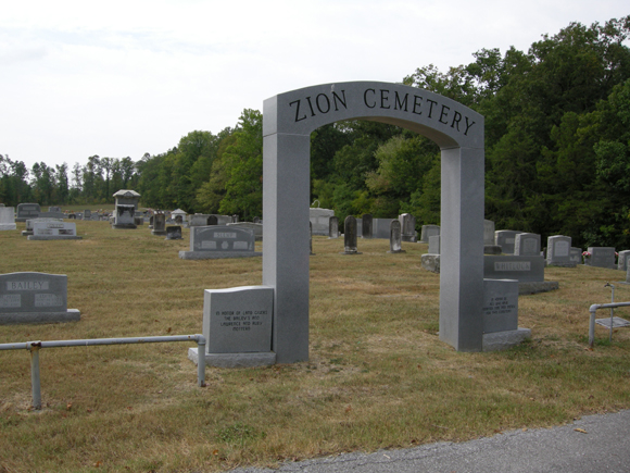
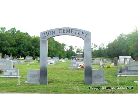
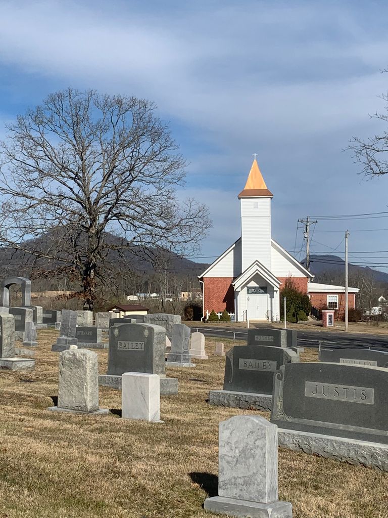
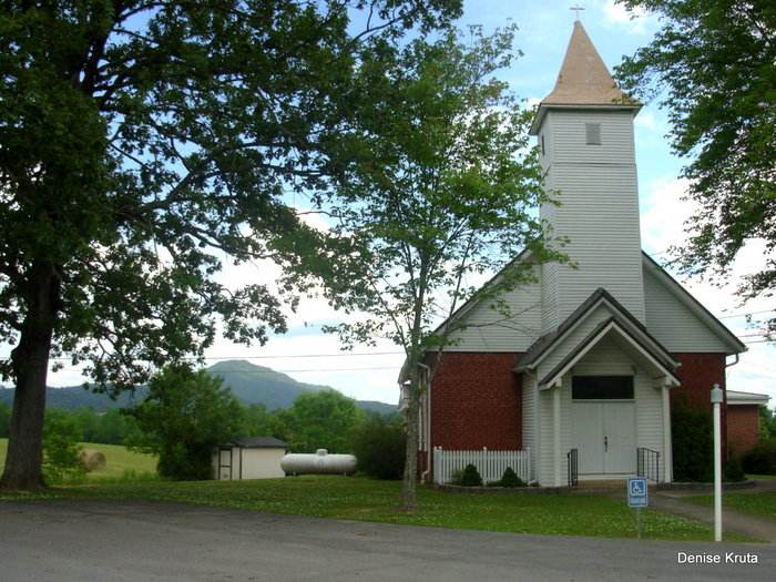
| Description | : | Located in Baileyton, at exit 38 of Interstate 81 in Greene County, Tennessee. To reach the church/cemetery, go north from the Interstate on Route 172 .8 miles, then west or left on Horton Highway about .3 miles on right. The church was organized in 1830 and the building, actually in use now, was built in 1858. There is a county historic designation plaque on the structure. |
frequently asked questions (FAQ):
-
Where is Zion United Methodist Church Cemetery?
Zion United Methodist Church Cemetery is located at 6055 Horton Hwy. Baileyton, Greene County ,Tennessee ,USA.
-
Zion United Methodist Church Cemetery cemetery's updated grave count on graveviews.com?
0 memorials
-
Where are the coordinates of the Zion United Methodist Church Cemetery?
Latitude: 36.3286150
Longitude: -82.8450880
Nearby Cemetories:
1. Bailey Cemetery
Baileyton, Greene County, USA
Coordinate: 36.3347015, -82.8469009
2. Carter Cemetery
Greene County, USA
Coordinate: 36.3005981, -82.8713989
3. Browns Mountain Cemetery
Hawkins County, USA
Coordinate: 36.3603800, -82.8686700
4. Ellis-Hendry Cemetery
Greene County, USA
Coordinate: 36.3074380, -82.8056080
5. Wesley Chapel UM Church Cemetery
Greeneville, Greene County, USA
Coordinate: 36.2878500, -82.8444100
6. Salem Cumberland Presbyterian Cemetery
Greeneville, Greene County, USA
Coordinate: 36.3314110, -82.7924970
7. Caney Creek Old Cemetery
Baileyton, Greene County, USA
Coordinate: 36.3511900, -82.7997600
8. Sulphur Springs Memorial Cemetery
Greeneville, Greene County, USA
Coordinate: 36.3059610, -82.7995350
9. Caney Creek Cemetery
Baileyton, Greene County, USA
Coordinate: 36.3448300, -82.7934800
10. Rock and Toby Cemetery
Greeneville, Greene County, USA
Coordinate: 36.2860660, -82.8161560
11. Butchers Valley Church Cemetery
Hawkins County, USA
Coordinate: 36.3613340, -82.8896660
12. Mountain Valley Church of the Brethren Cemetery
Ottway, Greene County, USA
Coordinate: 36.2931300, -82.8918500
13. Ball-Tunnell Cemetery
Hawkins County, USA
Coordinate: 36.3532340, -82.9045660
14. New Lebanon Missionary Baptist Church Cemetery
Baileyton, Greene County, USA
Coordinate: 36.3494400, -82.7784100
15. Smith Family Cemetery
Baileyton, Greene County, USA
Coordinate: 36.3432700, -82.7701300
16. Roaring Springs Cemetery
Afton, Greene County, USA
Coordinate: 36.2955940, -82.7771400
17. Price Cemetery
Baileyton, Greene County, USA
Coordinate: 36.2919360, -82.9192790
18. Burns Cemetery
Hawkins County, USA
Coordinate: 36.3499985, -82.9308014
19. Moore Cemetery
Greene County, USA
Coordinate: 36.3058014, -82.7589035
20. Cross Anchor Cemetery
Cross Anchor, Greene County, USA
Coordinate: 36.2566690, -82.8190810
21. Carter Family Cemetery
Greeneville, Greene County, USA
Coordinate: 36.2851390, -82.9241610
22. Dotys Chapel United Methodist Church Cemetery
Afton, Greene County, USA
Coordinate: 36.2846630, -82.7641680
23. Malone Cemetery
Ottway, Greene County, USA
Coordinate: 36.2508200, -82.8611200
24. Starnes family cemetery
Romeo, Greene County, USA
Coordinate: 36.2911110, -82.9358330