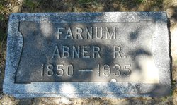
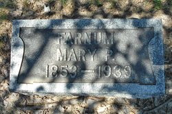
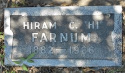
Abner Roswell Farnum
| Birth | : | 13 Aug 1850 Concord, Merrimack County, New Hampshire, USA |
| Death | : | 21 Jan 1935 Miles City, Custer County, Montana, USA |
| Burial | : | Ripon Cemetery, Ripon, San Joaquin County, USA |
| Coordinate | : | 37.7420311, -121.1238708 |
| Description | : | from a visitor: see Montana, Its Story and Biography: A History of Aboriginal and Territorial Montana and Three Decades of Statehood, Under the Editorial Supervision of Tom Stout (1921) ARNER R. FARNUM. While those who go into a region in advance of the army of settlers certain to come after a way is blazed have the advantage of a choice of location and securing land at a very low figure, they earn everything they obtain because of the privations and hard work inseparable from such an experience. Many of the pioneers of Montana faced other difficulties because of the scarcity of water... Read More |
frequently asked questions (FAQ):
-
Where is Abner Roswell Farnum's memorial?
Abner Roswell Farnum's memorial is located at: Ripon Cemetery, Ripon, San Joaquin County, USA.
-
When did Abner Roswell Farnum death?
Abner Roswell Farnum death on 21 Jan 1935 in Miles City, Custer County, Montana, USA
-
Where are the coordinates of the Abner Roswell Farnum's memorial?
Latitude: 37.7420311
Longitude: -121.1238708
Family Members:
Parent
Spouse
Siblings
Children
Flowers:
Nearby Cemetories:
1. Ripon Cemetery
Ripon, San Joaquin County, USA
Coordinate: 37.7420311, -121.1238708
2. Wood Colony Cemetery
Salida, Stanislaus County, USA
Coordinate: 37.6893730, -121.0682144
3. Saint John's Catholic Cemetery
Escalon, San Joaquin County, USA
Coordinate: 37.7994537, -121.0705185
4. Good Shepherd Catholic Cemetery
Modesto, Stanislaus County, USA
Coordinate: 37.6853130, -121.0672890
5. Atlanta Cemetery
Five Corners, San Joaquin County, USA
Coordinate: 37.8270035, -121.1420135
6. East Union Cemetery
Manteca, San Joaquin County, USA
Coordinate: 37.8114014, -121.2350006
7. Burwood Cemetery
Escalon, San Joaquin County, USA
Coordinate: 37.7616997, -120.9593964
8. Park View Cemetery
Manteca, San Joaquin County, USA
Coordinate: 37.8617249, -121.2238312
9. Modesto Citizens Cemetery
Modesto, Stanislaus County, USA
Coordinate: 37.6472930, -120.9845570
10. Acacia Memorial Park
Modesto, Stanislaus County, USA
Coordinate: 37.6481080, -120.9836610
11. Modesto County Cemetery
Modesto, Stanislaus County, USA
Coordinate: 37.6492400, -120.9813800
12. Modesto Pioneer Cemetery
Modesto, Stanislaus County, USA
Coordinate: 37.6473350, -120.9829040
13. Saint Stanislaus Catholic Cemetery
Modesto, Stanislaus County, USA
Coordinate: 37.6473610, -120.9808440
14. Collegeville Cemetery
Collegeville, San Joaquin County, USA
Coordinate: 37.9044800, -121.1466141
15. Valley Home Memorial Park
Oakdale, Stanislaus County, USA
Coordinate: 37.8275528, -120.9333267
16. Congregation Adas Yeshuran of Stockton Cemetery
French Camp, San Joaquin County, USA
Coordinate: 37.8784065, -121.2740784
17. Congregation of Ahavas Achim Cemetery
French Camp, San Joaquin County, USA
Coordinate: 37.8778419, -121.2753067
18. Langworth Cemetery
Oakdale, Stanislaus County, USA
Coordinate: 37.7580986, -120.8957977
19. Chinese Cemetery
French Camp, San Joaquin County, USA
Coordinate: 37.8819962, -121.2805862
20. Grayson Cemetery
Grayson, Stanislaus County, USA
Coordinate: 37.5594559, -121.1802826
21. Ceres Memorial Park
Ceres, Stanislaus County, USA
Coordinate: 37.5958214, -120.9634399
22. Highland View Memorial Gardens
Farmington, San Joaquin County, USA
Coordinate: 37.9242935, -121.0008621
23. Lakewood Memorial Park
Hughson, Stanislaus County, USA
Coordinate: 37.6199760, -120.8975983
24. Patterson District Cemetery
Patterson, Stanislaus County, USA
Coordinate: 37.5268135, -121.1728287

