
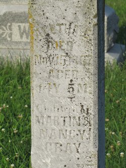
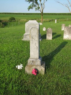
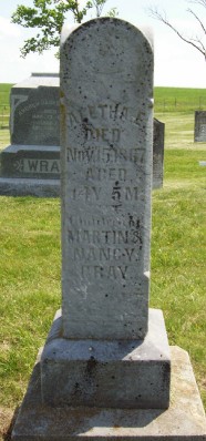
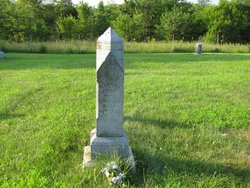
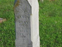
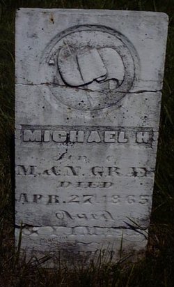
Aletha E. Gray
| Birth | : | 15 Jun 1853 Clearmont, Nodaway County, Missouri, USA |
| Death | : | 15 Nov 1867 Nodaway County, Missouri, USA |
| Burial | : | Beth Abraham Cemetery, West Roxbury, Suffolk County, USA |
| Coordinate | : | 42.2588500, -71.1536700 |
| Inscription | : | 14 years, 5 months |
frequently asked questions (FAQ):
-
Where is Aletha E. Gray's memorial?
Aletha E. Gray's memorial is located at: Beth Abraham Cemetery, West Roxbury, Suffolk County, USA.
-
When did Aletha E. Gray death?
Aletha E. Gray death on 15 Nov 1867 in Nodaway County, Missouri, USA
-
Where are the coordinates of the Aletha E. Gray's memorial?
Latitude: 42.2588500
Longitude: -71.1536700
Family Members:
Parent
Siblings
Flowers:


Nearby Cemetories:
1. Beth Abraham Cemetery
West Roxbury, Suffolk County, USA
Coordinate: 42.2588500, -71.1536700
2. Hebrew Progressive Cemetery
West Roxbury, Suffolk County, USA
Coordinate: 42.2586800, -71.1533900
3. Pride of Jacob Cemetery
West Roxbury, Suffolk County, USA
Coordinate: 42.2585487, -71.1534500
4. Tifereth Israel Cemetery
West Roxbury, Suffolk County, USA
Coordinate: 42.2585400, -71.1532300
5. Jewish Benevolent Cemetery
West Roxbury, Suffolk County, USA
Coordinate: 42.2592100, -71.1540800
6. Sons of Benjamin Cemetery
West Roxbury, Suffolk County, USA
Coordinate: 42.2592000, -71.1530700
7. Ohavi Sedeck Cemetery
West Roxbury, Suffolk County, USA
Coordinate: 42.2589400, -71.1544400
8. Adath Israel Cemetery
West Roxbury, Suffolk County, USA
Coordinate: 42.2594300, -71.1543200
9. Moses Mendelsohn Cemetery
West Roxbury, Suffolk County, USA
Coordinate: 42.2589100, -71.1525400
10. Har Moriah Cemetery
West Roxbury, Suffolk County, USA
Coordinate: 42.2593700, -71.1527200
11. Adath Jeshurun Cemetery
West Roxbury, Suffolk County, USA
Coordinate: 42.2587000, -71.1548500
12. Siskind Family Lot
West Roxbury, Suffolk County, USA
Coordinate: 42.2593600, -71.1526900
13. Jewish Civil Service Cemetery
West Roxbury, Suffolk County, USA
Coordinate: 42.2598300, -71.1532300
14. Shari Jerusalem Cemetery
West Roxbury, Suffolk County, USA
Coordinate: 42.2596900, -71.1546800
15. Young Israel Cemetery
West Roxbury, Suffolk County, USA
Coordinate: 42.2600900, -71.1534700
16. Saint Marys Cemetery
West Roxbury, Suffolk County, USA
Coordinate: 42.2596817, -71.1564331
17. Congregation Beth Israel Cemetery
West Roxbury, Suffolk County, USA
Coordinate: 42.2591300, -71.1634800
18. Boston United Hand In Hand Cemetery
West Roxbury, Suffolk County, USA
Coordinate: 42.2599300, -71.1635300
19. Temple Mishkan Tefila Memorial Park
West Roxbury, Suffolk County, USA
Coordinate: 42.2616800, -71.1635100
20. Anshe Dowig Cemetery
West Roxbury, Suffolk County, USA
Coordinate: 42.2591770, -71.1646910
21. Boston United New Hand In Hand Cemetery
West Roxbury, Suffolk County, USA
Coordinate: 42.2614444, -71.1642778
22. Heirs of Morris Greenhood Cemetery
West Roxbury, Suffolk County, USA
Coordinate: 42.2592100, -71.1648400
23. Congregation Sharei Sedek Cemetery
West Roxbury, Suffolk County, USA
Coordinate: 42.2591500, -71.1650000
24. Chevra Thillim Cemetery
West Roxbury, Suffolk County, USA
Coordinate: 42.2593800, -71.1654600