Alma Nevada Boyer Phillips
| Birth | : | 18 Mar 1898 Iowa, USA |
| Death | : | 10 May 1917 Morgan County, Missouri, USA |
| Burial | : | Woodlawn Cemetery, Rockland Township, Ontonagon County, USA |
| Coordinate | : | 46.7305984, -89.1980972 |
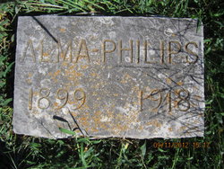
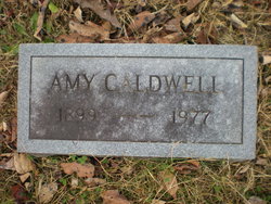
| Inscription | : | Alma Philips 1899 1918 The transcription on marker does not correspond with her death certificate. |
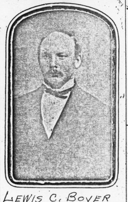
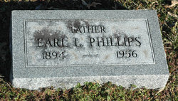
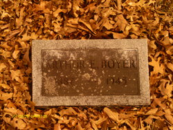
| Description | : | Alma's parents were: Louis Calvin Boyer 1858 – 1931 Sarah Ada Gravenor 1865 - 1936 Alma's siblings were Arthur Ellsworth, Minnie Esther, Anna Levana, Amy Rachel, Lola Edith, & Nora A. Missouri Marriage Records Name: Alma Nevada Boyer Marriage Date: 21 Jan 1914 Marriage Location: Morgan, Missouri Marriage County: Morgan Spouse Name: Earl Phillips Father's Name: Louis C Boyer Alma died from Puerperal Fever (a bacterial infection contracted during childbirth or miscarriage) at 2 p.m. on May 10, 1917, at her home in Moreau Township. Her husband, Earl Phillips of Versailles, was the informant on her death certificate. She had lived 20 years, 1 month, & 22 days. She was... Read More |
frequently asked questions (FAQ):
-
Where is Alma Nevada Boyer Phillips's memorial?
Alma Nevada Boyer Phillips's memorial is located at: Woodlawn Cemetery, Rockland Township, Ontonagon County, USA.
-
When did Alma Nevada Boyer Phillips death?
Alma Nevada Boyer Phillips death on 10 May 1917 in Morgan County, Missouri, USA
-
Where are the coordinates of the Alma Nevada Boyer Phillips's memorial?
Latitude: 46.7305984
Longitude: -89.1980972
Family Members:
Parent
Spouse
Siblings
Flowers:
Nearby Cemetories:
1. Woodlawn Cemetery
Rockland Township, Ontonagon County, USA
Coordinate: 46.7305984, -89.1980972
2. Rose Cemetery
Rockland, Ontonagon County, USA
Coordinate: 46.7341537, -89.1835327
3. Old Indian Burial Grounds
Rockland Township, Ontonagon County, USA
Coordinate: 46.7383245, -89.2194372
4. Irish Hollow Cemetery
Rockland Township, Ontonagon County, USA
Coordinate: 46.7299995, -89.1675034
5. Methodist Cemetery
Greenland, Ontonagon County, USA
Coordinate: 46.7794100, -89.0908600
6. Maple Grove Cemetery
Greenland, Ontonagon County, USA
Coordinate: 46.7808000, -89.0917000
7. Evergreen Cemetery
Ontonagon, Ontonagon County, USA
Coordinate: 46.8544390, -89.2798810
8. Norwich Cemetery
Matchwood, Ontonagon County, USA
Coordinate: 46.6583800, -89.3800000
9. Holy Family Catholic Cemetery
Ontonagon, Ontonagon County, USA
Coordinate: 46.8533300, -89.3133300
10. Riverside Cemetery
Ontonagon, Ontonagon County, USA
Coordinate: 46.8602982, -89.3236008
11. Rousseau Cemetery
Rousseau, Ontonagon County, USA
Coordinate: 46.7084274, -88.9691925
12. Carp Lake Township Cemetery
Green, Ontonagon County, USA
Coordinate: 46.8015862, -89.4400406
13. Evergreen Cemetery
Ewen, Ontonagon County, USA
Coordinate: 46.5351300, -89.2632290
14. Bruce Crossing Cemetery
Bruce Crossing, Ontonagon County, USA
Coordinate: 46.5214005, -89.1572037
15. Paynesville Cemetery
Paynesville, Ontonagon County, USA
Coordinate: 46.5205879, -89.1155701
16. Woodland Cemetery
Houghton County, USA
Coordinate: 46.8652992, -88.9000015
17. Maple Grove Cemetery
Bruce Crossing, Ontonagon County, USA
Coordinate: 46.4768982, -89.1802979
18. Agate Cemetery
Trout Creek, Ontonagon County, USA
Coordinate: 46.4613991, -89.0718994
19. Trout Creek Cemetery
Interior Township, Ontonagon County, USA
Coordinate: 46.4817009, -88.9957962
20. Saint Henrys Cemetery
Nisula, Houghton County, USA
Coordinate: 46.7650000, -88.7830000
21. Bergland Cemetery
Bergland, Ontonagon County, USA
Coordinate: 46.6016998, -89.5766983
22. Lakeview Cemetery
Bergland, Ontonagon County, USA
Coordinate: 46.5924644, -89.5733185
23. Alston Cemetery
Laird Township, Houghton County, USA
Coordinate: 46.7557983, -88.7397003
24. Kenton Cemetery
Duncan Township, Houghton County, USA
Coordinate: 46.4933014, -88.8897018

