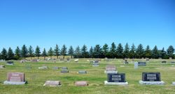
Alma “Rowene” Koller Kuhl
| Birth | : | 25 Oct 1923 Cardston, Claresholm Census Division, Alberta, Canada |
| Death | : | 20 Oct 2012 Milk River, Lethbridge Census Division, Alberta, Canada |
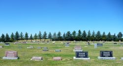
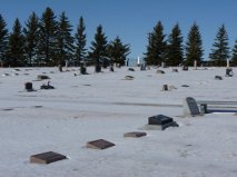
| Burial | : | Milk River Cemetery, Milk River, Lethbridge Census Division, Canada |
| Coordinate | : | 49.1442000, -112.0658700 |
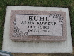
| Description | : | ALMA "ROWENE" KUHL October 25, 1923 ~ October 20, 2012 Alma was born in Cardston and moved to Milk River as a baby. She lived there all her life except for a few years in Ft. Saskatchewan. She married Cliff Kuhl in 1941, and was a wife, mother, grandmother, aunt, and friend. She loved to play the piano, sing, knit, crochet, read and play cards. She is survived by her children Robert (Joan) of Milk River, Lynette (Ronald) Ingram-Johnson of Fort Saskatchewan, and Patricia Barth of Sterling, Idaho; brother Lloyd (Vicki) Koller; sisters-in-law Maxine Koller, Mildred Bellew, and Dorothy Thielen; thirteen grandchildren and... Read More |
frequently asked questions (FAQ):
-
Where is Alma “Rowene” Koller Kuhl's memorial?
Alma “Rowene” Koller Kuhl's memorial is located at: Milk River Cemetery, Milk River, Lethbridge Census Division, Canada.
-
When did Alma “Rowene” Koller Kuhl death?
Alma “Rowene” Koller Kuhl death on 20 Oct 2012 in Milk River, Lethbridge Census Division, Alberta, Canada
-
Where are the coordinates of the Alma “Rowene” Koller Kuhl's memorial?
Latitude: 49.1442000
Longitude: -112.0658700
Family Members:
Spouse
Children
Flowers:
Nearby Cemetories:
1. Milk River Cemetery
Milk River, Lethbridge Census Division, Canada
Coordinate: 49.1442000, -112.0658700
2. Sweet Grass Cemetery
Sweet Grass, Toole County, USA
Coordinate: 48.9972120, -111.9966140
3. Holy Angels Cemetery Community
Coutts, Lethbridge Census Division, Canada
Coordinate: 48.9989440, -111.9649050
4. Coutts Cemetery
Coutts, Lethbridge Census Division, Canada
Coordinate: 48.9989690, -111.9647810
5. Hillside Hutterite Colony Cemetery
Toole County, USA
Coordinate: 48.9788000, -112.0740000
6. Warner Memorial Cemetery
Warner, Lethbridge Census Division, Canada
Coordinate: 49.2914900, -112.2246800
7. Allerston Cemetery
Milk River, Lethbridge Census Division, Canada
Coordinate: 49.1451500, -111.7664000
8. Rimrock Colony Cemetery
Toole County, USA
Coordinate: 48.8985000, -112.0980000
9. Masinasin Cemetery
Milk River, Lethbridge Census Division, Canada
Coordinate: 49.1302328, -111.6527199
10. Sunburst Cemetery
Sunburst, Toole County, USA
Coordinate: 48.8847800, -111.8743800
11. Glacier Colony Cemetery
Glacier Colony, Glacier County, USA
Coordinate: 48.8313000, -112.2154000
12. Zenith Colony Cemetery
Cut Bank, Glacier County, USA
Coordinate: 48.8678000, -112.3442000
13. Nutter Ranch Cemetery
Sunburst, Toole County, USA
Coordinate: 48.9668200, -111.6365320
14. New Dayton Community Cemetery
New Dayton, Lethbridge Census Division, Canada
Coordinate: 49.4254300, -112.3601800
15. Prairie Round Cemetery
Lucky Strike, Lethbridge Census Division, Canada
Coordinate: 49.2249600, -111.5523800
16. Wrentham Cemetery
Wrentham, Lethbridge Census Division, Canada
Coordinate: 49.5231200, -112.1574800
17. Prairie Home Hutterite Colony Cemetery
Wrentham, Lethbridge Census Division, Canada
Coordinate: 49.5291670, -111.9608330
18. Dahlen Family Homestead Cemetery
Kevin, Toole County, USA
Coordinate: 48.7504200, -112.1016200
19. Wolf Creek Hutterite Colony Cemetery
Stirling, Lethbridge Census Division, Canada
Coordinate: 49.4119142, -112.5163705
20. East Raymond Hutterite Colony Cemetery
Raymond, Lethbridge Census Division, Canada
Coordinate: 49.4185305, -112.5791329
21. Glendale Colony Cemetery
Glendale Colony, Glacier County, USA
Coordinate: 48.8380000, -112.5457000
22. Horizon Colony Cemetery
Cut Bank, Glacier County, USA
Coordinate: 48.7156000, -112.2290000
23. Stirling Mennonite Church Cemetery
Stirling, Lethbridge Census Division, Canada
Coordinate: 49.4607570, -112.5387970
24. Stirling Cemetery
Stirling, Lethbridge Census Division, Canada
Coordinate: 49.5093400, -112.5380000

