| Birth | : | 10 Dec 1881 Colo, Story County, Iowa, USA |
| Death | : | 21 Feb 1948 Boone, Boone County, Iowa, USA |
| Burial | : | Linwood Park Cemetery, Boone, Boone County, USA |
| Coordinate | : | 42.0550003, -93.8850021 |
| Plot | : | E |
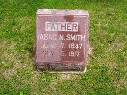
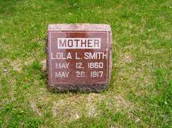
| Description | : | "Mae" was the daughter of Isaac Newton Smith & Lola Lurinda Smith. She married Marion Kieffier ("Kief") Low, 3 Sept 1902, Sheperdtown, Boone Co., IA. They had four sons, all of whom used nicknames: Vincent LuVearne ("Shrimp" / "Vern"); Cassine Maloy ("Skinny" / "Maloy"); Kieffier ElRoy ("Roy"); & Marvin Lawrence ("Bud"). The family is pictured at right. Mae & Kief are seated in the front. Their four sons are standing, left to right: Marvin Lawrence, Kieffier ElRoy, Cassine Maloy & Vincent LuVearne. Photo courtesy of Don Ludwig. |
frequently asked questions (FAQ):
-
Where is Altha Mae “Mae” Smith Low's memorial?
Altha Mae “Mae” Smith Low's memorial is located at: Linwood Park Cemetery, Boone, Boone County, USA.
-
When did Altha Mae “Mae” Smith Low death?
Altha Mae “Mae” Smith Low death on 21 Feb 1948 in Boone, Boone County, Iowa, USA
-
Where are the coordinates of the Altha Mae “Mae” Smith Low's memorial?
Latitude: 42.0550003
Longitude: -93.8850021
Family Members:
Parent
Spouse
Siblings
Children
Flowers:
Nearby Cemetories:
1. Linwood Park Cemetery
Boone, Boone County, USA
Coordinate: 42.0550003, -93.8850021
2. Latham Cemetery
Boone, Boone County, USA
Coordinate: 42.0489006, -93.8878021
3. Biblical College Cemetery
Boone, Boone County, USA
Coordinate: 42.0456009, -93.9113998
4. Sacred Heart Cemetery
Boone, Boone County, USA
Coordinate: 42.0485992, -93.9163971
5. Boone Memorial Gardens Cemetery
Boone, Boone County, USA
Coordinate: 42.0449982, -93.9152985
6. Sarah Dinwoodie Cemetery
Worth Township, Boone County, USA
Coordinate: 42.0278000, -93.8697000
7. Rose Hill Cemetery
Boone, Boone County, USA
Coordinate: 42.0419006, -93.9408035
8. Bass Point Cemetery
Boone, Boone County, USA
Coordinate: 42.0992012, -93.8957977
9. Oakwood Cemetery
Moingona, Boone County, USA
Coordinate: 42.0219002, -93.9396973
10. Squire Boone Cemetery
Luther, Boone County, USA
Coordinate: 42.0032997, -93.8531036
11. Buckley Cemetery
Boone, Boone County, USA
Coordinate: 42.0999810, -93.9418960
12. Hollaway Cemetery
Moingona, Boone County, USA
Coordinate: 42.0138720, -93.9530080
13. Quincy Cemetery
Boone, Boone County, USA
Coordinate: 42.0074997, -93.9503021
14. Hickory Grove Cemetery
Boone County, USA
Coordinate: 42.1074982, -93.9507980
15. Bluff Creek Cemetery
Boone, Boone County, USA
Coordinate: 42.0774994, -93.9796982
16. Sparks Cemetery
Boone County, USA
Coordinate: 41.9728012, -93.9191971
17. Hull Cemetery
Luther, Boone County, USA
Coordinate: 41.9603004, -93.8664017
18. Leininger Cemetery
Boone County, USA
Coordinate: 42.1492004, -93.8356018
19. Pleasant Hill Cemetery
Boone, Boone County, USA
Coordinate: 41.9618988, -93.9492035
20. Boone County Poor Farm Cemetery
Boone County, USA
Coordinate: 42.1591100, -93.9159000
21. Schlicht Cemetery
Fraser, Boone County, USA
Coordinate: 42.1444200, -93.9780100
22. Mitchell Cemetery
Boone County, USA
Coordinate: 42.1208000, -93.7544022
23. Saint Johns Catholic Cemetery
Ogden, Boone County, USA
Coordinate: 42.0344000, -94.0407000
24. Olive Branch Cemetery
Boone County, USA
Coordinate: 42.0080986, -93.7369003


