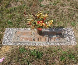
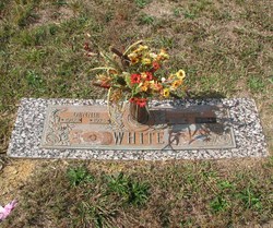
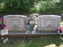
Altie Ward White
| Birth | : | 17 Dec 1922 Van Lear, Johnson County, Kentucky, USA |
| Death | : | 15 Nov 1994 Madisonville, Hopkins County, Kentucky, USA |
| Burial | : | Hungerpiller Family Cemetery, Elloree, Orangeburg County, USA |
| Coordinate | : | 33.5049010, -80.6123380 |
| Description | : | Married to Dennie white |
frequently asked questions (FAQ):
-
Where is Altie Ward White's memorial?
Altie Ward White's memorial is located at: Hungerpiller Family Cemetery, Elloree, Orangeburg County, USA.
-
When did Altie Ward White death?
Altie Ward White death on 15 Nov 1994 in Madisonville, Hopkins County, Kentucky, USA
-
Where are the coordinates of the Altie Ward White's memorial?
Latitude: 33.5049010
Longitude: -80.6123380
Family Members:
Parent
Spouse
Siblings
Children
Flowers:
Nearby Cemetories:
1. Hungerpiller Family Cemetery
Elloree, Orangeburg County, USA
Coordinate: 33.5049010, -80.6123380
2. Smith-Dantzler Cemetery
Elloree, Orangeburg County, USA
Coordinate: 33.4941130, -80.6052520
3. Granger Baptist Church Cemetery
Elloree, Orangeburg County, USA
Coordinate: 33.4909840, -80.6030410
4. Gresham Cemetery
Orangeburg County, USA
Coordinate: 33.4906006, -80.6031036
5. McGrew Cemetery
Elloree, Orangeburg County, USA
Coordinate: 33.4859880, -80.6027150
6. Dantzler Family Cemetery
Elloree, Orangeburg County, USA
Coordinate: 33.4762456, -80.6037355
7. Smith Family Cemetery
Midway, Calhoun County, USA
Coordinate: 33.5129060, -80.6501570
8. Brown Chapel AME Church Cemetery
Elloree, Orangeburg County, USA
Coordinate: 33.5253550, -80.6530780
9. Brown Chapel AME Church Cemetery
Calhoun County, USA
Coordinate: 33.5255490, -80.6531950
10. Browning Branch Cemetery
Elloree, Orangeburg County, USA
Coordinate: 33.5231820, -80.5632140
11. Bochette Cemetery
Orangeburg County, USA
Coordinate: 33.4592018, -80.6125031
12. Bookhart Cemetery
Elloree, Orangeburg County, USA
Coordinate: 33.5485992, -80.5924988
13. Jericho Methodist Church Cemetery
Cameron, Calhoun County, USA
Coordinate: 33.5330010, -80.6625040
14. Santee First Baptist Cemetery
Elloree, Orangeburg County, USA
Coordinate: 33.5553700, -80.6018080
15. Whitmore, Avinger, Norris, Felder Cemetery
Elloree, Orangeburg County, USA
Coordinate: 33.4870530, -80.5532600
16. Saluda Baptist Church Cemetery
Elloree, Orangeburg County, USA
Coordinate: 33.4757900, -80.5597300
17. Hart Graveyard
Holly Hill, Orangeburg County, USA
Coordinate: 33.4918320, -80.5470820
18. Elloree Hillcrest Cemetery
Elloree, Orangeburg County, USA
Coordinate: 33.5608720, -80.6099720
19. Jerusalem Cemetery
Elloree, Orangeburg County, USA
Coordinate: 33.5102340, -80.5447570
20. New Faith Community Church Cemetery
Elloree, Orangeburg County, USA
Coordinate: 33.5229150, -80.5477570
21. Riley Fogle Family Cemetery
Four Holes, Orangeburg County, USA
Coordinate: 33.4863860, -80.6822330
22. Mount Hebron Baptist Church Cemetery
Santee, Orangeburg County, USA
Coordinate: 33.5028570, -80.5381980
23. Ark of God Cemetery
Santee, Orangeburg County, USA
Coordinate: 33.4630210, -80.5558220
24. Collier Family Cemetery
Holly Hill, Orangeburg County, USA
Coordinate: 33.4418900, -80.6169070


