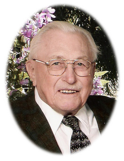
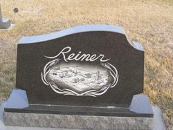
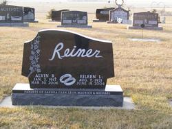
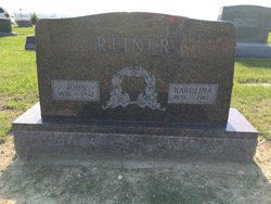
Alvin Ruben Reiner
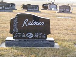
| Birth | : | 2 Jan 1917 Tripp, Hutchinson County, South Dakota, USA |
| Death | : | 30 Mar 2006 Sioux Falls, Minnehaha County, South Dakota, USA |
| Burial | : | Riverview Memorial Park, North Charleston, Charleston County, USA |
| Coordinate | : | 32.8452988, -79.9899979 |
| Description | : | Alvin Ruben Reiner was born on January 2, 1917 to John and Karoline (Mehlhaff) Reiner. He was baptized by Rev. Nusz and confirmed by Rev. Stuebbe. He graduated from 8th Grade at County School District #76. He was united in marriage to Eileen Guthmiller on March 1, 1942 in Frieden's Reformed Church by Rev. Odenbach. They farmed on the Reiner Homestead northeast of Tripp, started by Henry Reiner in 1884. They spent the 63 years of their married lives on the farm, later spending 17 of those winters in Arizona. Alvin was a lifetime member... Read More |
frequently asked questions (FAQ):
-
Where is Alvin Ruben Reiner's memorial?
Alvin Ruben Reiner's memorial is located at: Riverview Memorial Park, North Charleston, Charleston County, USA.
-
When did Alvin Ruben Reiner death?
Alvin Ruben Reiner death on 30 Mar 2006 in Sioux Falls, Minnehaha County, South Dakota, USA
-
Where are the coordinates of the Alvin Ruben Reiner's memorial?
Latitude: 32.8452988
Longitude: -79.9899979
Family Members:
Parent
Spouse
Children
Flowers:
Nearby Cemetories:
1. Riverview Memorial Park
North Charleston, Charleston County, USA
Coordinate: 32.8452988, -79.9899979
2. Sweet Rest Burial Ground
North Charleston, Charleston County, USA
Coordinate: 32.8461350, -79.9944270
3. Jenkins Orphanage Cemetery
Charleston Heights, Charleston County, USA
Coordinate: 32.8446910, -79.9947110
4. Accabee Plantation Cemetery
Charleston, Charleston County, USA
Coordinate: 32.8428800, -80.0017000
5. Racker Hill Cemetery
North Charleston, Charleston County, USA
Coordinate: 32.8507710, -79.9767150
6. Jerusalem Baptist Cemetery
North Charleston, Charleston County, USA
Coordinate: 32.8522758, -79.9758606
7. Promiseland Missionary Baptist Church
North Charleston, Charleston County, USA
Coordinate: 32.8581619, -80.0125046
8. Joshua Baptist Church Cemetery
North Charleston, Charleston County, USA
Coordinate: 32.8593254, -80.0129166
9. Saint Peters Catholic Church Cemetery
North Charleston, Charleston County, USA
Coordinate: 32.8484612, -79.9612656
10. New Zion RMUE Church Cemetery
North Charleston, Charleston County, USA
Coordinate: 32.8540580, -80.0185270
11. Union Baptist Church Cemetery
North Charleston, Charleston County, USA
Coordinate: 32.8713900, -80.0004900
12. Saint Peter's AME Church Cemetery
North Charleston, Charleston County, USA
Coordinate: 32.8778343, -79.9947891
13. Monrovia Cemetery
Charleston, Charleston County, USA
Coordinate: 32.8203870, -79.9550310
14. Monrovia Union Cemetery
Charleston, Charleston County, USA
Coordinate: 32.8213270, -79.9527970
15. Zion Cemetery
North Charleston, Charleston County, USA
Coordinate: 32.8181900, -79.9541200
16. Citadel Square Baptist Church Cemetery
Charleston County, USA
Coordinate: 32.8163986, -79.9558029
17. Morris Street Baptist Church Cemetery
Charleston, Charleston County, USA
Coordinate: 32.8164140, -79.9555430
18. Francis Brown AME Church Cemetery
Charleston, Charleston County, USA
Coordinate: 32.8163670, -79.9555620
19. New Life In Christ Baptist Church Cemetery
Charleston, Charleston County, USA
Coordinate: 32.8181750, -79.9533440
20. Friendly Charitable Association Cemetery
Charleston, Charleston County, USA
Coordinate: 32.8164710, -79.9551410
21. Memorial Baptist Church Cemetery
Charleston, Charleston County, USA
Coordinate: 32.8164482, -79.9549942
22. Saint Joseph's Catholic Church Columbarium
Charleston, Charleston County, USA
Coordinate: 32.8115734, -80.0200968
23. Heriot Street Cemetery
Charleston, Charleston County, USA
Coordinate: 32.8159670, -79.9523550
24. Centenary Cemetery
Charleston, Charleston County, USA
Coordinate: 32.8158300, -79.9522500

