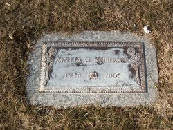
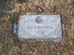
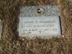
Amelia Gertrude Mangold Neiberger
| Birth | : | 7 Mar 1916 Luray, Russell County, Kansas, USA |
| Death | : | 6 Apr 2006 Greeley, Weld County, Colorado, USA |
| Burial | : | Tokomaru Bay Cemetery, Tokomaru, Gisborne District, New Zealand |
| Coordinate | : | -38.1402730, 178.3163420 |
| Plot | : | Sermon on the Mount Garden Lot 113 |
frequently asked questions (FAQ):
-
Where is Amelia Gertrude Mangold Neiberger's memorial?
Amelia Gertrude Mangold Neiberger's memorial is located at: Tokomaru Bay Cemetery, Tokomaru, Gisborne District, New Zealand.
-
When did Amelia Gertrude Mangold Neiberger death?
Amelia Gertrude Mangold Neiberger death on 6 Apr 2006 in Greeley, Weld County, Colorado, USA
-
Where are the coordinates of the Amelia Gertrude Mangold Neiberger's memorial?
Latitude: -38.1402730
Longitude: 178.3163420
Family Members:
Flowers:
Nearby Cemetories:
1. Tokomaru Bay Cemetery
Tokomaru, Gisborne District, New Zealand
Coordinate: -38.1402730, 178.3163420
2. Tuatini Māori Cemetery
Tokomaru, Gisborne District, New Zealand
Coordinate: -38.1310700, 178.3147500
3. Te Ariuru
Tokomaru, Gisborne District, New Zealand
Coordinate: -38.1093766, 178.3467334
4. Hinemaurea Marae Urupa
Tokomaru, Gisborne District, New Zealand
Coordinate: -38.2498150, 178.3207650
5. Okuri Marea Urupa
Tolaga Bay, Gisborne District, New Zealand
Coordinate: -38.3055250, 178.2704340
6. Tolaga Bay Urupā
Tolaga Bay, Gisborne District, New Zealand
Coordinate: -38.3629400, 178.3050080
7. Tolaga Bay Cemetery
Tolaga Bay, Gisborne District, New Zealand
Coordinate: -38.3643370, 178.3045240
8. Matahiia Cemetery
Ruatoria, Gisborne District, New Zealand
Coordinate: -37.9243300, 178.2298700
9. St. Matthew's Churchyard
Tuparoa, Gisborne District, New Zealand
Coordinate: -37.9167140, 178.3871320
10. Kohimarama Urupā
Tolaga Bay, Gisborne District, New Zealand
Coordinate: -38.3791770, 178.3007610
11. Te Aowera Marae Cemetery
Waipiro, Gisborne District, New Zealand
Coordinate: -37.9077306, 178.2433691
12. Taumataomihi Urupā
Gisborne, Gisborne District, New Zealand
Coordinate: -37.8976200, 178.3002000
13. Ruatoria Cemetery
Ruatoria, Gisborne District, New Zealand
Coordinate: -37.8956070, 178.3574100
14. Mangatarewa Cemetery
Ruatoria, Gisborne District, New Zealand
Coordinate: -37.8321773, 178.3685249
15. Porourangi Marae Urupā
Ruatoria, Gisborne District, New Zealand
Coordinate: -37.8156640, 178.3993750
16. Pukemanuka Cemetery
Gisborne District, New Zealand
Coordinate: -37.7883246, 178.3403532
17. Hinekopeka Urupā
Port Awanui, Gisborne District, New Zealand
Coordinate: -37.8000340, 178.4427170
18. Taumata Urupa
Port Awanui, Gisborne District, New Zealand
Coordinate: -37.8003278, 178.4581738
19. Okaroro Urupā
Rangitukia, Gisborne District, New Zealand
Coordinate: -37.7716419, 178.4587136
20. Whangara Urupā
Whangara, Gisborne District, New Zealand
Coordinate: -38.5716800, 178.2310400
21. Tapuae o te Rangi Urupā
Whatatutu, Gisborne District, New Zealand
Coordinate: -38.3791200, 177.8134180
22. Marangairoa Urupā
Te Araroa, Gisborne District, New Zealand
Coordinate: -37.6782490, 178.3561500
23. Pouawa Urupā
Whangara, Gisborne District, New Zealand
Coordinate: -38.6085500, 178.1825900
24. East Cape Lighthouse Cemetery
Gisborne District, New Zealand
Coordinate: -37.6889140, 178.5480850


