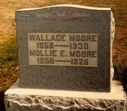
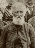
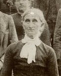
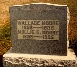
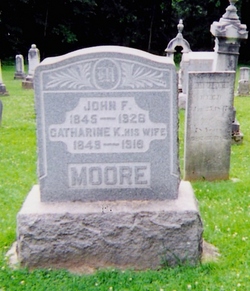
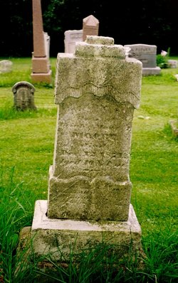
Anderson "Wallace" Moore
| Birth | : | 19 Aug 1856 Harrison County, Ohio, USA |
| Death | : | 17 Nov 1938 Harrison County, Ohio, USA |
| Burial | : | Griquastad Old Cemetery, Griekwastad, Pixley ka Seme District Municipality, South Africa |
| Description | : | Anderson Wallace Moore was one of the ten children of Uriah Moore and Mary Ann Fulton. The farm on which he lived was the original Moore farm. Wallace was a farmer who also did carpentry and house repair. In the 1930's he put the porches on his great-niece's house in Moorefield. He married Miss Amelia E. "Mollie" Erskine (1858-1925) and they had two daughters. "Wallace Moore, 82 well known farmer of Harrison county, died at his home on Freeport R.D. 2 Thursday morning 1:45 o'clock following a six weeks illness of heart trouble. His is... Read More |
frequently asked questions (FAQ):
-
Where is Anderson "Wallace" Moore's memorial?
Anderson "Wallace" Moore's memorial is located at: Griquastad Old Cemetery, Griekwastad, Pixley ka Seme District Municipality, South Africa.
-
When did Anderson "Wallace" Moore death?
Anderson "Wallace" Moore death on 17 Nov 1938 in Harrison County, Ohio, USA
Family Members:
Parent
Spouse
Siblings
Children
Flowers:
Nearby Cemetories:
1. Bongweni Burial Ground
Colesberg, Pixley ka Seme District Municipality, South Africa
Coordinate: -29.0677570, 23.6810183
2. Colesberg Boer Military Cemetery
Colesberg, Pixley ka Seme District Municipality, South Africa
Coordinate: -30.9962000, 23.7926700
3. Colesberg British Military Cemetery
Colesberg, Pixley ka Seme District Municipality, South Africa
Coordinate: -29.4018263, 22.1052065
4. Colesberg Cemetery
Colesberg, Pixley ka Seme District Municipality, South Africa
Coordinate: -29.4035941, 22.1143920
5. Colesberg Jewish Cemetery
Colesberg, Pixley ka Seme District Municipality, South Africa
Coordinate: -29.0280487, 24.2382434
6. Colesberg Main Cemetery
Colesberg, Pixley ka Seme District Municipality, South Africa
Coordinate: -29.0298318, 24.2359814
7. Kuyasa Cemetery
Colesberg, Pixley ka Seme District Municipality, South Africa
Coordinate: -29.6790500, 24.2046170
8. Hopetown Cemetery
Hopetown, Pixley ka Seme District Municipality, South Africa
Coordinate: -29.0552200, 23.7780700
9. Liebenbergspan Farm Burial Ground
Hopetown, Pixley ka Seme District Municipality, South Africa
Coordinate: -29.0661670, 23.7583500
10. Pioneers Cemetery
Hopetown, Pixley ka Seme District Municipality, South Africa
Coordinate: -29.0547170, 23.7808670
11. Steynville Cemetery
Hopetown, Pixley ka Seme District Municipality, South Africa
Coordinate: -29.3187564, 22.8430914
12. Van Wyksvle Cemetery
Van Wyksvlei, Pixley ka Seme District Municipality, South Africa
Coordinate: -29.3319965, 22.8440114
13. Bucklands Cemetery
Bucklands, Pixley ka Seme District Municipality, South Africa
Coordinate: -29.0677570, 23.6810183
14. Deelfontein Cemetery
Deelfontein, Pixley ka Seme District Municipality, South Africa
Coordinate: -30.9962000, 23.7926700
15. Marydale Cemetery
Marydale, Pixley ka Seme District Municipality, South Africa
Coordinate: -29.4018263, 22.1052065
16. Marydale East Cemetery
Marydale, Pixley ka Seme District Municipality, South Africa
Coordinate: -29.4035941, 22.1143920
17. NG Kerk - Plooysburg Kerkhof
Plooysburg, Pixley ka Seme District Municipality, South Africa
Coordinate: -29.0280487, 24.2382434
18. Plooysburg Cemetery
Plooysburg, Pixley ka Seme District Municipality, South Africa
Coordinate: -29.0298318, 24.2359814
19. Doornbult Concentration Camp Cemetery
Pixley ka Seme District Municipality, South Africa
Coordinate: -29.6790500, 24.2046170
20. Douglas Anglican Cemetery
Douglas, Pixley ka Seme District Municipality, South Africa
Coordinate: -29.0552200, 23.7780700
21. Douglas Main Cemetery
Douglas, Pixley ka Seme District Municipality, South Africa
Coordinate: -29.0661670, 23.7583500
22. Reverend Isaac Hughes Grave Site
Douglas, Pixley ka Seme District Municipality, South Africa
Coordinate: -29.0547170, 23.7808670
23. Niekerkshoop North Cemetery
Niekerkshoop, Pixley ka Seme District Municipality, South Africa
Coordinate: -29.3187564, 22.8430914
24. Niekerkshoop South Cemetery
Niekerkshoop, Pixley ka Seme District Municipality, South Africa
Coordinate: -29.3319965, 22.8440114

