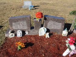
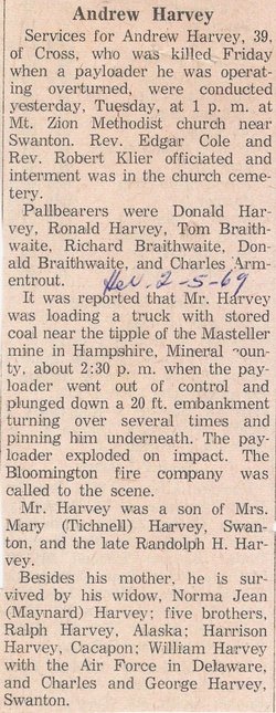
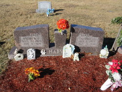
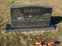
Andrew Claude Harvey
| Birth | : | 23 Sep 1929 Swanton, Garrett County, Maryland, USA |
| Death | : | 31 Jan 1969 Keyser, Mineral County, West Virginia, USA |
| Burial | : | Mount Zion Cemetery, Garrett County, USA |
| Coordinate | : | 39.4393997, -79.1710968 |
| Description | : | Name: Andrew Claude/Harvey Sex: Male Death Date: 31 Jan 1969 Death Place: Keyser, Mineral, WV Age at Death: 39y Birth Date: 23 Sep 1929 Birth Place: Marital Status: M Occupation: Laborer |
frequently asked questions (FAQ):
-
Where is Andrew Claude Harvey's memorial?
Andrew Claude Harvey's memorial is located at: Mount Zion Cemetery, Garrett County, USA.
-
When did Andrew Claude Harvey death?
Andrew Claude Harvey death on 31 Jan 1969 in Keyser, Mineral County, West Virginia, USA
-
Where are the coordinates of the Andrew Claude Harvey's memorial?
Latitude: 39.4393997
Longitude: -79.1710968
Family Members:
Parent
Spouse
Siblings
Flowers:
Nearby Cemetories:
1. Mount Zion Cemetery
Garrett County, USA
Coordinate: 39.4393997, -79.1710968
2. Manor Cemetery
Garrett County, USA
Coordinate: 39.4286003, -79.1505966
3. Kitzmiller Cemetery
Mineral County, USA
Coordinate: 39.4174995, -79.1350021
4. Evans Cemetery
Kitzmiller, Garrett County, USA
Coordinate: 39.4273500, -79.2201100
5. Virts Cemetery
Bethel, Garrett County, USA
Coordinate: 39.4474140, -79.1156660
6. Hamill Cemetery
Kitzmiller, Garrett County, USA
Coordinate: 39.3973500, -79.1889100
7. Bray Cemetery
Kitzmiller, Garrett County, USA
Coordinate: 39.3983002, -79.1999969
8. Kitzmiller Cemetery
Kitzmiller, Garrett County, USA
Coordinate: 39.3922005, -79.1817017
9. Dixon Cemetery
Elk Garden, Mineral County, USA
Coordinate: 39.3922005, -79.1568985
10. Barnard Cemetery
Garrett County, USA
Coordinate: 39.4850006, -79.1461029
11. Elk Garden Cemetery Old
Elk Garden, Mineral County, USA
Coordinate: 39.3850670, -79.1588600
12. Old Cross Dunkard Church Cemetery
Barnum, Mineral County, USA
Coordinate: 39.4300957, -79.0940933
13. Union Chapel Cemetery
Mineral County, USA
Coordinate: 39.4300150, -79.0926170
14. R.D. Dean Memorial I.O.O.F. Cemetery
Elk Garden, Mineral County, USA
Coordinate: 39.3767580, -79.1584820
15. Nethken Hill Cemetery
Elk Garden, Mineral County, USA
Coordinate: 39.3755989, -79.1592026
16. Sinclair Memorial Park
Cross, Mineral County, USA
Coordinate: 39.4338989, -79.0877991
17. Short Run Cemetery
Kitzmiller, Garrett County, USA
Coordinate: 39.3910100, -79.2278100
18. Kalbaugh Cemetery
Elk Garden, Mineral County, USA
Coordinate: 39.3744011, -79.1583023
19. Tasker Cemetery
Cross, Mineral County, USA
Coordinate: 39.4290657, -79.0853119
20. Joshua Kight Cemetery
Piedmont, Mineral County, USA
Coordinate: 39.4486000, -79.0679000
21. Wilson Cemetery
Altamont, Garrett County, USA
Coordinate: 39.4343600, -79.2764600
22. Rose Hill Cemetery
North Glade, Garrett County, USA
Coordinate: 39.4991989, -79.2450027
23. Paughs Cemetery
Garrett County, USA
Coordinate: 39.3869019, -79.2593994
24. Bloomington Cemetery
Bloomington, Garrett County, USA
Coordinate: 39.4799995, -79.0699997

