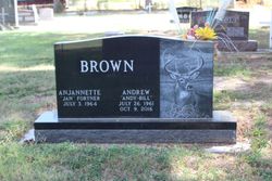
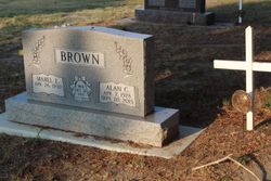
Andrew William “Andy Bill” Brown
| Birth | : | 26 Jul 1961 Ogallala, Keith County, Nebraska, USA |
| Death | : | 9 Oct 2016 Aurora, Adams County, Colorado, USA |
| Burial | : | Riverside Cemetery, Wauneta, Chase County, USA |
| Coordinate | : | 40.4188995, -101.3985977 |
| Description | : | Andrew William Brown, 55, of Chappell, NE, lost his hard-fought battle to cancer Sunday, October 9, 2016, in the University of Colorado Hospital in Aurora, CO. Andy Bill was born in Ogallala, Nebraska to Alan Charles Brown and Mabel Lorraine (Savage) Brown on July 26, 1961. He grew up in Ogallala and graduated from Ogallala High School in 1979. Andy was a mechanic and short-haul truck driver while the family lived in the panhandle. Andy met Jan in 1982 and they were married on June 4, 1983. They had four children: Brant, Jennifer, Shelby and Shania. The family moved to Chappell in... Read More |
frequently asked questions (FAQ):
-
Where is Andrew William “Andy Bill” Brown's memorial?
Andrew William “Andy Bill” Brown's memorial is located at: Riverside Cemetery, Wauneta, Chase County, USA.
-
When did Andrew William “Andy Bill” Brown death?
Andrew William “Andy Bill” Brown death on 9 Oct 2016 in Aurora, Adams County, Colorado, USA
-
Where are the coordinates of the Andrew William “Andy Bill” Brown's memorial?
Latitude: 40.4188995
Longitude: -101.3985977
Family Members:
Parent
Spouse
Flowers:
Nearby Cemetories:
1. Riverside Cemetery
Wauneta, Chase County, USA
Coordinate: 40.4188995, -101.3985977
2. Mount Zion Cemetery
Benkelman, Dundy County, USA
Coordinate: 40.3143997, -101.4366989
3. Eden Cemetery
Hitchcock County, USA
Coordinate: 40.3222237, -101.3147202
4. Saint Pauls Lutheran Cemetery
Dundy County, USA
Coordinate: 40.3490300, -101.5222500
5. Meadow Lawn Cemetery
Hamlet, Hayes County, USA
Coordinate: 40.3936005, -101.2363968
6. Ough Cemetery
Ough, Dundy County, USA
Coordinate: 40.3213997, -101.5214005
7. Elmer Cemetery
Hayes County, USA
Coordinate: 40.5532990, -101.2885971
8. Sleepy Hollow Cemetery
Dundy County, USA
Coordinate: 40.3149986, -101.5678024
9. Ash Grove Cemetery
Dundy County, USA
Coordinate: 40.2421989, -101.3617020
10. Saint John Catholic Cemetery
Hayes County, USA
Coordinate: 40.6027985, -101.3261032
11. Pleasant Ridge Cemetery
Stratton, Hitchcock County, USA
Coordinate: 40.2717018, -101.2305984
12. Hiawatha Cemetery
Dundy County, USA
Coordinate: 40.3293991, -101.6532974
13. Highland Cemetery
Dundy County, USA
Coordinate: 40.2056007, -101.4357986
14. Union Mission Cemetery
Hayes County, USA
Coordinate: 40.4463997, -101.1164017
15. Mount Hope Cemetery
Imperial, Chase County, USA
Coordinate: 40.5297012, -101.6607971
16. Old Palisade Cemetery
Palisade, Hitchcock County, USA
Coordinate: 40.3367004, -101.0971985
17. Palisade Cemetery
Palisade, Hitchcock County, USA
Coordinate: 40.3442001, -101.0892029
18. Attica Cemetery
Hayes County, USA
Coordinate: 40.6543999, -101.2632980
19. Rising Sun Cemetery
Palisade, Hitchcock County, USA
Coordinate: 40.2774000, -101.1170000
20. Blanche Cemetery
Chase County, USA
Coordinate: 40.6841900, -101.4390900
21. Rose Hill Cemetery
Stratton, Hitchcock County, USA
Coordinate: 40.1623000, -101.2393000
22. Lake View Cemetery
Champion, Chase County, USA
Coordinate: 40.4571991, -101.7705994
23. Hayes Center Cemetery
Hayes Center, Hayes County, USA
Coordinate: 40.5303001, -101.0252991
24. Max Cemetery
Max, Dundy County, USA
Coordinate: 40.0966500, -101.4184300


