
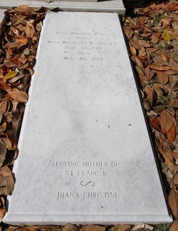
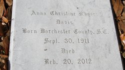
Anna Christine Rogers Davis
| Birth | : | 29 Sep 1911 Ridgeville, Dorchester County, South Carolina, USA |
| Death | : | 20 Feb 2012 Marion County, South Carolina, USA |
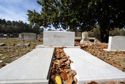
| Burial | : | Palmer Cemetery, Marion County, USA |
| Coordinate | : | 34.0205994, -79.3458023 |
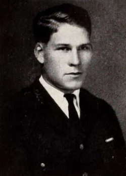
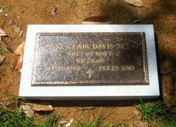
| Description | : | Christine Rogers Davis, aged 100, of Ella's Grove Plantation in Marion County, SC passed away peacefully February 20, 2012. She was the wife of the late St. Clair Davis, Sr., and mother of the late St. Clair Davis, Jr. Anna Christine was born on September 30, 1911 in Ridgeville, SC to Sabrie Cornelia Rudd and Louis Manning Rogers. She was valedictorian of Ridgeville High School, and in 1934, she graduated from Columbia College in Columbia, SC. After college, she taught school for several years in Hemingway, SC. Upon marrying her beloved St. Clair Davis, Sr, who was a WWII US... Read More |
frequently asked questions (FAQ):
-
Where is Anna Christine Rogers Davis's memorial?
Anna Christine Rogers Davis's memorial is located at: Palmer Cemetery, Marion County, USA.
-
When did Anna Christine Rogers Davis death?
Anna Christine Rogers Davis death on 20 Feb 2012 in Marion County, South Carolina, USA
-
Where are the coordinates of the Anna Christine Rogers Davis's memorial?
Latitude: 34.0205994
Longitude: -79.3458023
Family Members:
Parent

Spouse
Siblings
Children
Flowers:


Nearby Cemetories:
1. Palmer Cemetery
Marion County, USA
Coordinate: 34.0205994, -79.3458023
2. Centerville Baptist Church Cemetery
Centenary, Marion County, USA
Coordinate: 34.0302990, -79.3608240
3. Terrells Bay Cemetery
Marion, Marion County, USA
Coordinate: 34.0383640, -79.3684010
4. Centenary United Methodist Church Cemetery
Marion, Marion County, USA
Coordinate: 34.0653230, -79.3558650
5. Wateree Cemetery
Marion, Marion County, USA
Coordinate: 34.0397200, -79.2902800
6. Munnerlyn Cemetery
Ariel Cross Road, Marion County, USA
Coordinate: 34.0702950, -79.3149240
7. Saint James Cemetery
Marion, Marion County, USA
Coordinate: 34.0737010, -79.3041280
8. Ariel Baptist Church Cemetery
Mullins, Marion County, USA
Coordinate: 34.0789986, -79.3116989
9. Friendship AME Church Cemetery
Gresham, Marion County, USA
Coordinate: 33.9900970, -79.4180260
10. New Cemetery
Marion County, USA
Coordinate: 34.0816994, -79.3118973
11. Zion Cemetery
Aynor, Horry County, USA
Coordinate: 34.0266670, -79.2638900
12. Friendship Baptist Church Cemetery
Friendship, Marion County, USA
Coordinate: 34.0184760, -79.4301530
13. Tabernacle AME Church Cemetery
Gresham, Marion County, USA
Coordinate: 34.0472240, -79.4252780
14. Bethlehem African Methodist Episcopal Church Cemet
Rains, Marion County, USA
Coordinate: 34.0895980, -79.3169480
15. Antley Cemetery
Gresham, Marion County, USA
Coordinate: 33.9473751, -79.3367195
16. Gresham Chapel Freewill Baptist Church Cemetery
Gresham, Marion County, USA
Coordinate: 34.0141650, -79.4360800
17. Antley Richardson Cemetery
Centenary, Marion County, USA
Coordinate: 33.9454500, -79.3386667
18. Red Hill Methodist Church Cemetery
Galivants Ferry, Horry County, USA
Coordinate: 34.0001800, -79.2578170
19. Nebo Baptist Church Cemetery
Gresham, Marion County, USA
Coordinate: 33.9364000, -79.3442920
20. Tabernacle Cemetery
Marion County, USA
Coordinate: 34.0629500, -79.4338990
21. Richardson Family Cemetery
Brittons Neck, Marion County, USA
Coordinate: 33.9346310, -79.3362370
22. Baptist Colored Cemetery
Galivants Ferry, Horry County, USA
Coordinate: 33.9906830, -79.2469640
23. Ford Cemetery
Marion County, USA
Coordinate: 34.0139008, -79.4514008
24. Reedy Creek Baptist Church Cemetery
Marion County, USA
Coordinate: 34.1125700, -79.3331000