| Birth | : | 14 Feb 1911 Meagher County, Montana, USA |
| Death | : | 3 Feb 1992 Johnson, Nemaha County, Nebraska, USA |
| Burial | : | Sterling Cemetery, Sterling, Johnson County, USA |
| Coordinate | : | 40.4585991, -96.3582993 |
| Plot | : | Block SW |
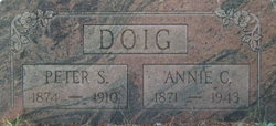
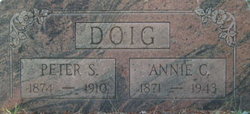
| Description | : | Anna, the daughter of Peter Scott and Annie (Campbell) Doig, married Joseph Lewis Beetem in July of 1937 |
frequently asked questions (FAQ):
-
Where is Anna Ellen Elizabeth Doig Beetem's memorial?
Anna Ellen Elizabeth Doig Beetem's memorial is located at: Sterling Cemetery, Sterling, Johnson County, USA.
-
When did Anna Ellen Elizabeth Doig Beetem death?
Anna Ellen Elizabeth Doig Beetem death on 3 Feb 1992 in Johnson, Nemaha County, Nebraska, USA
-
Where are the coordinates of the Anna Ellen Elizabeth Doig Beetem's memorial?
Latitude: 40.4585991
Longitude: -96.3582993
Family Members:
Parent
Spouse
Siblings
Flowers:
Nearby Cemetories:
1. Sterling Cemetery
Sterling, Johnson County, USA
Coordinate: 40.4585991, -96.3582993
2. Saint John North Lutheran Cemetery
Sterling, Johnson County, USA
Coordinate: 40.4689500, -96.3878500
3. South Saint John Lutheran Cemetery
Sterling, Johnson County, USA
Coordinate: 40.4355500, -96.3858000
4. Weber Cemetery
Sterling, Johnson County, USA
Coordinate: 40.4581000, -96.4177000
5. Immanuel Cemetery
Sterling, Johnson County, USA
Coordinate: 40.4692001, -96.4253006
6. Holy Rosary Catholic Cemetery
Saint Mary, Johnson County, USA
Coordinate: 40.4280000, -96.2905000
7. Granite Hill Cemetery
Johnson County, USA
Coordinate: 40.4180984, -96.4417038
8. Latrobe Cemetery
Sterling, Johnson County, USA
Coordinate: 40.5151000, -96.4557000
9. Wilcox Cemetery
Burr, Otoe County, USA
Coordinate: 40.5254478, -96.2708740
10. Hooker Cemetery
Adams, Gage County, USA
Coordinate: 40.4207993, -96.4732971
11. Vesta Cemetery
Johnson County, USA
Coordinate: 40.3630981, -96.3414001
12. Helena Cemetery
Johnson County, USA
Coordinate: 40.5085983, -96.2457962
13. Hope Lutheran Cemetery
Burr, Otoe County, USA
Coordinate: 40.5525017, -96.2938995
14. Dughman Cemetery
Douglas, Otoe County, USA
Coordinate: 40.5705986, -96.3452988
15. Highland Cemetery
Adams, Gage County, USA
Coordinate: 40.4580994, -96.5196991
16. Saint Martins Cemetery
Douglas, Otoe County, USA
Coordinate: 40.5844002, -96.3861008
17. Rosehill Cemetery
Douglas, Otoe County, USA
Coordinate: 40.5845940, -96.3867900
18. Saint Andrews Cemetery
Tecumseh, Johnson County, USA
Coordinate: 40.3918991, -96.1999969
19. Crab Orchard Cemetery
Crab Orchard, Johnson County, USA
Coordinate: 40.3274994, -96.4366989
20. Pella Cemetery
Panama, Lancaster County, USA
Coordinate: 40.5555992, -96.5014038
21. Cook Cemetery
Cook, Johnson County, USA
Coordinate: 40.5168991, -96.1797028
22. Grace Lutheran Church Cemetery
Cook, Johnson County, USA
Coordinate: 40.5178000, -96.1799500
23. Solon Cemetery
Otoe County, USA
Coordinate: 40.5917015, -96.4436035
24. Hopewell Presbyterian Church Cemetery
Otoe County, USA
Coordinate: 40.6090150, -96.2930630

