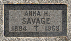
Anna H DeKay Savage
| Birth | : | 26 Dec 1894 Wetmore, Nemaha County, Kansas, USA |
| Death | : | 21 Dec 1969 Holton, Jackson County, Kansas, USA |
| Burial | : | Wetmore Cemetery, Wetmore, Nemaha County, USA |
| Coordinate | : | 39.6396800, -95.8108400 |
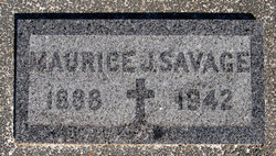
| Description | : | Mrs. Anna H. Savage, 74, Wetmore, died Sunday, Dec. 21, 1969 in a Holton hospital. She had an abdominal ailment. She was born Dec. 26, 1894, near Wetmore and spent most of her life in the Wetmore community. She was a member of the Methodist Church at Wetmore. Her husband, Maurice Savage, died in February, 1942. A sister, Mrs. Opal Smith, Everest, survives. Services will be at 10:30 a.m. Wednesday at Mercer Funeral Home at Holton. Burial will be in Wetmore Cemetery. Topeka Capital ~ Dec.22, 1969 |
frequently asked questions (FAQ):
-
Where is Anna H DeKay Savage's memorial?
Anna H DeKay Savage's memorial is located at: Wetmore Cemetery, Wetmore, Nemaha County, USA.
-
When did Anna H DeKay Savage death?
Anna H DeKay Savage death on 21 Dec 1969 in Holton, Jackson County, Kansas, USA
-
Where are the coordinates of the Anna H DeKay Savage's memorial?
Latitude: 39.6396800
Longitude: -95.8108400
Family Members:
Parent
Spouse
Flowers:
Nearby Cemetories:
1. Wetmore Cemetery
Wetmore, Nemaha County, USA
Coordinate: 39.6396800, -95.8108400
2. Wolfley Cemetery
Goff, Nemaha County, USA
Coordinate: 39.6454400, -95.8633900
3. South Powhattan Cemetery
Powhattan, Brown County, USA
Coordinate: 39.6608009, -95.7596970
4. Netawaka Cemetery
Netawaka, Jackson County, USA
Coordinate: 39.6075300, -95.7223700
5. Pleasant Grove Cemetery
Jackson County, USA
Coordinate: 39.5664000, -95.7789000
6. Barnes Cemetery
Goff, Nemaha County, USA
Coordinate: 39.6960983, -95.8824997
7. Granada Cemetery
Granada, Nemaha County, USA
Coordinate: 39.7324982, -95.7988968
8. Ontario Cemetery
Nemaha County, USA
Coordinate: 39.5663795, -95.8885193
9. Fairview Cemetery
Goff, Nemaha County, USA
Coordinate: 39.6831017, -95.9383011
10. Grant-Mjessepe Cemetery
Horton, Brown County, USA
Coordinate: 39.6663000, -95.6576000
11. Comet Cemetery
Powhattan Township, Brown County, USA
Coordinate: 39.7542600, -95.7340400
12. Kennekuk Church Cemetery
Horton, Brown County, USA
Coordinate: 39.7074600, -95.6672300
13. Jessepe Indian Cemetery
Horton, Brown County, USA
Coordinate: 39.6715000, -95.6438000
14. Capioma Cemetery
Capioma, Nemaha County, USA
Coordinate: 39.7805099, -95.8205719
15. Carmel Cemetery
Circleville, Jackson County, USA
Coordinate: 39.4984400, -95.7967700
16. Circleville Cemetery
Circleville, Jackson County, USA
Coordinate: 39.5014000, -95.8664017
17. Pleasant Hill Cemetery
Corning, Nemaha County, USA
Coordinate: 39.6895800, -95.9907400
18. Grasshopper Burial Ground
Powhattan Township, Brown County, USA
Coordinate: 39.7578020, -95.6949820
19. Saint Augustine Catholic Cemetery
Capioma Township, Nemaha County, USA
Coordinate: 39.7904282, -95.7897034
20. Soldier Cemetery
Soldier, Jackson County, USA
Coordinate: 39.5417900, -95.9654800
21. Woodlawn Cemetery
Woodlawn, Nemaha County, USA
Coordinate: 39.7905998, -95.8638992
22. Spring Hill Cemetery
Whiting, Jackson County, USA
Coordinate: 39.6021996, -95.6121979
23. Jonach Cemetery
Nemaha County, USA
Coordinate: 39.7925700, -95.8646600
24. Saint Patricks Cemetery
Corning, Nemaha County, USA
Coordinate: 39.6521988, -96.0250015


