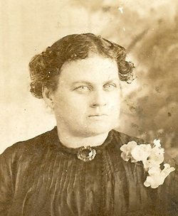
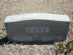
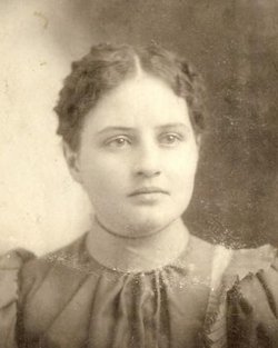
Anna Phylista Smith Lane
| Birth | : | 20 Oct 1860 Missouri, USA |
| Death | : | 23 May 1929 Holly, Prowers County, Colorado, USA |
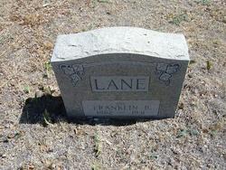
| Burial | : | Holly Cemetery, Holly, Prowers County, USA |
| Coordinate | : | 38.0593987, -102.1085968 |
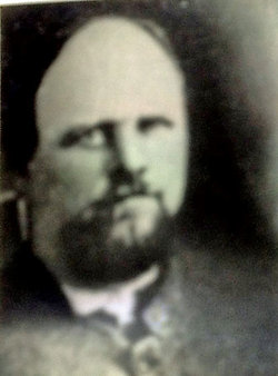
| Description | : | Anna Smith was born in western Missouri in 1860 to Julia Ann (Cobb) and Charles W. Smith. The Civil War caused much bloodshed in the area, mostly due to the Jayhawkers and guerrilla fighting. Anna's father enlisted as a private in Company C, 12th Missouri Cavalry Volunteers in February 1864, and later served as a scout for General Crook during the Indian wars. His absence caused great suffering and hardship for the family. They moved to Melvern, Osage County, Kansas in 1872. Anna Phylista Smith married Stephen S. Lane in about 1876. Their first child, Cora Etta, was born November... Read More |
frequently asked questions (FAQ):
-
Where is Anna Phylista Smith Lane's memorial?
Anna Phylista Smith Lane's memorial is located at: Holly Cemetery, Holly, Prowers County, USA.
-
When did Anna Phylista Smith Lane death?
Anna Phylista Smith Lane death on 23 May 1929 in Holly, Prowers County, Colorado, USA
-
Where are the coordinates of the Anna Phylista Smith Lane's memorial?
Latitude: 38.0593987
Longitude: -102.1085968
Family Members:
Parent
Spouse
Children
Flowers:
Nearby Cemetories:
1. Holly Cemetery
Holly, Prowers County, USA
Coordinate: 38.0593987, -102.1085968
2. Fort Holly Cemetery
Holly, Prowers County, USA
Coordinate: 38.0323910, -102.1589900
3. Amity Cemetery
Hartman, Prowers County, USA
Coordinate: 38.0786018, -102.2091980
4. Coolidge Cemetery
Coolidge, Hamilton County, USA
Coordinate: 38.0569000, -102.0006027
5. Hartman Cemetery
Hartman, Prowers County, USA
Coordinate: 38.1147003, -102.2185974
6. Barton Cemetery
Granada, Prowers County, USA
Coordinate: 38.0432070, -102.2382550
7. Hillside Cemetery
Granada, Prowers County, USA
Coordinate: 38.0485992, -102.3094025
8. Sunnyvale Cemetery
Hamilton County, USA
Coordinate: 37.9131012, -101.9819031
9. Amache Cemetery
Granada, Prowers County, USA
Coordinate: 38.0435982, -102.3356018
10. Sunnyslope Cemetery
Bristol, Prowers County, USA
Coordinate: 38.1255989, -102.3210983
11. Garber Cemetery
Prowers County, USA
Coordinate: 37.8050003, -102.1108017
12. Glacken Gravesite
Syracuse, Hamilton County, USA
Coordinate: 38.0599861, -101.7628403
13. Syracuse Cemetery
Syracuse, Hamilton County, USA
Coordinate: 37.9925003, -101.7683029
14. Green Lawn Pioneer Cemetery
Hamilton County, USA
Coordinate: 37.9863800, -101.7393090
15. Bear Creek Cemetery
Hamilton County, USA
Coordinate: 37.7606010, -101.9338989
16. Mathews Cemetery
Greeley County, USA
Coordinate: 38.3935580, -101.9929930
17. Amerine Cemetery
Holly, Prowers County, USA
Coordinate: 37.6874800, -102.0862600
18. Rural Cemetery #12
Lamar, Prowers County, USA
Coordinate: 38.0711000, -102.5989000
19. Fairmount Cemetery
Lamar, Prowers County, USA
Coordinate: 38.0508003, -102.6069031
20. Riverside Cemetery
Lamar, Prowers County, USA
Coordinate: 38.0932999, -102.6072006
21. Mount Olive Cemetery
Lamar, Prowers County, USA
Coordinate: 38.0508003, -102.6089020
22. Towner Cemetery
Kiowa County, USA
Coordinate: 38.4631004, -102.0955963
23. Ebenfleur Cemetery
Hamilton County, USA
Coordinate: 37.8264465, -101.6882477
24. Taft Cemetery
Prowers County, USA
Coordinate: 37.7593994, -102.4942017

