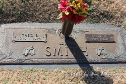
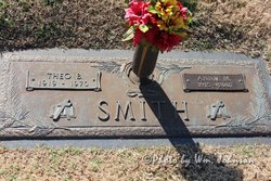
Annie Beatrice Monday Smith
| Birth | : | 20 Jan 1915 Bluefield, Mercer County, West Virginia, USA |
| Death | : | 8 Aug 2007 Greensboro, Guilford County, North Carolina, USA |
| Burial | : | Bendolba Anglican Cemetery, Bendolba, Dungog Shire, Australia |
| Coordinate | : | -32.3210790, 151.7249510 |
| Description | : | Mrs. Annie Beatrice Monday Smith of Mt. Airy, widow of Theo Byron Smith, passed away Wednesday, August 8, 2007 at Moses Cone Hospital in Greensboro, NC. She was born in Bluefield, WV to the late Robert Seymour and Louvenia Leftwich Monday. She was a member of First Baptist Church in Mt. Airy, where she was active in the missionary circle. She was a member of the Mt. Airy Woman's Club and was also a member of the Colonial Dames, Woods River Chapter in Galax, VA. Mrs. Smith retired from J.C. Penney Company in 2002 after working for many years, several... Read More |
frequently asked questions (FAQ):
-
Where is Annie Beatrice Monday Smith's memorial?
Annie Beatrice Monday Smith's memorial is located at: Bendolba Anglican Cemetery, Bendolba, Dungog Shire, Australia.
-
When did Annie Beatrice Monday Smith death?
Annie Beatrice Monday Smith death on 8 Aug 2007 in Greensboro, Guilford County, North Carolina, USA
-
Where are the coordinates of the Annie Beatrice Monday Smith's memorial?
Latitude: -32.3210790
Longitude: 151.7249510
Family Members:
Parent
Spouse
Siblings
Flowers:
Nearby Cemetories:
1. Bendolba Anglican Cemetery
Bendolba, Dungog Shire, Australia
Coordinate: -32.3210790, 151.7249510
2. Bendolba General & War Cemetery
Bendolba, Dungog Shire, Australia
Coordinate: -32.3209930, 151.7251180
3. Banden Grove Cemetery
Banden Grove, Dungog Shire, Australia
Coordinate: -32.2964900, 151.7236800
4. Quart Pot Cemetery
Banden Grove, Dungog Shire, Australia
Coordinate: -32.2779150, 151.6415950
5. Dungog Uniting Church
Dungog, Dungog Shire, Australia
Coordinate: -32.4005385, 151.7576070
6. Dungog Presbyterian Columbarium
Dungog, Dungog Shire, Australia
Coordinate: -32.4054570, 151.7572590
7. Dungog Anglican Church Columbarium
Dungog, Dungog Shire, Australia
Coordinate: -32.4062660, 151.7569690
8. Dungog General Cemetery
Dungog, Dungog Shire, Australia
Coordinate: -32.4188490, 151.7382580
9. Hooke Family Cemetery
Wirragulla, Dungog Shire, Australia
Coordinate: -32.4454490, 151.7507070
10. Thalaba Baptist Community Cemetery
Dungog, Dungog Shire, Australia
Coordinate: -32.4437900, 151.7841030
11. Chichester Anglican Church
Mid-Coast Council, Australia
Coordinate: -32.1961800, 151.6202260
12. Allynbrook Anglican Cemetery
Allynbrook, Dungog Shire, Australia
Coordinate: -32.3619460, 151.5446780
13. Melbury Church Cemetery
Salisbury, Dungog Shire, Australia
Coordinate: -32.2297220, 151.5722230
14. Salisbury Cemetery
Salisbury, Dungog Shire, Australia
Coordinate: -32.2241290, 151.5675540
15. St. Helen’s Catholic Cemetery
Gresford, Dungog Shire, Australia
Coordinate: -32.4333344, 151.5666656
16. East Gresford Cemetery
East Gresford, Dungog Shire, Australia
Coordinate: -32.4262660, 151.5559390
17. Camyr Allyn Estate
Gresford, Dungog Shire, Australia
Coordinate: -32.4162159, 151.5451979
18. East Gresford Catholic Cemetery
East Gresford, Dungog Shire, Australia
Coordinate: -32.4334180, 151.5548250
19. Hilldale Union Church Columbarium
Hilldale, Dungog Shire, Australia
Coordinate: -32.5033190, 151.6567690
20. Belgrave Cemetery
Eccleston, Dungog Shire, Australia
Coordinate: -32.2845380, 151.5011970
21. Gresford Anglican Cemetery
Gresford, Dungog Shire, Australia
Coordinate: -32.4286310, 151.5313570
22. Glen William Cemetery
Glen William, Dungog Shire, Australia
Coordinate: -32.5216700, 151.8048400
23. Wards River Cemetery
Wards River, Mid-Coast Council, Australia
Coordinate: -32.2191000, 151.9464000
24. Stroud Anglican Cemetery
Stroud, Mid-Coast Council, Australia
Coordinate: -32.4052620, 151.9677280

