
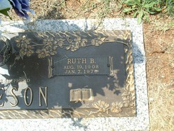

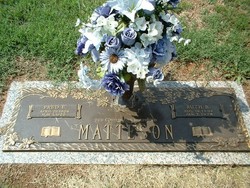
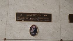
Annie Ruth Brown Matteson
| Birth | : | 19 Aug 1908 |
| Death | : | 7 Jan 1976 |
| Burial | : | Drayton and Toowoomba Cemetery, Toowoomba, Toowoomba Region, Australia |
| Coordinate | : | -27.5768090, 151.9184880 |
| Plot | : | Garden of Jesus in the Temple, Section E |
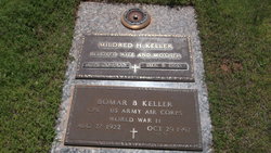
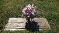
| Description | : | THE GREENVILLE NEWS - Jan. 8, 1976 p.11 Mrs. Ruth Brown Matteson, 67, of 314 Ohio St., City View, a retired employee of Monaghan Mill and widow of Fred E. Matteson, died Wednesday. A native of Greenville County, daughter of Mrs. Dora Bomar Brown Keller of Greer and the late Will Brown, she was a member of City View First Baptist Church, the Ladies' Class and Senior Citizens of the Church. Surviving are two daughters, Mrs. Donald Bowlin of Simpsonville and Mrs. Thomas Myers of Greenville; a son, Jerry Matteson of Greer; three brothers, Troy Brown of Greer, Bill Keller of Easley and... Read More |
frequently asked questions (FAQ):
-
Where is Annie Ruth Brown Matteson's memorial?
Annie Ruth Brown Matteson's memorial is located at: Drayton and Toowoomba Cemetery, Toowoomba, Toowoomba Region, Australia.
-
When did Annie Ruth Brown Matteson death?
Annie Ruth Brown Matteson death on 7 Jan 1976 in
-
Where are the coordinates of the Annie Ruth Brown Matteson's memorial?
Latitude: -27.5768090
Longitude: 151.9184880
Family Members:
Parent

Spouse
Siblings
Children
Flowers:


Nearby Cemetories:
1. Drayton and Toowoomba Cemetery
Toowoomba, Toowoomba Region, Australia
Coordinate: -27.5768090, 151.9184880
2. St Patrick's Cathedral
Toowoomba Region, Australia
Coordinate: -27.5694185, 151.9533937
3. Drayton Cemetery
Toowoomba Region, Australia
Coordinate: -27.5768740, 151.9546226
4. Toowoomba Garden of Remembrance
Toowoomba, Toowoomba Region, Australia
Coordinate: -27.6072330, 151.9426800
5. Westbrook Cemetery
Toowoomba Region, Australia
Coordinate: -27.6023480, 151.8005810
6. Glencoe Lawn Cemetery
Toowoomba Region, Australia
Coordinate: -27.4716670, 151.8744210
7. Glencoe Bethlehem Lutheran Congregational Cemetery
Toowoomba Region, Australia
Coordinate: -27.4700680, 151.8608750
8. Highfields Baptist Church Cemetery
Highfields, Toowoomba Region, Australia
Coordinate: -27.4605410, 151.9449660
9. Cabarlah Cemetery
Cabarlah, Toowoomba Region, Australia
Coordinate: -27.4513410, 151.9876760
10. Meringandan Cemetery
Meringandan, Toowoomba Region, Australia
Coordinate: -27.4255316, 151.8993308
11. Murphy's Creek Cemetery
Murphys Creek, Lockyer Valley Region, Australia
Coordinate: -27.4598700, 152.0405800
12. Toowoomba Region Lone Graves
Toowoomba Region, Australia
Coordinate: -27.7082200, 151.7925340
13. Helidon Catholic Cemetery
Helidon, Lockyer Valley Region, Australia
Coordinate: -27.5456350, 152.1191570
14. Helidon General Cemetery
Helidon, Lockyer Valley Region, Australia
Coordinate: -27.5488500, 152.1313000
15. Greenmount Cemetery
Cambooya, Toowoomba Region, Australia
Coordinate: -27.7838780, 151.9306530
16. Oakey Cemetery
Oakey, Toowoomba Region, Australia
Coordinate: -27.4327915, 151.7094802
17. Ma Ma Creek Anglican Cemetery
Ma Ma Creek, Lockyer Valley Region, Australia
Coordinate: -27.6294760, 152.1897330
18. Aubigny Catholic Cemetery
Aubigny, Toowoomba Region, Australia
Coordinate: -27.5251080, 151.6469360
19. Aubigny Lutheran Cemetery
Aubigny, Toowoomba Region, Australia
Coordinate: -27.5226480, 151.6429360
20. Douglas Lutheran Cemetery
Crows Nest, Toowoomba Region, Australia
Coordinate: -27.3174600, 151.9119210
21. Nobby Cemetery
Nobby, Toowoomba Region, Australia
Coordinate: -27.8322200, 151.8662000
22. Caffey Cemetery
Toowoomba, Toowoomba Region, Australia
Coordinate: -27.6964730, 152.2198720
23. Pittsworth Cemetery
Pittsworth, Toowoomba Region, Australia
Coordinate: -27.7267154, 151.6343844
24. Ropeley Lutheran Cemetery
Ropeley, Lockyer Valley Region, Australia
Coordinate: -27.6453990, 152.2538760