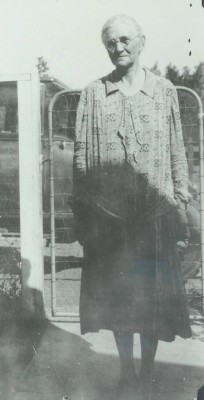
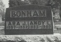
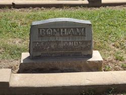
Ara Jane Prather Bonham
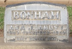
| Birth | : | 8 Jan 1867 Randolph County, Missouri, USA |
| Death | : | 29 Apr 1952 Sacramento, Sacramento County, California, USA |
| Burial | : | McFarlan Cemetery, What Cheer, Keokuk County, USA |
| Coordinate | : | 41.4085999, -92.3371964 |
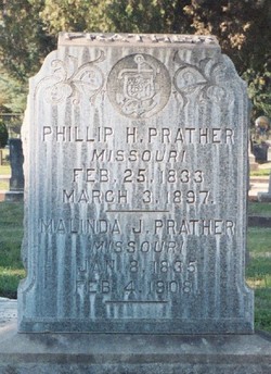
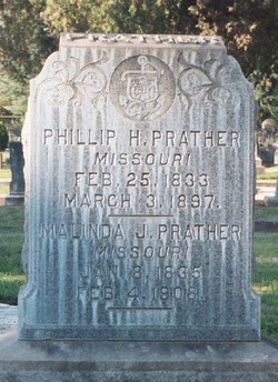
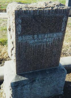
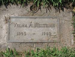
| Description | : | Daughter of Philip H. & Malinda J. (MC DAVITT) PRATHER. Wife of Andrew L. BONHAM. Mother of Alice L. (BONHAM) BEANLAND, Velma A. (BONHAM) MELTZIAN PEASE, Maud G. (BONHAM) WESTFALL JONES, Bess (BONHAM) MILLER, baby boy BONHAM, Carlton L. BONHAM, Ruth M. (BONHAM) MARVIN. BONHAM-In Sacramento, Calif., April 29, 1952, Ara J. Bonham, wife of the late Andy L. Bonham; mother of Mrs. R.I. Miller of Stockton, Mrs. Thomas Jones of Mariposa, Mrs. Albert Marvin of Linden, Velma Meltzian of Stockton, Carlton Bonham of Oakland, Mrs. Lloyd Nutter and Mrs. Willing Gates, both of Sacramento; sister of Mittie Stowers... Read More |
frequently asked questions (FAQ):
-
Where is Ara Jane Prather Bonham's memorial?
Ara Jane Prather Bonham's memorial is located at: McFarlan Cemetery, What Cheer, Keokuk County, USA.
-
When did Ara Jane Prather Bonham death?
Ara Jane Prather Bonham death on 29 Apr 1952 in Sacramento, Sacramento County, California, USA
-
Where are the coordinates of the Ara Jane Prather Bonham's memorial?
Latitude: 41.4085999
Longitude: -92.3371964
Family Members:
Parent
Spouse
Siblings
Children
Flowers:
Nearby Cemetories:
1. McFarlan Cemetery
What Cheer, Keokuk County, USA
Coordinate: 41.4085999, -92.3371964
2. Saint Josephs Cemetery
What Cheer, Keokuk County, USA
Coordinate: 41.4007988, -92.3300018
3. Highland Cemetery
What Cheer, Keokuk County, USA
Coordinate: 41.3936005, -92.3407974
4. Saint Martin Evangelical Lutheran Cemetery
Keokuk County, USA
Coordinate: 41.4100075, -92.2971268
5. Humes Cemetery
Thornburg, Keokuk County, USA
Coordinate: 41.4085999, -92.2968979
6. Coal Creek Cemetery
What Cheer, Keokuk County, USA
Coordinate: 41.4392520, -92.3843340
7. Rice Cemetery
What Cheer, Keokuk County, USA
Coordinate: 41.3793983, -92.3891983
8. Sixteen Cemetery
Thornburg, Keokuk County, USA
Coordinate: 41.4622002, -92.3538971
9. Bailey Cemetery
Keswick, Keokuk County, USA
Coordinate: 41.4449997, -92.2677994
10. Waddell Cemetery
Keokuk County, USA
Coordinate: 41.3574982, -92.3874969
11. White Oak Cemetery
Keokuk County, USA
Coordinate: 41.4738500, -92.3157000
12. Springfield Cemetery
Delta, Keokuk County, USA
Coordinate: 41.3386002, -92.3531036
13. Johnson Cemetery
Sigourney, Keokuk County, USA
Coordinate: 41.3824997, -92.2485962
14. Garrett Cemetery
Delta, Keokuk County, USA
Coordinate: 41.3368988, -92.3277969
15. Indianapolis Cemetery
Rose Hill, Mahaska County, USA
Coordinate: 41.4053001, -92.4364014
16. Hewitt Cemetery
Delta, Keokuk County, USA
Coordinate: 41.3277874, -92.3807409
17. Turner-Tinkerville-Wapalo Cemetery
Rose Hill, Mahaska County, USA
Coordinate: 41.3426130, -92.4177970
18. Hopewell Cemetery
Rose Hill, Mahaska County, USA
Coordinate: 41.3502998, -92.4494019
19. Bedwell Cemetery
Monroe Township, Mahaska County, USA
Coordinate: 41.3667400, -92.4637400
20. Tinsley Cemetery
Mahaska County, USA
Coordinate: 41.3941994, -92.4783020
21. Kensler Cemetery
Delta, Keokuk County, USA
Coordinate: 41.2994003, -92.3246994
22. Pleasant Grove Cemetery
Sigourney, Keokuk County, USA
Coordinate: 41.3405991, -92.2200012
23. Clary Cemetery
Sigourney, Keokuk County, USA
Coordinate: 41.3589080, -92.2000090
24. Sorden Cemetery
Webster, Keokuk County, USA
Coordinate: 41.4575005, -92.1905975

