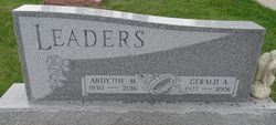
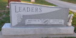
Ardythe Mae Olsen Leaders
| Birth | : | 2 May 1930 Council Bluffs, Pottawattamie County, Iowa, USA |
| Death | : | 15 Jul 2016 Missouri Valley, Harrison County, Iowa, USA |
| Burial | : | Pleasant Hill Cemetery, Dunlap, Harrison County, USA |
| Coordinate | : | 41.8446999, -95.5939026 |
| Plot | : | New Section, Block 5 |
| Description | : | . . FUNERAL SERVICE Tuesday, July 19 10:30 AM Fouts Funeral Home Hwy 30 & Court Streets Dunlap, IA 51529 Ardythe Mae (Olsen) Leaders was born May 2, 1930, to Albert and Sarah (Boren) Olsen in Council Bluffs, Iowa. She grew up in Treynor, Iowa and graduated from high school there. Ardythe then taught country school. On June 8, 1947, Ardythe married Gerald Leaders. The couple farmed near Gerald's childhood home near Bentley, Iowa until moving to Council Bluffs in 1960. In 1963, the family moved to Dunlap. Ardythe enjoyed help out at the implement business and taking care of the books. Gerald... Read More |
frequently asked questions (FAQ):
-
Where is Ardythe Mae Olsen Leaders's memorial?
Ardythe Mae Olsen Leaders's memorial is located at: Pleasant Hill Cemetery, Dunlap, Harrison County, USA.
-
When did Ardythe Mae Olsen Leaders death?
Ardythe Mae Olsen Leaders death on 15 Jul 2016 in Missouri Valley, Harrison County, Iowa, USA
-
Where are the coordinates of the Ardythe Mae Olsen Leaders's memorial?
Latitude: 41.8446999
Longitude: -95.5939026
Family Members:
Parent
Spouse
Flowers:
Nearby Cemetories:
1. Pleasant Hill Cemetery
Dunlap, Harrison County, USA
Coordinate: 41.8446999, -95.5939026
2. Valley View Cemetery
Crawford County, USA
Coordinate: 41.8647003, -95.6252975
3. Manteno Cemetery
Shelby County, USA
Coordinate: 41.8343964, -95.5367355
4. Doyle Cemetery
Earling, Shelby County, USA
Coordinate: 41.8051000, -95.5087000
5. Abel Galland Memorial Cemetery
Manteno, Shelby County, USA
Coordinate: 41.8370000, -95.4932500
6. Gallands Grove RLDS Holcomb Cemetery
Shelby County, USA
Coordinate: 41.8342018, -95.4788971
7. Dow City Cemetery
Dow City, Crawford County, USA
Coordinate: 41.9219017, -95.5119019
8. Woodbine Cemetery
Woodbine, Harrison County, USA
Coordinate: 41.7466316, -95.7143936
9. Butler Cemetery
Arion, Crawford County, USA
Coordinate: 41.9364014, -95.4627991
10. Washington Township Cemetery
Panama, Shelby County, USA
Coordinate: 41.7305984, -95.4867020
11. Saint Marys Cemetery
Panama, Shelby County, USA
Coordinate: 41.7332993, -95.4811020
12. Mefferd Cemetery
Harrison County, USA
Coordinate: 41.7132200, -95.6576200
13. Saint Joseph Cemetery
Earling, Shelby County, USA
Coordinate: 41.7797012, -95.4207993
14. Willow Township Cemetery
Charter Oak, Crawford County, USA
Coordinate: 41.9913776, -95.6141702
15. Benjamin Purcell Cemetery
Allen, Harrison County, USA
Coordinate: 41.7694328, -95.7794523
16. Cowan-Pardee Cemetery
Woodbine, Harrison County, USA
Coordinate: 41.6976500, -95.6765000
17. Crawford County Poor Farm Cemetery
Crawford County, USA
Coordinate: 41.9508216, -95.4308331
18. Buck Grove Cemetery
Buck Grove, Crawford County, USA
Coordinate: 41.9067841, -95.3839722
19. Soldier Lutheran Church Cemetery
Soldier, Monona County, USA
Coordinate: 41.9510000, -95.7800000
20. Old Norwegian Lutheran Cemetery
Soldier, Monona County, USA
Coordinate: 41.9460000, -95.7885000
21. Biglers Grove Cemetery
Woodbine, Harrison County, USA
Coordinate: 41.7327995, -95.7786026
22. Union Township Cemetery
Defiance, Shelby County, USA
Coordinate: 41.8269005, -95.3471985
23. Saints Peter and Paul Catholic Cemetery
Defiance, Shelby County, USA
Coordinate: 41.8269005, -95.3450012
24. Ellison Cemetery
Harrison County, USA
Coordinate: 41.6561012, -95.6260986


