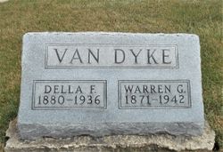
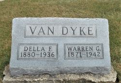
| Birth | : | 30 Aug 1900 Mendota, Putnam County, Missouri, USA |
| Death | : | 27 Jul 1995 Palisade, Mesa County, Colorado, USA |
| Burial | : | Zion Hill Cemetery, Hartford, Hartford County, USA |
| Coordinate | : | 41.7550011, -72.6917038 |
frequently asked questions (FAQ):
-
Where is Arla M. Van Dyke Bates's memorial?
Arla M. Van Dyke Bates's memorial is located at: Zion Hill Cemetery, Hartford, Hartford County, USA.
-
When did Arla M. Van Dyke Bates death?
Arla M. Van Dyke Bates death on 27 Jul 1995 in Palisade, Mesa County, Colorado, USA
-
Where are the coordinates of the Arla M. Van Dyke Bates's memorial?
Latitude: 41.7550011
Longitude: -72.6917038
Family Members:
Parent
Spouse
Siblings
Flowers:
Nearby Cemetories:
1. Zion Hill Cemetery
Hartford, Hartford County, USA
Coordinate: 41.7550011, -72.6917038
2. Agudas Achim Cemetery
Hartford, Hartford County, USA
Coordinate: 41.7549200, -72.6915300
3. Congregation Adas Israel Cemetery
Hartford, Hartford County, USA
Coordinate: 41.7553291, -72.6898804
4. Beth Israel Cemetery
Hartford, Hartford County, USA
Coordinate: 41.7556700, -72.6893500
5. Trinity College Chapel Memorial Garden
Hartford, Hartford County, USA
Coordinate: 41.7488870, -72.6902355
6. Emanuel Lutheran Church Memorial Garden
Hartford, Hartford County, USA
Coordinate: 41.7631600, -72.6856660
7. Hartford Armory
Hartford, Hartford County, USA
Coordinate: 41.7643890, -72.6865692
8. Old South Burying Ground
Hartford, Hartford County, USA
Coordinate: 41.7472000, -72.6802979
9. Soldiers and Sailors Memorial Arch
Hartford, Hartford County, USA
Coordinate: 41.7656479, -72.6799469
10. Trinity Church Memorial Garden
Hartford, Hartford County, USA
Coordinate: 41.7688408, -72.6936417
11. Asylum Hill Congregational Church
West Hartford, Hartford County, USA
Coordinate: 41.7699550, -72.6915950
12. Immanuel Congregational Church Memorial Garden
Hartford, Hartford County, USA
Coordinate: 41.7681920, -72.7017000
13. Ancient Burying Ground
Hartford, Hartford County, USA
Coordinate: 41.7648582, -72.6744232
14. Saint Patrick Saint Anthony RC Church
Hartford, Hartford County, USA
Coordinate: 41.7690010, -72.6780014
15. First Burying Ground of Hartford
Hartford, Hartford County, USA
Coordinate: 41.7659900, -72.6724040
16. Sisters of Saint Joseph Cemetery
West Hartford, Hartford County, USA
Coordinate: 41.7549400, -72.7181091
17. Norman Morison Gravesite
Hartford, Hartford County, USA
Coordinate: 41.7678833, -72.6712418
18. Saint Johns Episcopal Church Cloister Garden
West Hartford, Hartford County, USA
Coordinate: 41.7650240, -72.7174320
19. Saint Patricks Cemetery
Hartford, Hartford County, USA
Coordinate: 41.7813988, -72.6806030
20. Old North Cemetery
Hartford, Hartford County, USA
Coordinate: 41.7807999, -72.6781006
21. Quaker Cemetery
West Hartford, Hartford County, USA
Coordinate: 41.7593575, -72.7289581
22. Hartford Free Burial Association
Hartford, Hartford County, USA
Coordinate: 41.7826340, -72.6817990
23. Beth Midrash Hagadol Cemetery
Hartford, Hartford County, USA
Coordinate: 41.7820700, -72.6792600
24. Workers Circle Branch 610 Cemetery
Hartford, Hartford County, USA
Coordinate: 41.7829210, -72.6831230


