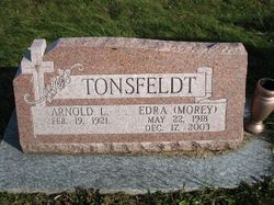
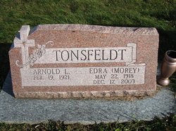
Arnold LuVerne Tonsfeldt
| Birth | : | 19 Feb 1921 Ogden, Boone County, Iowa, USA |
| Death | : | 18 Feb 2010 Dana, Greene County, Iowa, USA |
| Burial | : | Maas Cemetery, Boone County, USA |
| Coordinate | : | 42.0908012, -94.0618973 |
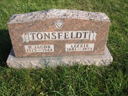
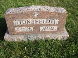
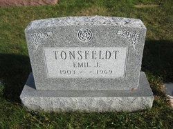
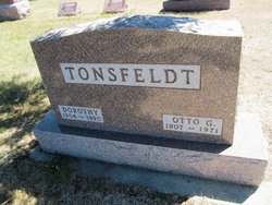
| Description | : | Arnold LuVerne Tonsfeldt was born on February 19, 1921, in rural Ogden, Iowa, the son of Hans Jacob and Lizzie (Kuhl) Tonsfeldt. He graduated from the Boxholm High School. Following his education, Arnold farmed with his brother, Emil, northwest of Ogden. On August 3, 1941, Arnold was united in marriage to Edra L. Morey at her parent's home in Grand Junction by Rev. E.H. Widman. The couple lived and farmed in Amaqua Township northwest of Ogden for 12 years. In 1952, the couple bought a farm east of Dana where they lived for the remainder of their lives. Edra passed... Read More |
frequently asked questions (FAQ):
-
Where is Arnold LuVerne Tonsfeldt's memorial?
Arnold LuVerne Tonsfeldt's memorial is located at: Maas Cemetery, Boone County, USA.
-
When did Arnold LuVerne Tonsfeldt death?
Arnold LuVerne Tonsfeldt death on 18 Feb 2010 in Dana, Greene County, Iowa, USA
-
Where are the coordinates of the Arnold LuVerne Tonsfeldt's memorial?
Latitude: 42.0908012
Longitude: -94.0618973
Family Members:
Parent
Spouse
Siblings
Flowers:
Nearby Cemetories:
1. Maas Cemetery
Boone County, USA
Coordinate: 42.0908012, -94.0618973
2. Maple Grove Cemetery
Boxholm, Boone County, USA
Coordinate: 42.0793690, -94.0859890
3. Grand Ridge Cemetery
Beaver, Boone County, USA
Coordinate: 42.0786018, -94.1157990
4. Union Cemetery
Boxholm, Boone County, USA
Coordinate: 42.1369019, -94.0852966
5. Glenwood Cemetery
Ogden, Boone County, USA
Coordinate: 42.0340000, -94.0440000
6. Saint Johns Catholic Cemetery
Ogden, Boone County, USA
Coordinate: 42.0344000, -94.0407000
7. Bluff Creek Cemetery
Boone, Boone County, USA
Coordinate: 42.0774994, -93.9796982
8. Renner Cemetery
Boone County, USA
Coordinate: 42.1380420, -94.1256570
9. Beaver Cemetery
Beaver, Boone County, USA
Coordinate: 42.0462000, -94.1446000
10. Pilot Mound Cemetery
Pilot Mound, Boone County, USA
Coordinate: 42.1636200, -94.0282600
11. Schlicht Cemetery
Fraser, Boone County, USA
Coordinate: 42.1444200, -93.9780100
12. Hickory Grove Cemetery
Boone County, USA
Coordinate: 42.1074982, -93.9507980
13. Lawn Cemetery
Boone County, USA
Coordinate: 42.1771011, -94.0867996
14. Buckley Cemetery
Boone, Boone County, USA
Coordinate: 42.0999810, -93.9418960
15. Runyan Cemetery
Pilot Mound, Boone County, USA
Coordinate: 42.1749992, -94.0015030
16. Rose Hill Cemetery
Boone, Boone County, USA
Coordinate: 42.0419006, -93.9408035
17. Hollaway Cemetery
Moingona, Boone County, USA
Coordinate: 42.0138720, -93.9530080
18. White Cemetery
Boone County, USA
Coordinate: 42.1777992, -93.9636002
19. Oakwood Cemetery
Moingona, Boone County, USA
Coordinate: 42.0219002, -93.9396973
20. Sacred Heart Cemetery
Boone, Boone County, USA
Coordinate: 42.0485992, -93.9163971
21. Swede Valley Lutheran Church Cemetery
Ogden, Boone County, USA
Coordinate: 41.9770000, -94.0285000
22. Quincy Cemetery
Boone, Boone County, USA
Coordinate: 42.0074997, -93.9503021
23. Boone Memorial Gardens Cemetery
Boone, Boone County, USA
Coordinate: 42.0449982, -93.9152985
24. Biblical College Cemetery
Boone, Boone County, USA
Coordinate: 42.0456009, -93.9113998

