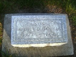
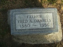
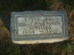
Arthur Dale Daniels
| Birth | : | 18 Jul 1927 Aurelia, Cherokee County, Iowa, USA |
| Death | : | 13 Nov 1998 Cherokee, Cherokee County, Iowa, USA |
| Burial | : | Flat Rock Missionary Baptist Cemetery, Williamsboro, Vance County, USA |
| Coordinate | : | 36.4208000, -78.4491500 |
| Description | : | Arthur Dale Daniels was born July 18, 1927, to Fred A. and Blanche E.(Anderson) Daniels, Sr. in Aurelia, Iowa. Arthur died Fri. Nov. 13, 1998, at the Sioux Valley Memorial Hospital in Cherokee, Ia. Burial was in Pleasant Hill Cemetery. Funeral services for Arthur Daniels, 71, were held Monday, Nov. 16, 1998, at 11:00 a.m. at the First United Methodist Church, Pastor Jack Weida officiated. Arthur graduated from the Aurelia High School in 1945. He attended Buena Vista College and received a bachelor of Arts degree in 1951. Arthur was a lifelong resident of Aurelia. He owned and operated Daniels Well... Read More |
frequently asked questions (FAQ):
-
Where is Arthur Dale Daniels's memorial?
Arthur Dale Daniels's memorial is located at: Flat Rock Missionary Baptist Cemetery, Williamsboro, Vance County, USA.
-
When did Arthur Dale Daniels death?
Arthur Dale Daniels death on 13 Nov 1998 in Cherokee, Cherokee County, Iowa, USA
-
Where are the coordinates of the Arthur Dale Daniels's memorial?
Latitude: 36.4208000
Longitude: -78.4491500
Family Members:
Parent
Siblings
Flowers:
Nearby Cemetories:
1. Flat Rock Missionary Baptist Cemetery
Williamsboro, Vance County, USA
Coordinate: 36.4208000, -78.4491500
2. Island Creek Baptist Church Cemetery
Williamsboro, Vance County, USA
Coordinate: 36.4229700, -78.4469500
3. Montpelier Plantation Cemetery
Henderson, Vance County, USA
Coordinate: 36.4165860, -78.4358600
4. Our Sleeping Garden
Henderson, Vance County, USA
Coordinate: 36.4187640, -78.4657590
5. Saint John's Episcopal Churchyard
Williamsboro, Vance County, USA
Coordinate: 36.4294860, -78.4339710
6. Knott Family Cemetery
Vance County, USA
Coordinate: 36.4272520, -78.4828611
7. Rice Family Cemetery
Williamsboro, Vance County, USA
Coordinate: 36.4514700, -78.4392900
8. Robards-Royster Family Cemetery
Henderson, Vance County, USA
Coordinate: 36.4073950, -78.4090780
9. Mount Zion United Church of Christ Cemetery
Vance County, USA
Coordinate: 36.4549713, -78.4376450
10. Samuel Wilson Family Cemetery
Knotts Crossroads, Vance County, USA
Coordinate: 36.4068310, -78.4930660
11. Gospel Independent Baptist Church Cemetery
Granville County, USA
Coordinate: 36.4038950, -78.4999430
12. Saint Beulah Holiness Church Cemetery
Henderson, Vance County, USA
Coordinate: 36.4650120, -78.4431820
13. Mount Zion United Church of Christ
Henderson, Vance County, USA
Coordinate: 36.4720040, -78.4536160
14. Unidentified Cemetery (Possibly Smith Family)
Dabney Township, Vance County, USA
Coordinate: 36.3679110, -78.4671150
15. Ashley Grove Baptist Church Cemetery
Henderson, Vance County, USA
Coordinate: 36.4090339, -78.3791635
16. Nutbush Baptist Church Cemetery
Henderson, Vance County, USA
Coordinate: 36.3657200, -78.4189600
17. Norwood Family Cemetery
Stovall, Granville County, USA
Coordinate: 36.4385556, -78.5208056
18. Livingstone Christian Church Cemetery
Henderson, Vance County, USA
Coordinate: 36.3627870, -78.4202480
19. Dexter Baptist Church
Dexter, Granville County, USA
Coordinate: 36.3884670, -78.5164330
20. Morning Star United Church Cemetery
Henderson, Vance County, USA
Coordinate: 36.4151500, -78.3689300
21. Michael Creek Missionary Baptist Church Cemetery
Stovall, Granville County, USA
Coordinate: 36.4381800, -78.5277400
22. Machpelah Cemetery
Townsville, Vance County, USA
Coordinate: 36.4862390, -78.4329370
23. Saint Andrews Prebyterian Church Cemetery
Henderson, Vance County, USA
Coordinate: 36.3537820, -78.4518780
24. Marrows Chapel United Methodist Church Cemetery
Henderson, Vance County, USA
Coordinate: 36.4831800, -78.4832400

