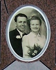
Arthur Loft
| Birth | : | 9 Sep 1916 Milk River, Lethbridge Census Division, Alberta, Canada |
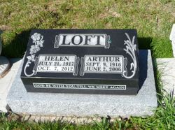
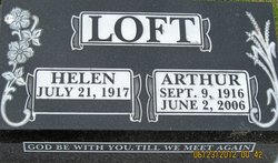
| Death | : | 2 Jun 2006 |
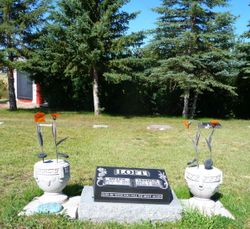
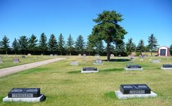
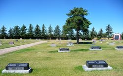
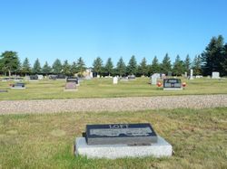
| Burial | : | Milk River Cemetery, Milk River, Lethbridge Census Division, Canada |
| Coordinate | : | 49.1442000, -112.0658700 |
| Description | : | Arthur "Art" was born on the Stevens place 7.5 miles north of Milk River Alberta. He was the third child born to Anna & Albert Loft. Art has known his wife since they were 4 years old as they were neighbors. They had the first date Art was 15 & Helen was 14 years old. Art took her to a show in Ellert's Hall. They both felt so shy & self conscious that they didn't date again for a couple of years. Art & Helen (Barrows) were married Dec 6 1939 at Helen parents place. They took there short honeymoon... Read More |
frequently asked questions (FAQ):
-
Where is Arthur Loft's memorial?
Arthur Loft's memorial is located at: Milk River Cemetery, Milk River, Lethbridge Census Division, Canada.
-
When did Arthur Loft death?
Arthur Loft death on 2 Jun 2006 in
-
Where are the coordinates of the Arthur Loft's memorial?
Latitude: 49.1442000
Longitude: -112.0658700
Family Members:
Parent
Spouse
Siblings
Flowers:
Nearby Cemetories:
1. Milk River Cemetery
Milk River, Lethbridge Census Division, Canada
Coordinate: 49.1442000, -112.0658700
2. Sweet Grass Cemetery
Sweet Grass, Toole County, USA
Coordinate: 48.9972120, -111.9966140
3. Holy Angels Cemetery Community
Coutts, Lethbridge Census Division, Canada
Coordinate: 48.9989440, -111.9649050
4. Coutts Cemetery
Coutts, Lethbridge Census Division, Canada
Coordinate: 48.9989690, -111.9647810
5. Hillside Hutterite Colony Cemetery
Toole County, USA
Coordinate: 48.9788000, -112.0740000
6. Warner Memorial Cemetery
Warner, Lethbridge Census Division, Canada
Coordinate: 49.2914900, -112.2246800
7. Allerston Cemetery
Milk River, Lethbridge Census Division, Canada
Coordinate: 49.1451500, -111.7664000
8. Rimrock Colony Cemetery
Toole County, USA
Coordinate: 48.8985000, -112.0980000
9. Masinasin Cemetery
Milk River, Lethbridge Census Division, Canada
Coordinate: 49.1302328, -111.6527199
10. Sunburst Cemetery
Sunburst, Toole County, USA
Coordinate: 48.8847800, -111.8743800
11. Glacier Colony Cemetery
Glacier Colony, Glacier County, USA
Coordinate: 48.8313000, -112.2154000
12. Zenith Colony Cemetery
Cut Bank, Glacier County, USA
Coordinate: 48.8678000, -112.3442000
13. Nutter Ranch Cemetery
Sunburst, Toole County, USA
Coordinate: 48.9668200, -111.6365320
14. New Dayton Community Cemetery
New Dayton, Lethbridge Census Division, Canada
Coordinate: 49.4254300, -112.3601800
15. Prairie Round Cemetery
Lucky Strike, Lethbridge Census Division, Canada
Coordinate: 49.2249600, -111.5523800
16. Wrentham Cemetery
Wrentham, Lethbridge Census Division, Canada
Coordinate: 49.5231200, -112.1574800
17. Prairie Home Hutterite Colony Cemetery
Wrentham, Lethbridge Census Division, Canada
Coordinate: 49.5291670, -111.9608330
18. Dahlen Family Homestead Cemetery
Kevin, Toole County, USA
Coordinate: 48.7504200, -112.1016200
19. Wolf Creek Hutterite Colony Cemetery
Stirling, Lethbridge Census Division, Canada
Coordinate: 49.4119142, -112.5163705
20. East Raymond Hutterite Colony Cemetery
Raymond, Lethbridge Census Division, Canada
Coordinate: 49.4185305, -112.5791329
21. Glendale Colony Cemetery
Glendale Colony, Glacier County, USA
Coordinate: 48.8380000, -112.5457000
22. Horizon Colony Cemetery
Cut Bank, Glacier County, USA
Coordinate: 48.7156000, -112.2290000
23. Stirling Mennonite Church Cemetery
Stirling, Lethbridge Census Division, Canada
Coordinate: 49.4607570, -112.5387970
24. Stirling Cemetery
Stirling, Lethbridge Census Division, Canada
Coordinate: 49.5093400, -112.5380000

