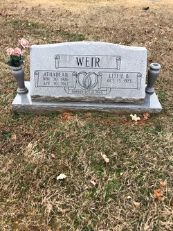
Athadean Self Weir
| Birth | : | 20 Nov 1926 Waldron, Scott County, Arkansas, USA |
| Death | : | 30 Apr 2012 Springdale, Washington County, Arkansas, USA |
| Burial | : | Bluff Cemetery, Springdale, Washington County, USA |
| Coordinate | : | 36.1931000, -94.1327972 |
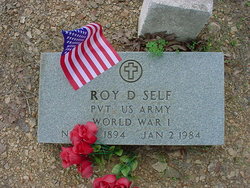
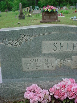
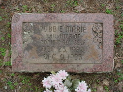
| Description | : | Athadean Self Weir, 85, passed away Monday, April 30, 2012 at the Earlene Howard Hospice House in Springdale. She was born November 20, 1926 in Waldron, Arkansas. She was the daughter of Roy Dennis Self, Sr. and Sadie Marie Kopf Self. She was preceded in death by her parents, two sisters, Robbie Marie Self, Eva Leta Self Thomas; one brother, R.D. Self, Jr. Growing up during the Great Depression left a mark on her character that lasted her entire life. She could never bring herself to waste anything and could find a use for most everything... Read More |
frequently asked questions (FAQ):
-
Where is Athadean Self Weir's memorial?
Athadean Self Weir's memorial is located at: Bluff Cemetery, Springdale, Washington County, USA.
-
When did Athadean Self Weir death?
Athadean Self Weir death on 30 Apr 2012 in Springdale, Washington County, Arkansas, USA
-
Where are the coordinates of the Athadean Self Weir's memorial?
Latitude: 36.1931000
Longitude: -94.1327972
Family Members:
Parent
Spouse
Siblings
Flowers:
Nearby Cemetories:
1. Bluff Cemetery
Springdale, Washington County, USA
Coordinate: 36.1931000, -94.1327972
2. First United Methodist Church Columbarium
Springdale, Washington County, USA
Coordinate: 36.1866850, -94.1329800
3. Forest Park Cemetery
Springdale, Washington County, USA
Coordinate: 36.2024994, -94.1363983
4. Holcomb Cemetery
Springdale, Washington County, USA
Coordinate: 36.1828003, -94.1436005
5. Fitzgerald Cemetery
Springdale, Washington County, USA
Coordinate: 36.2025640, -94.1199040
6. Salem Lutheran Church Cemetery
Springdale, Washington County, USA
Coordinate: 36.1886060, -94.1493120
7. First Presbyterian Columbarium
Springdale, Washington County, USA
Coordinate: 36.1843530, -94.1625690
8. Silent Grove Cemetery
Benton County, USA
Coordinate: 36.2216670, -94.1598540
9. Wilson Cemetery
Lowell, Benton County, USA
Coordinate: 36.2108002, -94.0847015
10. Ingram Cemetery
Lowell, Benton County, USA
Coordinate: 36.2316055, -94.1059647
11. Friendship Cemetery
Springdale, Washington County, USA
Coordinate: 36.1681280, -94.0854990
12. Shady Grove Cemetery
Springdale, Washington County, USA
Coordinate: 36.1460991, -94.1483002
13. Saint Thomas Episcopal Church Columbarium
Springdale, Washington County, USA
Coordinate: 36.1604100, -94.1843600
14. Sharp Cemetery
Benton County, USA
Coordinate: 36.2241880, -94.1868240
15. Phillips Cemetery
Lowell, Benton County, USA
Coordinate: 36.2380981, -94.0960999
16. Spring Creek Cemetery
Cave Springs, Benton County, USA
Coordinate: 36.2261009, -94.1917038
17. Goad Springs Cemetery
Lowell, Benton County, USA
Coordinate: 36.2496986, -94.1530991
18. Zion Cemetery
Springdale, Washington County, USA
Coordinate: 36.1327100, -94.0962230
19. Stuckey Cemetery
Johnson, Washington County, USA
Coordinate: 36.1383018, -94.1866989
20. Oakland Cemetery
Fayetteville, Washington County, USA
Coordinate: 36.1232990, -94.1026670
21. Stearns Cemetery
Fayetteville, Washington County, USA
Coordinate: 36.1150017, -94.1397018
22. Elm Springs Cemetery
Elm Springs, Washington County, USA
Coordinate: 36.2060020, -94.2287270
23. Sonora Cemetery
Sonora, Washington County, USA
Coordinate: 36.1652390, -94.0409630
24. Saint Joseph Cemetery
Tontitown, Washington County, USA
Coordinate: 36.1685982, -94.2350006


