
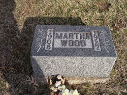
| Birth | : | 8 Nov 1903 Shelby County, Missouri, USA |
| Death | : | 6 Apr 1945 La Junta, Otero County, Colorado, USA |
| Burial | : | Lyons Cemetery, Elizabethton, Carter County, USA |
| Coordinate | : | 36.2530000, -82.2444170 |
| Description | : | 1945 - Obituary - Clarence Courier - Clarence, Shelby Co., MO Prentice WOOD Dies Of Burns Trapped In Prairie Fire Audrey Prentice WOOD, 41, assistant fire chief at the La Junta, Colo., army air field passed away at 2:00 o'clock Friday afternoon at the station hospital at the base, after having been severely burned when he was trapped in a prairie fire at the field March 22. Three other fellows were also burned while fighting the grass fire which was a mile long and an eighth of a mile wide. Due to a sudden shift of the wind the fellows... Read More |
frequently asked questions (FAQ):
-
Where is Audrey Prentice Wood's memorial?
Audrey Prentice Wood's memorial is located at: Lyons Cemetery, Elizabethton, Carter County, USA.
-
When did Audrey Prentice Wood death?
Audrey Prentice Wood death on 6 Apr 1945 in La Junta, Otero County, Colorado, USA
-
Where are the coordinates of the Audrey Prentice Wood's memorial?
Latitude: 36.2530000
Longitude: -82.2444170
Family Members:
Parent

Spouse

Siblings
Flowers:


Nearby Cemetories:
1. Lyons Cemetery
Elizabethton, Carter County, USA
Coordinate: 36.2530000, -82.2444170
2. Stout - Lewis
Elizabethton, Carter County, USA
Coordinate: 36.2546592, -82.2361110
3. Buchanan Cemetery
Elizabethton, Carter County, USA
Coordinate: 36.2729630, -82.2327330
4. Loveless-Woodby Cemetery
Elizabethton, Carter County, USA
Coordinate: 36.2753700, -82.2340400
5. Jessie Hyder Cemetery
Elizabethton, Carter County, USA
Coordinate: 36.2782690, -82.2369190
6. Oak Hill Free Will Baptist Church Cemetery
Hampton, Carter County, USA
Coordinate: 36.2340190, -82.2142550
7. McKeehan Cemetery
Elizabethton, Carter County, USA
Coordinate: 36.2844009, -82.2485962
8. Powder Branch Road Cemetery
Elizabethton, Carter County, USA
Coordinate: 36.2871000, -82.2527400
9. Street Cemetery
Hampton, Carter County, USA
Coordinate: 36.2262300, -82.2168400
10. Hyder Cemetery
Gap Creek, Carter County, USA
Coordinate: 36.2857300, -82.2292000
11. Stevens Cemetery
Hampton, Carter County, USA
Coordinate: 36.2302700, -82.2110200
12. Hyder Cemetery
Gap Creek, Carter County, USA
Coordinate: 36.2874310, -82.2333660
13. McKinney Cemetery
Hampton, Carter County, USA
Coordinate: 36.2178001, -82.2375031
14. Roberts Cemetery
Hampton, Carter County, USA
Coordinate: 36.2624410, -82.2015650
15. Hughes Cemetery
Hampton, Carter County, USA
Coordinate: 36.2622220, -82.2011700
16. McKinney Cemetery
Hampton, Carter County, USA
Coordinate: 36.2238900, -82.2176400
17. Correll Family Cemetery
Unicoi County, USA
Coordinate: 36.2272600, -82.2784600
18. Woodby Cemetery
Hampton, Carter County, USA
Coordinate: 36.2142100, -82.2427860
19. Tolley Cemetery
Hampton, Carter County, USA
Coordinate: 36.2342900, -82.2021700
20. Tolley Cemetery
Hampton, Carter County, USA
Coordinate: 36.2318000, -82.2039700
21. Johnson Cemetery
Hampton, Carter County, USA
Coordinate: 36.2490900, -82.1956100
22. Britt Cemetery
Carter County, USA
Coordinate: 36.2674200, -82.2904100
23. McKinney Cemetery
Elizabethton, Carter County, USA
Coordinate: 36.2893982, -82.2238998
24. Hyder Cemetery
Hampton, Carter County, USA
Coordinate: 36.2577590, -82.1949650