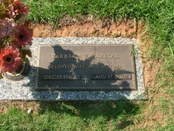
Barbara Ford Carroll
| Birth | : | 13 Dec 1940 |
| Death | : | 17 Aug 2002 |
| Burial | : | St. Joseph's Catholic Cemetery, Chelmsford, Greater Sudbury Municipality, Canada |
| Coordinate | : | 46.5855050, -81.1820650 |
| Plot | : | The Garden of the Well of Samaria |
| Description | : | Barbara Ford Carroll, wife of Sidney Barnard Carroll Jr. of 136 Pisgah Road, died Saturday, August 17, 2002, at her home. Born in Belton, daughter of Sudie Page Ford McDonald and the late Truman Lee Ford, she was a registered nurse with the Home Health Services, a member of the National Nursing Association and the American Medical Records Association. Surviving are her husband of the home; mother of Williamston; daughter, Kristie Carroll Henderson of Easley; stepdaughter, Jeree Outz of Greenville; brother, Bill Ford of Belton; three sisters, Betty Casey, Rachel Brandt, Brenda Gill, all of Williamston; and two step-grandchildren. Private... Read More |
frequently asked questions (FAQ):
-
Where is Barbara Ford Carroll's memorial?
Barbara Ford Carroll's memorial is located at: St. Joseph's Catholic Cemetery, Chelmsford, Greater Sudbury Municipality, Canada.
-
When did Barbara Ford Carroll death?
Barbara Ford Carroll death on 17 Aug 2002 in
-
Where are the coordinates of the Barbara Ford Carroll's memorial?
Latitude: 46.5855050
Longitude: -81.1820650
Family Members:
Spouse
Flowers:
Nearby Cemetories:
1. Chelmsford Protestant Cemetery
Chelmsford, Greater Sudbury Municipality, Canada
Coordinate: 46.5687130, -81.2120780
2. Blezard Valley Cemetery
Blezard Valley, Greater Sudbury Municipality, Canada
Coordinate: 46.6094760, -81.0542630
3. Maple Crest Cemetery
Dowling, Greater Sudbury Municipality, Canada
Coordinate: 46.5710600, -81.3674300
4. LaSalle Roman Catholic Cemetery
Sudbury, Greater Sudbury Municipality, Canada
Coordinate: 46.5226600, -80.9773200
5. Park Lawn Cemetery
Sudbury, Greater Sudbury Municipality, Canada
Coordinate: 46.4842010, -81.0127730
6. Sudbury Anglican Cemetery
Sudbury, Greater Sudbury Municipality, Canada
Coordinate: 46.4843600, -81.0075800
7. Eyre Cemetery
Sudbury, Greater Sudbury Municipality, Canada
Coordinate: 46.4839190, -81.0080430
8. Saint Stanislaus Roman Catholic Cemetery New
Lively, Greater Sudbury Municipality, Canada
Coordinate: 46.4316700, -81.1162900
9. Waters Cemetery
Lively, Greater Sudbury Municipality, Canada
Coordinate: 46.4236500, -81.1359200
10. Saint Jacques Roman Catholic Cemetery
Hanmer, Greater Sudbury Municipality, Canada
Coordinate: 46.6520700, -80.9422600
11. Valley East Cemetery
Valley East, Greater Sudbury Municipality, Canada
Coordinate: 46.6675800, -80.9518900
12. Atikameksheng Cemetery
Naughton, Greater Sudbury Municipality, Canada
Coordinate: 46.4014470, -81.1790660
13. Civic Memorial Cemetery
Sudbury, Greater Sudbury Municipality, Canada
Coordinate: 46.4995995, -80.9368515
14. McFarlane Cemetery
Sudbury, Greater Sudbury Municipality, Canada
Coordinate: 46.4358620, -80.9913230
15. Long Lake Finnish Cemetery
Sudbury, Sudbury District, Canada
Coordinate: 46.4218490, -81.0052630
16. Capreol Cemetery
Capreol, Greater Sudbury Municipality, Canada
Coordinate: 46.6962130, -80.9126210
17. Saint John's Cemetery
Garson, Greater Sudbury Municipality, Canada
Coordinate: 46.5513581, -80.8613157
18. Whitefish Catholic Cemetery
Whitefish, Greater Sudbury Municipality, Canada
Coordinate: 46.3806900, -81.3232800
19. Whitefish Public Cemetery
Whitefish, Greater Sudbury Municipality, Canada
Coordinate: 46.3772000, -81.3185800
20. Good Shepherd Cemetery
Garson, Greater Sudbury Municipality, Canada
Coordinate: 46.5722850, -80.8472730
21. Ruff Pioneer Cemetery
Garson, Greater Sudbury Municipality, Canada
Coordinate: 46.5586900, -80.8132800
22. Cartier Pioneer Cemetery
Cartier, Sudbury District, Canada
Coordinate: 46.7023030, -81.5521650
23. United Church Cemetery
Cartier, Sudbury District, Canada
Coordinate: 46.7061730, -81.5511830
24. St. Francois Xavier Cemetery
Cartier, Sudbury District, Canada
Coordinate: 46.7058330, -81.5514770


