| Birth | : | 4 Nov 1869 Germany |
| Death | : | 5 Oct 1948 Omak, Okanogan County, Washington, USA |
| Burial | : | Omak Memorial Cemetery, Okanogan, Okanogan County, USA |
| Coordinate | : | 48.3874000, -119.5565800 |
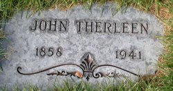
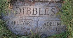
| Description | : | m: John Therleen 25 Apr 1893 in Kootanai Co, ID Washington Death Certificates Name Barbara Dibbles Event Date 05 Oct 1948 Event Place Omak, Okanogan, Washington Gender Female Age (Formatted) 80 years 11 months 1 day Birth Year (Estimated) 1868 Marital Status Married Spouse's Name Charles Father's Name Dill |
frequently asked questions (FAQ):
-
Where is Barbara M Dill Dibbles's memorial?
Barbara M Dill Dibbles's memorial is located at: Omak Memorial Cemetery, Okanogan, Okanogan County, USA.
-
When did Barbara M Dill Dibbles death?
Barbara M Dill Dibbles death on 5 Oct 1948 in Omak, Okanogan County, Washington, USA
-
Where are the coordinates of the Barbara M Dill Dibbles's memorial?
Latitude: 48.3874000
Longitude: -119.5565800
Family Members:
Spouse
Children
Flowers:
Nearby Cemetories:
1. Omak Memorial Cemetery
Okanogan, Okanogan County, USA
Coordinate: 48.3874000, -119.5565800
2. Okanogan Valley Memorial Gardens
Omak, Okanogan County, USA
Coordinate: 48.3911018, -119.5691986
3. Okanogan City Cemetery
Okanogan, Okanogan County, USA
Coordinate: 48.3546982, -119.6061020
4. Spring Coulee Family Cemetery
Okanogan County, USA
Coordinate: 48.3895950, -119.6289460
5. Sand Flats Cemetery
Omak, Okanogan County, USA
Coordinate: 48.4157600, -119.4836600
6. Stoddard Gravesite
Okanogan, Okanogan County, USA
Coordinate: 48.4531140, -119.5411680
7. Saint Marys Mission Catholic Cemetery
Omak, Okanogan County, USA
Coordinate: 48.3752800, -119.4452800
8. Swipkin Family Cemetery
Riverside, Okanogan County, USA
Coordinate: 48.4664270, -119.4618660
9. Brooks Cemetery
Omak, Okanogan County, USA
Coordinate: 48.3786110, -119.3941670
10. Riverside Cemetery
Riverside, Okanogan County, USA
Coordinate: 48.4944400, -119.5022200
11. Cameron Lake Pioneer Memorial Cemetery
Malott, Okanogan County, USA
Coordinate: 48.2708330, -119.5700000
12. Malott Community Cemetery
Malott, Okanogan County, USA
Coordinate: 48.2925000, -119.7047300
13. Booher Grave
Riverside, Okanogan County, USA
Coordinate: 48.3409070, -119.3244000
14. Ruby Cemetery
Okanogan County, USA
Coordinate: 48.5085983, -119.7221985
15. Chiliwist Cemetery
Okanogan County, USA
Coordinate: 48.2630997, -119.7363968
16. Conconully Cemetery
Conconully, Okanogan County, USA
Coordinate: 48.5441600, -119.7400100
17. Tunk Valley Cemetery
Riverside, Okanogan County, USA
Coordinate: 48.5222015, -119.3242035
18. South Pine Creek Cemetery
Riverside, Okanogan County, USA
Coordinate: 48.5925900, -119.5663400
19. Fort Okanogan Memorial Cemetery
Okanogan, Okanogan County, USA
Coordinate: 48.1594009, -119.6632996
20. Pine Creek Cemetery
Tonasket, Okanogan County, USA
Coordinate: 48.6330560, -119.6502780
21. Kartar Cemetery
Okanogan County, USA
Coordinate: 48.2197100, -119.2694500
22. Cook Family Cemetery
Carlton, Okanogan County, USA
Coordinate: 48.6083300, -119.3544400
23. Cook Place Cemetery
Tonasket, Okanogan County, USA
Coordinate: 48.6083330, -119.3544440
24. Elizabeth Osborn Mikel Gravesite
Brewster, Okanogan County, USA
Coordinate: 48.1498900, -119.7514700


