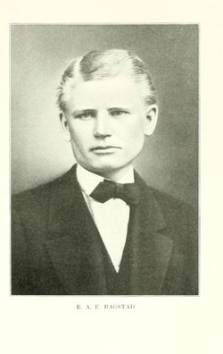
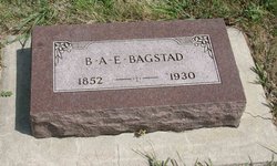
Barent Anton Emil “Emil” Bagstad
| Birth | : | 14 Oct 1851 Dane County, Wisconsin, USA |
| Death | : | 20 Dec 1930 |
| Burial | : | McGrew Cemetery, Anneta, Grayson County, USA |
| Coordinate | : | 37.3622300, -86.2547600 |
| Plot | : | Plot is Block 34, Lot 2, Grave 6 |
| Description | : | History of Dakota Territory IV, By George W. Kingsbury, 1915 In the southern part of the state not to know B. A. E. Bagstad, or Emil Bagstad, as he is usually called, is to argue oneself unknown. It has been customary to think of the pioneers largely as those who have claimed the land and converted it into productive farms or founded the cities and promoted their commercial enterprises, but there are few whose lives so closely touch the lives of others and work for advancement and improvement in so great a degree as that of the educator. To the work... Read More |
frequently asked questions (FAQ):
-
Where is Barent Anton Emil “Emil” Bagstad's memorial?
Barent Anton Emil “Emil” Bagstad's memorial is located at: McGrew Cemetery, Anneta, Grayson County, USA.
-
When did Barent Anton Emil “Emil” Bagstad death?
Barent Anton Emil “Emil” Bagstad death on 20 Dec 1930 in
-
Where are the coordinates of the Barent Anton Emil “Emil” Bagstad's memorial?
Latitude: 37.3622300
Longitude: -86.2547600
Family Members:
Parent
Siblings
Flowers:
Nearby Cemetories:
1. McGrew Cemetery
Anneta, Grayson County, USA
Coordinate: 37.3622300, -86.2547600
2. Anneta United Baptist Church Cemetery
Anneta, Grayson County, USA
Coordinate: 37.3710800, -86.2449400
3. Glasscock Cemetery
Grayson County, USA
Coordinate: 37.3579800, -86.2359200
4. Old Time Holiness House of God Cemetery
Anneta, Grayson County, USA
Coordinate: 37.3630920, -86.2748350
5. Decker Holiness Church Cemetery
Leitchfield, Grayson County, USA
Coordinate: 37.3467360, -86.2871640
6. Decker Cemetery #1
Grayson County, USA
Coordinate: 37.3469192, -86.2882828
7. Polly Ann Salings Cemetery
Leitchfield, Grayson County, USA
Coordinate: 37.3482550, -86.2938610
8. Decker Cemetery
Grayson County, USA
Coordinate: 37.4035988, -86.2371979
9. Bee Spring Missionary Baptist Church Cemetery
Bee Spring, Edmonson County, USA
Coordinate: 37.3174020, -86.2706240
10. Hubsfield Apostolic Church Cemetery
Bee Spring, Edmonson County, USA
Coordinate: 37.3173610, -86.2710600
11. Providence General Baptist Church Cemetery
Leitchfield, Grayson County, USA
Coordinate: 37.4082910, -86.2742320
12. Wortham Cemetery
Hilltop, Grayson County, USA
Coordinate: 37.3886500, -86.3094300
13. John Stevenson Cemetery
Broadway, Edmonson County, USA
Coordinate: 37.3119670, -86.2653990
14. Hack-Oller Cemetery
Sadler, Grayson County, USA
Coordinate: 37.3630229, -86.3191367
15. Antioch General Baptist Church Cemetery
Clarkson, Grayson County, USA
Coordinate: 37.3924700, -86.2006600
16. Washington Meredith Masonic Cemetery
Bee Spring, Edmonson County, USA
Coordinate: 37.3085700, -86.2644120
17. Blowtown Cemetery
Leitchfield, Grayson County, USA
Coordinate: 37.3994090, -86.3061040
18. Peonia Christian Church Cemetery
Clarkson, Grayson County, USA
Coordinate: 37.3986940, -86.2022680
19. Peonia Annex Cemetery
Peonia, Grayson County, USA
Coordinate: 37.3991510, -86.2025350
20. Jock United Baptist Church Cemetery
Bee Spring, Edmonson County, USA
Coordinate: 37.3066216, -86.2626419
21. John Brooks Cemetery
Bee Spring, Edmonson County, USA
Coordinate: 37.3065820, -86.2629640
22. Meisel Cemetery
Edmonson County, USA
Coordinate: 37.3124460, -86.2874990
23. Saint Anthony Cemetery
Peonia, Grayson County, USA
Coordinate: 37.4134630, -86.2231290
24. Sadler Cemetery
Sadler, Grayson County, USA
Coordinate: 37.3777300, -86.3262100

