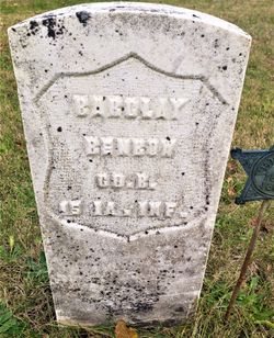
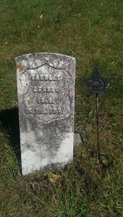
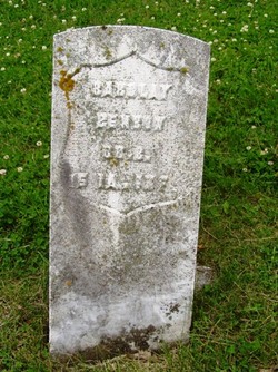
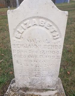
Bartholomew “Barclay” Benbow
| Birth | : | 11 Apr 1828 Indiana, USA |
| Death | : | 20 Mar 1905 Boone, Boone County, Iowa, USA |
| Burial | : | Roberts Cemetery, Doddridge County, USA |
| Coordinate | : | 39.3642006, -80.6785965 |
| Plot | : | G.A.R. |
| Description | : | Boone County Democrat March 31 1905 Bartholomew Benbo, one of the oldest and best known residents of Boone County, passed away at 4:30 o'clock Monday evening, March 20, at the home of his niece, Mrs. Henry Burgess, in Yell Township. Death is supposed to have been caused by the rupture of a blood vessel in the brain. The rupture is thought to have occurred early Friday morning, as he was found about that time at his home in Fraser in an unconscious condition and remained unconscious until his death. When it was found that nothing could be done... Read More |
frequently asked questions (FAQ):
-
Where is Bartholomew “Barclay” Benbow's memorial?
Bartholomew “Barclay” Benbow's memorial is located at: Roberts Cemetery, Doddridge County, USA.
-
When did Bartholomew “Barclay” Benbow death?
Bartholomew “Barclay” Benbow death on 20 Mar 1905 in Boone, Boone County, Iowa, USA
-
Where are the coordinates of the Bartholomew “Barclay” Benbow's memorial?
Latitude: 39.3642006
Longitude: -80.6785965
Family Members:
Parent
Siblings
Flowers:
Nearby Cemetories:
1. Roberts Cemetery
Doddridge County, USA
Coordinate: 39.3642006, -80.6785965
2. Chestnut Grove Cemetery
Flint, Doddridge County, USA
Coordinate: 39.3608017, -80.7157974
3. Underwood Cemetery
Doddridge County, USA
Coordinate: 39.4000200, -80.6947560
4. Pleasant Baptist Church Cemetery
Center Point, Doddridge County, USA
Coordinate: 39.3923073, -80.6406555
5. Center Point Cemetery
Center Point, Doddridge County, USA
Coordinate: 39.3877983, -80.6333008
6. Big Battle Cemetery
Center Point, Doddridge County, USA
Coordinate: 39.3541800, -80.6247600
7. Greathouse Cemetery
New Milton, Doddridge County, USA
Coordinate: 39.3248960, -80.6489930
8. McReynolds Family Cemetery
Center Point, Doddridge County, USA
Coordinate: 39.3890280, -80.7312350
9. Gaskins-McKinney Cemetery
Canton, Doddridge County, USA
Coordinate: 39.3442400, -80.7346220
10. Old Bethel Cemetery
Smithburg, Doddridge County, USA
Coordinate: 39.3166000, -80.6900000
11. Keys Cemetery
Doddridge County, USA
Coordinate: 39.3194008, -80.6485977
12. Doak Cemetery
Doddridge County, USA
Coordinate: 39.3196983, -80.6324997
13. Kinney Family Cemetery
West Union, Doddridge County, USA
Coordinate: 39.3356460, -80.7490450
14. Cedar Grove Cemetery
Shirley, Tyler County, USA
Coordinate: 39.3999825, -80.7447128
15. Underwood Cemetery
Tyler County, USA
Coordinate: 39.3969002, -80.7546997
16. Sedalia Cemetery
Doddridge County, USA
Coordinate: 39.3608017, -80.5849991
17. Shirley United Methodist Church Cemetery
Shirley, Tyler County, USA
Coordinate: 39.3961000, -80.7646000
18. McIntyre Cemetery
Tyler County, USA
Coordinate: 39.4406000, -80.6639000
19. Stanley Cemetery
Doddridge County, USA
Coordinate: 39.2858009, -80.6694031
20. Swiger Cemetery
Doddridge County, USA
Coordinate: 39.4371790, -80.6393820
21. Victory Cemetery
Doddridge County, USA
Coordinate: 39.2892560, -80.6414720
22. Wolverton Cemetery
Doddridge County, USA
Coordinate: 39.2855988, -80.6544037
23. Homer Cemetery
Dale, Tyler County, USA
Coordinate: 39.4458000, -80.6919000
24. Horner Family Cemetery
Tyler County, USA
Coordinate: 39.4458000, -80.6919000

